Cof Cymru: National Historic Assets of Wales · Wales
L-shped Block to rear of
Machynlleth, Powys, Wales
A Grade II listed building in Machynlleth, Powys, designated on 19 November 1990.
The record
- Designation
- Listed building, Grade II
- Broad class
- Domestic
- Date of designation
- 19 November 1990
- Community
- Machynlleth
- Unitary authority
- Powys
- Country
- Wales
- Coordinates
- 52.59041, -3.85040
- Cadw reference
- 8447
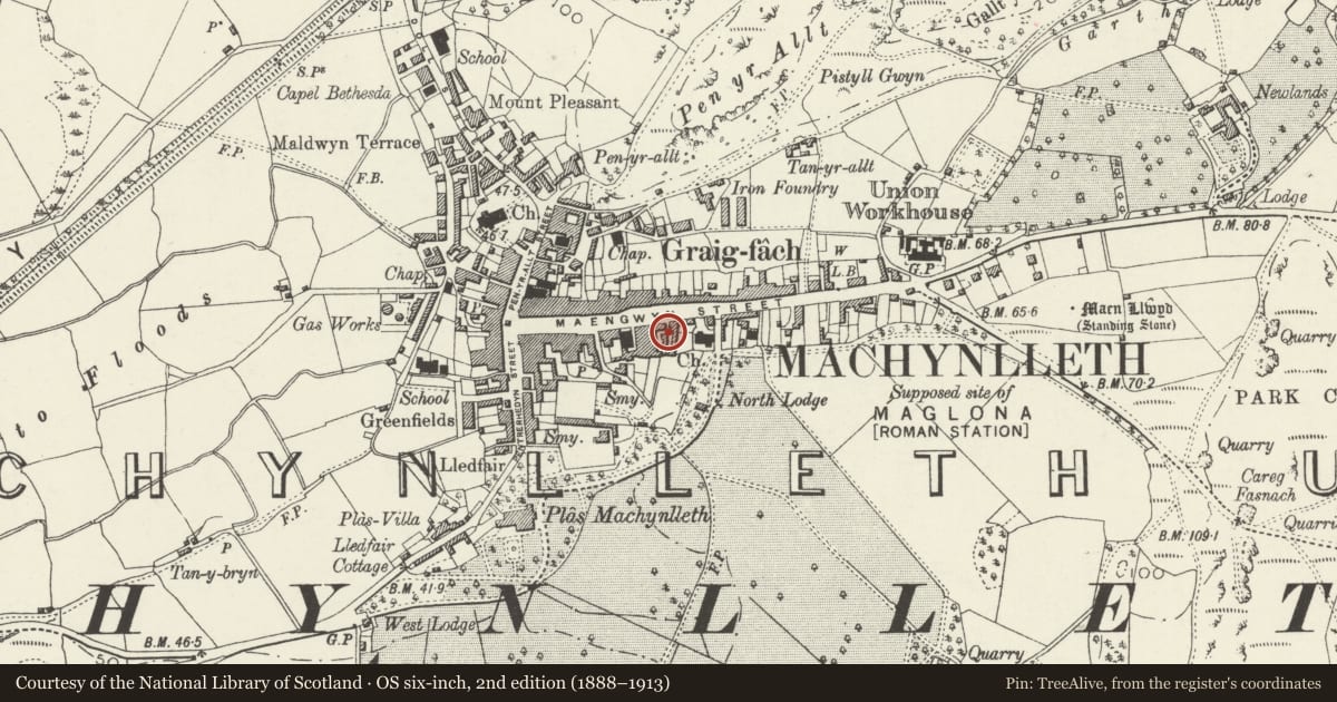
Slide toward Today to fade the historical sheet and see the modern map underneath.
David Rumsey Map Collection, Stanford LibrariesDavid Rumsey Map Collection, Stanford LibrariesDavid Rumsey Map Collection, Stanford LibrariesLlyfrgell Genedlaethol Cymru – The National Library of WalesDavid Rumsey Map Collection, Stanford Libraries
5 historical maps cover this location, the earliest the 1795 map "To Sir Watkin Williams-Wynn Bart ... the map of the six counties of North Wales is most humbly inscribed by his obedient humble servant" (Llyfrgell Genedlaethol Cymru – The National Library of Wales).
Historical maps covering this location
- 1795 · To Sir Watkin Williams-Wynn Bart ... the map of the six counties of North Wales is most… (Llyfrgell Genedlaethol Cymru – The National Library of Wales)
- 1830 · V.3:11-15:XV. Britisches Reich. A. Kon: England. b. Frstenthum Wales: Shire: 37-40 (David Rumsey Map Collection, Stanford Libraries)
- 1883 · Watershed map England, Wales 3. (David Rumsey Map Collection, Stanford Libraries)
- 1899 · 149 Barmouth (Hills) (David Rumsey Map Collection, Stanford Libraries)
- 1901 · Sheet 9 and 10. (David Rumsey Map Collection, Stanford Libraries)
Cadw's description
Location
In the courtyard immediately to rear of Nos 46 to 50; side elevation to path between Nos 50 and 52.
Exterior
Early to mid C19. 3-storeys to front with 2-storey cross range to rear; may have been similar to the cross range to the rear of No 44 in comprising cottages with weaving loft over. Rubble construction, part whitewashed to front; slate roofs with cut down rubble chimney stacks. 3-window front with several 9-pane sash windows; one cross-frame small pane casement to left beside a blocked window. Boarded doors to ground floor and a small brick lean-to. Blocked openings on right gable end and to rear. The cross range has cambered arched ground floor openings with red brick voussoirs. Cement rendered gable end with chimney breast (cut down).
Reason for designation
Included for group value with Nos 44 to 54.
Nearby in the register
- AnniesCommercialunder 1 mi
- 50 Heol MaengwynCommercialunder 1 mi
- 46 Heol MaengwynCommercialunder 1 mi
- 44 Heol MaengwynCommercialunder 1 mi
Other entries of the same register within about three miles of this one, by straight line.