Cof Cymru: National Historic Assets of Wales · Wales
Barn, cart shed and granary at Cefn Camberth
Llangelynin, Gwynedd, Wales
A Grade II listed building in Tonfanau, Llangelynin, Gwynedd, designated on 7 June 2005.
The record
- Designation
- Listed building, Grade II
- Broad class
- No class recorded
- Date of designation
- 7 June 2005
- Locality
- Tonfanau
- Community
- Llangelynin
- Unitary authority
- Gwynedd
- Country
- Wales
- Coordinates
- 52.61183, -4.11379
- Cadw reference
- 84466
Slide toward Today to fade the historical sheet and see the modern map underneath.
David Rumsey Map Collection, Stanford LibrariesDavid Rumsey Map Collection, Stanford LibrariesDavid Rumsey Map Collection, Stanford LibrariesLlyfrgell Genedlaethol Cymru – The National Library of WalesDavid Rumsey Map Collection, Stanford Libraries
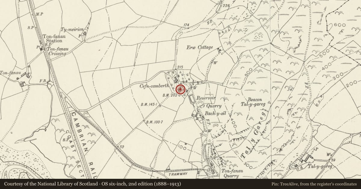
5 historical maps cover this location, the earliest the 1795 map "To Sir Watkin Williams-Wynn Bart ... the map of the six counties of North Wales is most humbly inscribed by his obedient humble servant" (Llyfrgell Genedlaethol Cymru – The National Library of Wales).
Historical maps covering this location
- 1795 · To Sir Watkin Williams-Wynn Bart ... the map of the six counties of North Wales is most… (Llyfrgell Genedlaethol Cymru – The National Library of Wales)
- 1830 · V.3:11-15:XV. Britisches Reich. A. Kon: England. b. Frstenthum Wales: Shire: 37-40 (David Rumsey Map Collection, Stanford Libraries)
- 1883 · Watershed map England, Wales 3. (David Rumsey Map Collection, Stanford Libraries)
- 1896 · Sheet 7. Ordnance Survey of England and Wales. (David Rumsey Map Collection, Stanford Libraries)
- 1901 · Sheet 9 and 10. (David Rumsey Map Collection, Stanford Libraries)
Cadw's description
Location
To the S of the house and the SW side of the farm.
History
An C18 multi-purpose farm building shown on the 1889 Ordnance Survey.
Exterior
A barn of roughly-coursed rubble stone and graded slate roof behind coped gables. On the outer (SE) side it has replacement boarded wagon-bay doors in a doorway carried slightly above the eaves. To its L are 2 ventilation strips. To the R is an original opening for a cart shed, under a replacement iron lintel and with brickwork above. The R gable end, where the ground level is higher, has a boarded granary door. The rear has lower boarded wagon-bay doors and a blocked ventilation strip to the R.
Interior
The main barn has a 4-bay roof, which has tie-beam trusses with collar beams and diagonal struts.
Reason for designation
Listed for its special architectural interest as a well-preserved vernacular barn range retaining definite regional character, and forming part of a strong farm group.
Nearby in the register
- Stable at Cefn CamberthNo class recordedunder 1 mi
- Cow house and stable at Cefn CamberthNo class recordedunder 1 mi
- Cefn CamberthNo class recordedunder 1 mi
- Well at Cefn CamberthNo class recordedunder 1 mi
Other entries of the same register within about three miles of this one, by straight line.