Cof Cymru: National Historic Assets of Wales · Wales
Outbuilding across road to E of Wernfigin Isaf
Trallong, Powys, Wales
A Grade II listed building in Trallong, Brecon, Powys, designated on 27 May 2005.
The record
- Designation
- Listed building, Grade II
- Broad class
- Agriculture and Subsistence
- Date of designation
- 27 May 2005
- Locality
- Trallong
- Town
- Brecon
- Community
- Trallong
- Unitary authority
- Powys
- Country
- Wales
- Coordinates
- 51.96329, -3.53171
- Cadw reference
- 84449
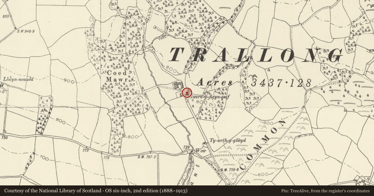
Slide toward Today to fade the historical sheet and see the modern map underneath.
David Rumsey Map Collection, Stanford LibrariesDavid Rumsey Map Collection, Stanford LibrariesDavid Rumsey Map Collection, Stanford LibrariesDavid Rumsey Map Collection, Stanford LibrariesDavid Rumsey Map Collection, Stanford Libraries
5 historical maps cover this location, the earliest the 1636 map "Cornubia : Devonia, Somersetus, Dorcestria, Wiltonia, Glocestria ..." (David Rumsey Map Collection, Stanford Libraries).
Historical maps covering this location
- 1636 · Cornubia : Devonia, Somersetus, Dorcestria, Wiltonia, Glocestria ... (David Rumsey Map Collection, Stanford Libraries)
- 1830 · V.3:11-15:XV. Britisches Reich. A. Kon: England. b. Frstenthum Wales: Shire: 37-40 (David Rumsey Map Collection, Stanford Libraries)
- 1856 · 42. Brecon. (David Rumsey Map Collection, Stanford Libraries)
- 1898 · 213 Brecon (Hills) (David Rumsey Map Collection, Stanford Libraries)
- 1901 · Sheet 14. (David Rumsey Map Collection, Stanford Libraries)
Cadw's description
Location
Situated across a track just to E of Wernfigin Isaf.
History
Outbuilding, possibly late C18 or early C19, a lofted cart-shed with added lean-to pigsties.
Exterior
Outbuilding, and corrugated iron roof, hipped to S, and with boarded gable over stone-tiled hip to N. W front has two elliptical-arched cart entries with thin stone voussoirs, rectangular loft opening over left arch, in altered opening with timber lintel. To left of left arch is a raised pier and straight joint, the wall beyond ending as a steeply raked buttress. N end has recess under the stone-tiled roof, between the ends of the W and E walls, the W one ending in raking buttress. Stone tiles supported on centre post. Within recess, brick and stone steps to loft door.
S end has lean-to with slate roof and overgrown pigsties.
Reason for designation
Included as a lofted outbuilding of definite regional character and having group value with Wernfigin Isaf farmhouse.
Nearby in the register
- Wernfigin IsafDomesticunder 1 mi
- Farm buildings to N of Wernfigin IsafAgriculture and Subsistenceunder 1 mi
- Wernfigin Uchaf and attached outbuildingsDomesticunder 1 mi
- Outbuilding at right angles to The Park farmhouseAgriculture and Subsistenceunder 1 mi
Other entries of the same register within about three miles of this one, by straight line.