Cof Cymru: National Historic Assets of Wales · Wales
Barn range at Aberbran Fawr
Trallong, Powys, Wales
A Grade II listed building in Aberbran, Brecon, Trallong, Powys, designated on 27 May 2005.
The record
- Designation
- Listed building, Grade II
- Broad class
- Agriculture and Subsistence
- Date of designation
- 27 May 2005
- Locality
- Aberbran
- Town
- Brecon
- Community
- Trallong
- Unitary authority
- Powys
- Country
- Wales
- Coordinates
- 51.95012, -3.47268
- Cadw reference
- 84438
Slide toward Today to fade the historical sheet and see the modern map underneath.
David Rumsey Map Collection, Stanford LibrariesDavid Rumsey Map Collection, Stanford LibrariesDavid Rumsey Map Collection, Stanford LibrariesDavid Rumsey Map Collection, Stanford LibrariesDavid Rumsey Map Collection, Stanford Libraries
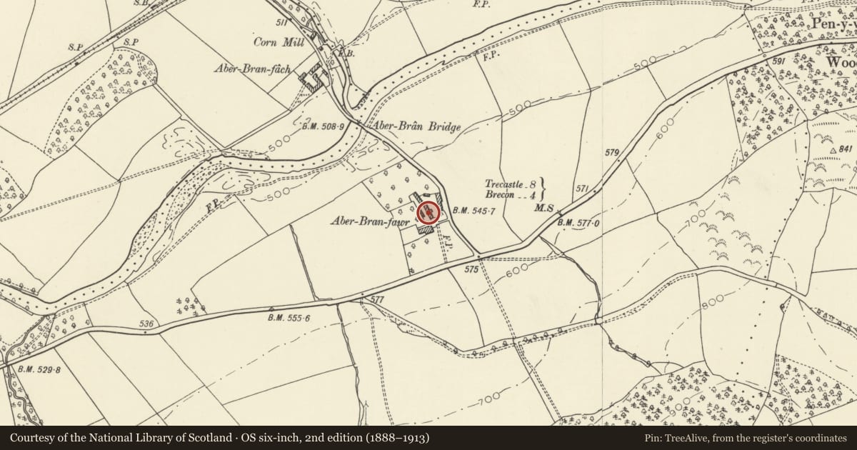
5 historical maps cover this location, the earliest the 1636 map "Cornubia : Devonia, Somersetus, Dorcestria, Wiltonia, Glocestria ..." (David Rumsey Map Collection, Stanford Libraries).
Historical maps covering this location
- 1636 · Cornubia : Devonia, Somersetus, Dorcestria, Wiltonia, Glocestria ... (David Rumsey Map Collection, Stanford Libraries)
- 1830 · V.3:11-15:XV. Britisches Reich. A. Kon: England. b. Frstenthum Wales: Shire: 37-40 (David Rumsey Map Collection, Stanford Libraries)
- 1856 · 42. Brecon. (David Rumsey Map Collection, Stanford Libraries)
- 1898 · 213 Brecon (Hills) (David Rumsey Map Collection, Stanford Libraries)
- 1901 · Sheet 14. (David Rumsey Map Collection, Stanford Libraries)
Cadw's description
Location
Situated at right angles to the house, running downhill to N.
History
Long barn range of C18 to C19 dates, marked on 1838 Tithe map. Barn at S end, lofted stable to N with added haybarn at N end.
Exterior
Barn range, rubble stone with imitation slate and corrugated metal roofs. The range runs downhill with low S gable end and high N end. S barn has two loops and a loft door in S gable end. W side has added lean-to and loop each side of door with oak lintel. The next range has C19 yellow brick heads to a stable door flanked by small windows. Long loft door above stable door, under eaves. Added tall rubble wall to left, the back wall of the hay barn.
The E side has a lean-to to upper end, an inserted door into the centre section and a hay barn at the N. The tall hay barn of three bays has two tall square rubble piers from ground to roof, with timber lintels across to carry an open-fronted loft floor. The N end wall is rebuilt, the gable left open.
Reason for designation
Included for its special interest as a long outbuilding range of group value with Aberbran Fawr, with unusually tall hay barn.
Nearby in the register
- Aberbran FawrDomesticunder 1 mi
- Outbuilding to N of main barn range at Aberbran FawrAgriculture and Subsistenceunder 1 mi
- Aberbran Bridge / Pont AberbranTransportunder 1 mi
- Farm courtyard at Aberbran FachAgriculture and Subsistenceunder 1 mi
Other entries of the same register within about three miles of this one, by straight line.