Cof Cymru: National Historic Assets of Wales · Wales
Outbuilding to SW of Y Rheithordy
Cadfarch, Powys, Wales
A Grade II listed building in Penegoes, Cadfarch, Powys, designated on 2 July 1962.
The record
- Designation
- Listed building, Grade II
- Broad class
- No class recorded
- Date of designation
- 2 July 1962
- Locality
- Penegoes
- Community
- Cadfarch
- Unitary authority
- Powys
- Country
- Wales
- Coordinates
- 52.59102, -3.81708
- Cadw reference
- 84428
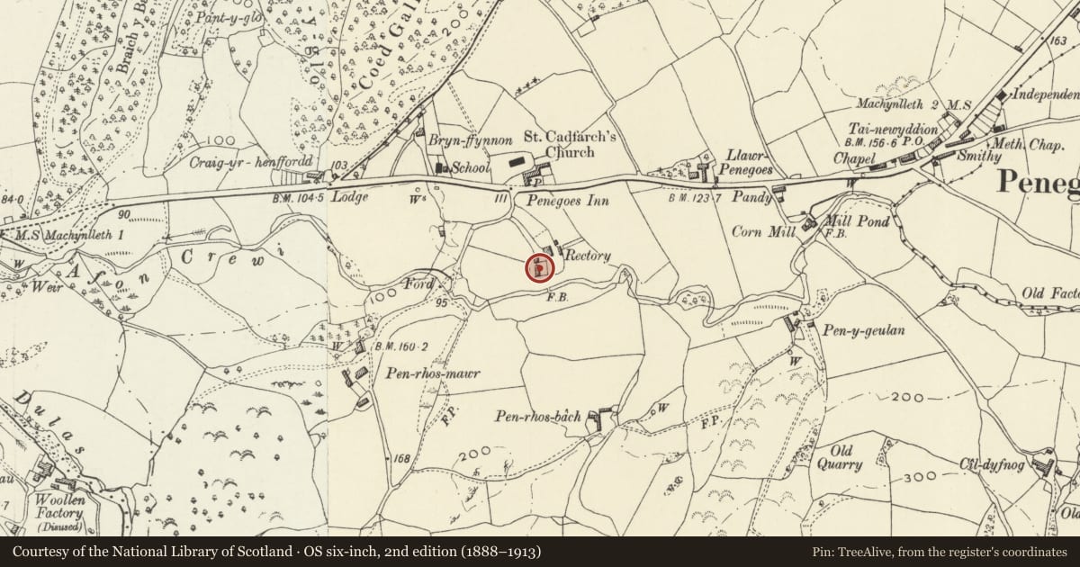
Slide toward Today to fade the historical sheet and see the modern map underneath.
David Rumsey Map Collection, Stanford LibrariesDavid Rumsey Map Collection, Stanford LibrariesDavid Rumsey Map Collection, Stanford LibrariesLlyfrgell Genedlaethol Cymru – The National Library of WalesDavid Rumsey Map Collection, Stanford Libraries
5 historical maps cover this location, the earliest the 1795 map "To Sir Watkin Williams-Wynn Bart ... the map of the six counties of North Wales is most humbly inscribed by his obedient humble servant" (Llyfrgell Genedlaethol Cymru – The National Library of Wales).
Historical maps covering this location
- 1795 · To Sir Watkin Williams-Wynn Bart ... the map of the six counties of North Wales is most… (Llyfrgell Genedlaethol Cymru – The National Library of Wales)
- 1830 · V.3:11-15:XV. Britisches Reich. A. Kon: England. b. Frstenthum Wales: Shire: 37-40 (David Rumsey Map Collection, Stanford Libraries)
- 1883 · Watershed map England, Wales 3. (David Rumsey Map Collection, Stanford Libraries)
- 1899 · 149 Barmouth (Hills) (David Rumsey Map Collection, Stanford Libraries)
- 1901 · Sheet 9 and 10. (David Rumsey Map Collection, Stanford Libraries)
Cadw's description
Location
Located to the SW of Y Rheithordy.
History
Probably early-C19; now a garage but possibly a coach-house originally. There was formerly an attached building which was demolished in the 2nd half of the C20. It included accommodation, but may have been the original stables.
Penegoes Rectory is the site of the birthplace of Richard Wilson (1713-82), the foremost landscape painter of Wales in the C18. His father, John Wilson of Trefeglwys, was Rector of Penegoes, but Richard, the 3rd son, spent much of his youth at Leeswood Hall in Mold, the family home of his mother, Alice Wynne. It was his grandfather, Sir George Wynne, who helped him train as a portrait painter in London. Wilson gradually turned to landscape painting, spending his foremost years in Rome, returning to London in 1757 where he was a founder member of the Royal Academy, and its librarian from 1776. He retired to Mold, where he later died.
Exterior
Outbuilding of shaley rubble stone under a renewed slate roof. It has 2 pairs of full-height boarded doors leading to garages. The R-hand gable is boarded and has a loading door. The L-hand gable end has brick quoins (where the attached building was taken down) and a rendered gable. The rear has a single ventilation slit on the L side.
Interior
The 3-bay roof has tie beams with raking struts.
Reason for designation
Listed for group value with Y Rheithordy.
Nearby in the register
- Y RheithordyDomesticunder 1 mi
- Church of St CadfarchNo class recordedunder 1 mi
- Felin CrewiIndustrialunder 1 mi
- Plas DolguogDomesticunder 1 mi
Other entries of the same register within about three miles of this one, by straight line.