Cof Cymru: National Historic Assets of Wales · Wales
Black Lion Inn
Cadfarch, Powys, Wales
A Grade II listed building in Derwenlas, Cadfarch, Powys, designated on 27 May 2005.
The record
- Designation
- Listed building, Grade II
- Broad class
- No class recorded
- Date of designation
- 27 May 2005
- Locality
- Derwenlas
- Community
- Cadfarch
- Unitary authority
- Powys
- Country
- Wales
- Coordinates
- 52.57423, -3.88899
- Cadw reference
- 84415
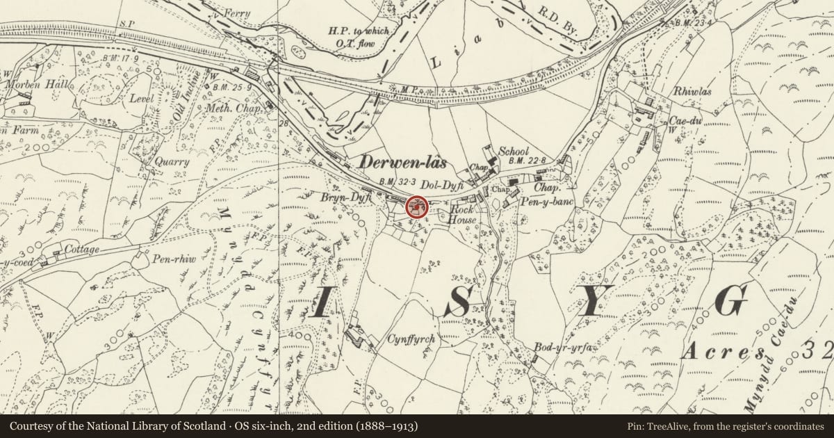
Slide toward Today to fade the historical sheet and see the modern map underneath.
David Rumsey Map Collection, Stanford LibrariesDavid Rumsey Map Collection, Stanford LibrariesLlyfrgell Genedlaethol Cymru – The National Library of WalesDavid Rumsey Map Collection, Stanford LibrariesDavid Rumsey Map Collection, Stanford Libraries
5 historical maps cover this location, the earliest the 1608 map "(13) Cambriae Typus." (David Rumsey Map Collection, Stanford Libraries).
Historical maps covering this location
- 1608 · (13) Cambriae Typus. (David Rumsey Map Collection, Stanford Libraries)
- 1795 · To Sir Watkin Williams-Wynn Bart ... the map of the six counties of North Wales is most… (Llyfrgell Genedlaethol Cymru – The National Library of Wales)
- 1830 · V.3:11-15:XV. Britisches Reich. A. Kon: England. b. Frstenthum Wales: Shire: 37-40 (David Rumsey Map Collection, Stanford Libraries)
- 1883 · Watershed map England, Wales 3. (David Rumsey Map Collection, Stanford Libraries)
- 1896 · Sheet 7. Ordnance Survey of England and Wales. (David Rumsey Map Collection, Stanford Libraries)
Cadw's description
Location
Located in the Centre of Derwenlas on the S side of the main road.
History
Probably early C19; shown on the Tithe map of 1845 as part of a terrace labelled 'cottages and gardens'. It may have been converted to a Public House later, built to serve this port on the Dovey Estuary. Much of the front detail is late-C19.
Exterior
A 2-storey 3-unit inn, with white-washed rendered front under an old slate roof with stone end stacks. Raised quoins with decorated ends, and raised surrounds to openings with keystones and a decorative boss to each side. The entrance is offset slightly L of centre and contains a wide late C20 boarded door with small light. The windows are 4-pane sashes, flanking entrance, and 3 aligned to upper storey.
Interior
Interior not seen at resurvey.
Reason for designation
Listed as an Inn, probably with earlier origins, which retains definite C19 character and detail.
Nearby in the register
- CynffyrchNo class recordedunder 1 mi
- Llugwy HallDomesticunder 1 mi
- Dolgelynen, including front garden wallsDomesticunder 1 mi
- Llugwy LodgeDomesticunder 1 mi
Other entries of the same register within about three miles of this one, by straight line.