Cof Cymru: National Historic Assets of Wales · Wales
32 Heol Maengwyn
Machynlleth, Powys, Wales
A Grade II listed building in Machynlleth, Powys, designated on 19 January 1952.
The record
- Designation
- Listed building, Grade II
- Broad class
- Commercial
- Date of designation
- 19 January 1952
- Community
- Machynlleth
- Unitary authority
- Powys
- Country
- Wales
- Coordinates
- 52.59042, -3.85146
- Cadw reference
- 8439
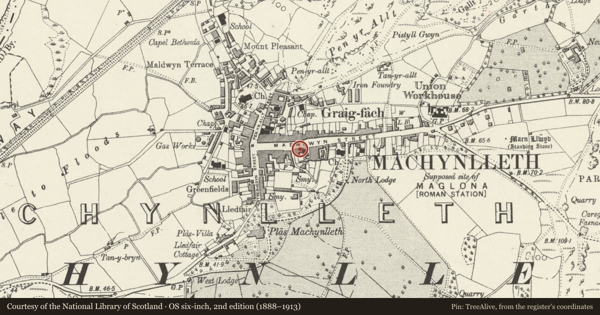
Slide toward Today to fade the historical sheet and see the modern map underneath.
David Rumsey Map Collection, Stanford LibrariesDavid Rumsey Map Collection, Stanford LibrariesDavid Rumsey Map Collection, Stanford LibrariesDavid Rumsey Map Collection, Stanford LibrariesLlyfrgell Genedlaethol Cymru – The National Library of Wales
5 historical maps cover this location, the earliest the 1795 map "To Sir Watkin Williams-Wynn Bart ... the map of the six counties of North Wales is most humbly inscribed by his obedient humble servant" (Llyfrgell Genedlaethol Cymru – The National Library of Wales).
Historical maps covering this location
- 1795 · To Sir Watkin Williams-Wynn Bart ... the map of the six counties of North Wales is most… (Llyfrgell Genedlaethol Cymru – The National Library of Wales)
- 1883 · Watershed map England, Wales 3. (David Rumsey Map Collection, Stanford Libraries)
- 1896 · Sheet 7. Ordnance Survey of England and Wales. (David Rumsey Map Collection, Stanford Libraries)
- 1899 · 149 Barmouth (Hills) (David Rumsey Map Collection, Stanford Libraries)
- 1901 · Sheet 9 and 10. (David Rumsey Map Collection, Stanford Libraries)
Cadw's description
Location
To right of Maengwyn Chapel, towards the W end of the street.
History
These houses form the greater part of a fine late Cl8 Georgian terrace, only no longer complete because of the remodelling of No 30, ca 1900. As originally built it was probably one of the finest planned, symmetrical terraces of this date in Mid-Wales. Hugh Williams, manager of Dylife lead mines lived in No 36; his daughter married Richard Cobdon and his son was the solicitor who defended many of the Chartists - it has been suggested that he may in fact have been 'Rebecca'.
Exterior
3-storeys; coursed and dressed local stone, slate roof, boxed eaves and red and blue brick chimney stacks. 6-window front with attic window to gable over the centre of the former terrace. l2-pane sash windows throughout with stone voussoirs. Modern shop fronts to Nos 32 and 34, splayed bay to the former. 6-panel door with traceried overlight to No 36; this also has forecourt with contemporary spearhead railings; JáBáDavies and Co foundry plate.
Rubble left gable. Some slate hanging to rear and small pane sashes; cross range to No 32 and corrugated iron jetty to No 36 at 2nd floor, No 36 also has monopitch outshut.
Internally No 36 has arched openings to hall, 6-panel doors and shaped tread ends to dog-leg staircase.
Reason for designation
Group value with No 30, Maengwyn Chapel and Nos 27-37.
Nearby in the register
- 34 Heol MaengwynCommercialunder 1 mi
- Allan'sCommercialunder 1 mi
- 36 Heol MaengwynDomesticunder 1 mi
- Maengwyn Chapel (Welsh Presbyterian Church)Religious, Ritual and Funeraryunder 1 mi
Other entries of the same register within about three miles of this one, by straight line.