Cof Cymru: National Historic Assets of Wales · Wales
Maengwyn House
Machynlleth, Powys, Wales
A Grade II listed building in Machynlleth, Powys, designated on 19 January 1952.
The record
- Designation
- Listed building, Grade II
- Broad class
- Domestic
- Date of designation
- 19 January 1952
- Community
- Machynlleth
- Unitary authority
- Powys
- Country
- Wales
- Coordinates
- 52.59107, -3.84665
- Cadw reference
- 8436
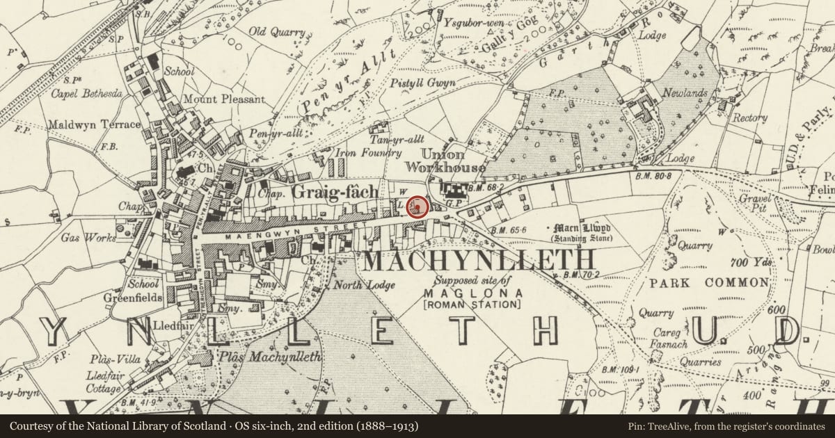
Slide toward Today to fade the historical sheet and see the modern map underneath.
David Rumsey Map Collection, Stanford LibrariesDavid Rumsey Map Collection, Stanford LibrariesDavid Rumsey Map Collection, Stanford LibrariesLlyfrgell Genedlaethol Cymru – The National Library of WalesDavid Rumsey Map Collection, Stanford Libraries
5 historical maps cover this location, the earliest the 1795 map "To Sir Watkin Williams-Wynn Bart ... the map of the six counties of North Wales is most humbly inscribed by his obedient humble servant" (Llyfrgell Genedlaethol Cymru – The National Library of Wales).
Historical maps covering this location
- 1795 · To Sir Watkin Williams-Wynn Bart ... the map of the six counties of North Wales is most… (Llyfrgell Genedlaethol Cymru – The National Library of Wales)
- 1830 · V.3:11-15:XV. Britisches Reich. A. Kon: England. b. Frstenthum Wales: Shire: 37-40 (David Rumsey Map Collection, Stanford Libraries)
- 1883 · Watershed map England, Wales 3. (David Rumsey Map Collection, Stanford Libraries)
- 1899 · 149 Barmouth (Hills) (David Rumsey Map Collection, Stanford Libraries)
- 1901 · Sheet 9 and 10. (David Rumsey Map Collection, Stanford Libraries)
Cadw's description
Location
Detached near the top, eastern end of the street.
Exterior
Probably mid Cl9 2-storey 3+1-window scribed stucco elevation with rusticated quoins and plinth. Slate roof with bracket eaves and stock brick chimney stacks midway down front and rear roof pitches. Horned sash windows with horizontal glazing bars, architraves and bracket cills; also bracket cornices to ground floor. Doric porch to centre with fluted columns; panelled reveals and 6-panel door.
4-pane sashes to left gable end. Rubble right gable with chimney breast towards the front; lower cross range beyond. Shallow gable projection and bay window at ivy clad rear with bracket eaves.
Spearhead railings to front and rubble boundary walls to either side.
Interior
Ribbed plasterwork to hallway; said to retain fine chimneypiece to one of the public rooms.
Reason for designation
Group value with Nos ll3 and ll5 and Nos 94 to 106.
Nearby in the register
- The Court HouseDomesticunder 1 mi
- 102 Heol MaengwynHealth and Welfareunder 1 mi
- The Court HouseDomesticunder 1 mi
- 100 Heol MaengwynHealth and Welfareunder 1 mi
Other entries of the same register within about three miles of this one, by straight line.