Cof Cymru: National Historic Assets of Wales · Wales
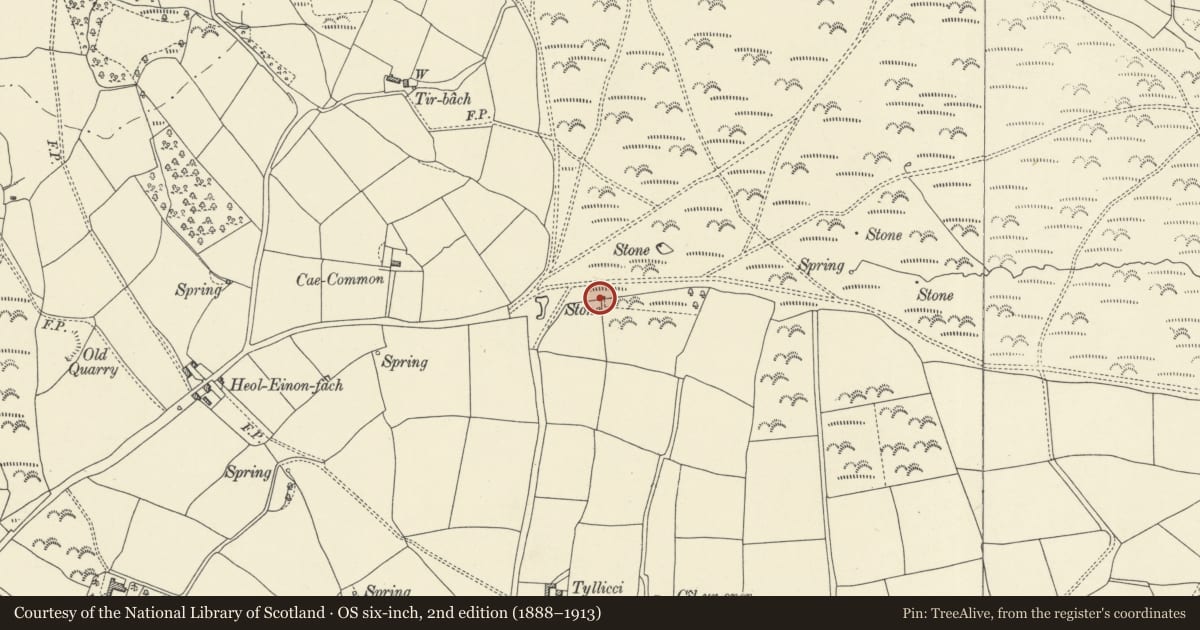
Boundary stone E of Cae-common to E of field gate
Felin-Fach, Powys, Wales
A Grade II listed building in Llandefalle, Brecon, Felin-Fach, Powys, designated on 31 March 2005.
The record
- Designation
- Listed building, Grade II
- Broad class
- Civil
- Date of designation
- 31 March 2005
- Locality
- Llandefalle
- Town
- Brecon
- Community
- Felin-Fach
- Unitary authority
- Powys
- Country
- Wales
- Coordinates
- 52.03628, -3.33479
- Cadw reference
- 84308
Slide toward Today to fade the historical sheet and see the modern map underneath.
David Rumsey Map Collection, Stanford LibrariesDavid Rumsey Map Collection, Stanford LibrariesDavid Rumsey Map Collection, Stanford LibrariesDavid Rumsey Map Collection, Stanford LibrariesDavid Rumsey Map Collection, Stanford Libraries
5 historical maps cover this location, the earliest the 1608 map "(13) Cambriae Typus." (David Rumsey Map Collection, Stanford Libraries).
Historical maps covering this location
- 1608 · (13) Cambriae Typus. (David Rumsey Map Collection, Stanford Libraries)
- 1636 · Cornubia : Devonia, Somersetus, Dorcestria, Wiltonia, Glocestria ... (David Rumsey Map Collection, Stanford Libraries)
- 1637 · Particular description of Wales. Cambria seu Wallia (David Rumsey Map Collection, Stanford Libraries)
- 1856 · 42. Brecon. (David Rumsey Map Collection, Stanford Libraries)
- 1901 · Sheet 14. (David Rumsey Map Collection, Stanford Libraries)
Cadw's description
Location
On Llangoed Common on the E side of a field gate some 275m E of Cae-common.
History
Boundary stone marking boundary of different manors, this one part of a set marking Lord Ashburnham's lands, erected 1815-16.
Exterior
Red sandstone round topped marker inscribed 'A:M:L: Lord Ashburnham 1815'.
Reason for designation
Included for special historic interest as one of an unusual group of early C19 boundary markers.
Nearby in the register
- Boundary stone E of Cae-common to W of field gateNo class recordedunder 1 mi
- Boundary stone SE of TriffwrdCivilunder 1 mi
- Boundary stone NW of PentrenewburyCivilunder 1 mi
- Boundary stone SW of WerntoeCivil1 mi
Other entries of the same register within about three miles of this one, by straight line.