Cof Cymru: National Historic Assets of Wales · Wales
Lychgate at Church of St Curig
Llangurig, Powys, Wales
A Grade II listed building in Llangurig, Powys, designated on 24 March 2005.
The record
- Designation
- Listed building, Grade II
- Broad class
- No class recorded
- Date of designation
- 24 March 2005
- Locality
- Llangurig
- Community
- Llangurig
- Unitary authority
- Powys
- Country
- Wales
- Coordinates
- 52.40642, -3.60640
- Cadw reference
- 84296
Slide toward Today to fade the historical sheet and see the modern map underneath.
David Rumsey Map Collection, Stanford LibrariesDavid Rumsey Map Collection, Stanford LibrariesDavid Rumsey Map Collection, Stanford LibrariesDavid Rumsey Map Collection, Stanford LibrariesDavid Rumsey Map Collection, Stanford Libraries
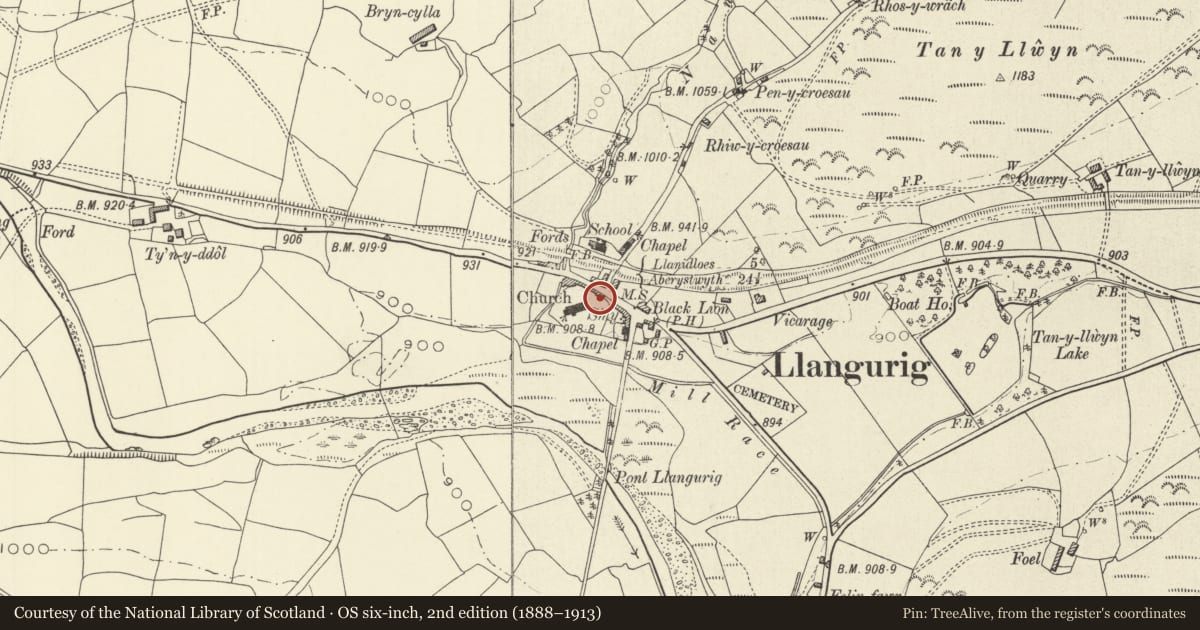
5 historical maps cover this location, the earliest the 1608 map "(13) Cambriae Typus." (David Rumsey Map Collection, Stanford Libraries).
Historical maps covering this location
- 1608 · (13) Cambriae Typus. (David Rumsey Map Collection, Stanford Libraries)
- 1830 · V.3:11-15:XV. Britisches Reich. A. Kon: England. b. Frstenthum Wales: Shire: 37-40 (David Rumsey Map Collection, Stanford Libraries)
- 1883 · Watershed map England, Wales 3. (David Rumsey Map Collection, Stanford Libraries)
- 1899 · 164 Llanidloes (Hills) (David Rumsey Map Collection, Stanford Libraries)
- 1901 · Sheet 14. (David Rumsey Map Collection, Stanford Libraries)
Cadw's description
Location
On the S side of the A44 and forming the main entrance to the church.
History
Lychgate dated 1740, some of the external detail C19.
Exterior
Gabled lychgate constructed of random stone under a slate roof. Entrances to N and S, the shallow arched wooden tie beams with depressed ogee heads. C19 vertical boarding to gables, with decorative barge boards with wave moulding to N side and zig-zag moulding to S side.
Two-bay roof, the central truss also with a depressed ogee-arched tie-beam, supported on corbels. Raked struts above tie-beam; diagonal wind-braces above purlins, all the timbers pegged. On the N side of the central tie-beam is a carved inscription reading 'GD (W) SH 1740 DG (C) IO'. The former initials refer to the churchwardens, George David and Solomon Hamer, the latter initials possibly to the carpenters. A pair of double wooden gates are fixed beneath, with mid-rail and open panels with trefoiled heads.
Reason for designation
Listed as an unusually well-detailed C18 lychgate, and for group value with the Church of St Curig and other structures in the village.
Nearby in the register
- Memorial to Chevalier LloydNo class recordedunder 1 mi
- The Blue Bell InnNo class recordedunder 1 mi
- Memorial FountainCommemorativeunder 1 mi
- Church of St CurigReligious, Ritual and Funeraryunder 1 mi
Other entries of the same register within about three miles of this one, by straight line.