Cof Cymru: National Historic Assets of Wales · Wales
Farm range at Glanrhyd
Llangurig, Powys, Wales
A Grade II listed building in Marsh's Pool, Llangurig, Powys, designated on 24 March 2005.
The record
- Designation
- Listed building, Grade II
- Broad class
- Domestic
- Date of designation
- 24 March 2005
- Locality
- Marsh's Pool
- Community
- Llangurig
- Unitary authority
- Powys
- Country
- Wales
- Coordinates
- 52.41979, -3.57941
- Cadw reference
- 84285
Slide toward Today to fade the historical sheet and see the modern map underneath.
David Rumsey Map Collection, Stanford LibrariesDavid Rumsey Map Collection, Stanford LibrariesDavid Rumsey Map Collection, Stanford LibrariesDavid Rumsey Map Collection, Stanford LibrariesDavid Rumsey Map Collection, Stanford Libraries
5 historical maps cover this location, the earliest the 1608 map "(13) Cambriae Typus." (David Rumsey Map Collection, Stanford Libraries).
Historical maps covering this location
- 1608 · (13) Cambriae Typus. (David Rumsey Map Collection, Stanford Libraries)
- 1637 · Particular description of Wales. Cambria seu Wallia (David Rumsey Map Collection, Stanford Libraries)
- 1883 · Watershed map England, Wales 3. (David Rumsey Map Collection, Stanford Libraries)
- 1899 · 164 Llanidloes (Hills) (David Rumsey Map Collection, Stanford Libraries)
- 1901 · Sheet 14. (David Rumsey Map Collection, Stanford Libraries)
Cadw's description
Location
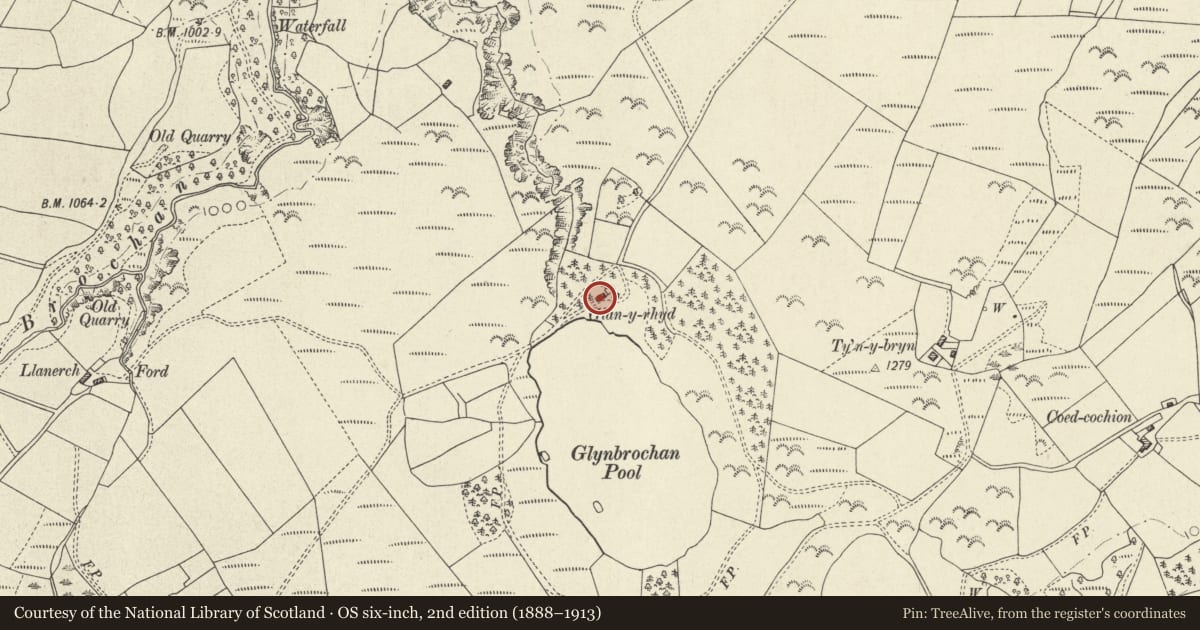
Located immediately W of Glan y rhyd on the N side of Marsh's Pool.
History
A mid-late C19 farm range adjacent to the lakeside cottage at Glanrhyd. The lake was apparently constructed in 1852, and stocked with fish. It seems likely that the farm range is contemporary with the cottage, which was probably built in association with the construction of the lake (perhaps as a retreat for angling parties, or perhaps for a keeper). Marked as a boat-house on the 1886 Ordnance Survey, the building has rather been used for animals and as a fodder store.
Exterior
Long lofted range under a slate roof, with weather-boarded front on a stone plinth; the gable end and rear walls are of shaley rubble with dressed stone quoins. To the front are 2 wide doorways, each with double boarded doors. Single doorway to far right. Loft hatch with double doors to right of centre. Ventilation slits in each gable end.
Interior
Interior not seen at resurvey.
Reason for designation
Listed as a traditionally constructed farm range retaining C19 character, and for group value with the cottage at Glanrhyd.
Nearby in the register
- GlanrhydNo class recordedunder 1 mi
- Rhyd yr Onen Mound & Bailey CastleMotte and Baileyunder 1 mi
- Bwlch y garregNo class recordedunder 1 mi
- The VulcanNo class recorded1 mi
Other entries of the same register within about three miles of this one, by straight line.