Cof Cymru: National Historic Assets of Wales · Wales
Entrance gates and piers to Eglwys Newydd church
Pontarfynach, Ceredigion, Wales
A Grade II listed building in Hafod, Aberystwyth, Pontarfynach, Ceredigion, designated on 16 March 2005.
The record
- Designation
- Listed building, Grade II
- Broad class
- Religious, Ritual and Funerary
- Date of designation
- 16 March 2005
- Locality
- Hafod
- Town
- Aberystwyth
- Community
- Pontarfynach
- Unitary authority
- Ceredigion
- Country
- Wales
- Coordinates
- 52.34755, -3.80900
- Cadw reference
- 84253
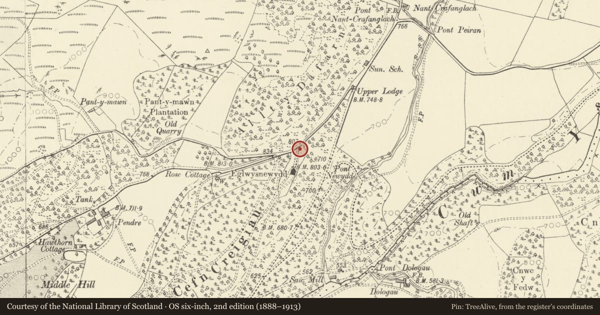
Slide toward Today to fade the historical sheet and see the modern map underneath.
David Rumsey Map Collection, Stanford LibrariesDavid Rumsey Map Collection, Stanford LibrariesDavid Rumsey Map Collection, Stanford LibrariesDavid Rumsey Map Collection, Stanford LibrariesDavid Rumsey Map Collection, Stanford Libraries
5 historical maps cover this location, the earliest the 1608 map "(13) Cambriae Typus." (David Rumsey Map Collection, Stanford Libraries).
Historical maps covering this location
- 1608 · (13) Cambriae Typus. (David Rumsey Map Collection, Stanford Libraries)
- 1830 · V.3:11-15:XV. Britisches Reich. A. Kon: England. b. Frstenthum Wales: Shire: 37-40 (David Rumsey Map Collection, Stanford Libraries)
- 1883 · Watershed map England, Wales 3. (David Rumsey Map Collection, Stanford Libraries)
- 1899 · 178 Llanilar (Hills) (David Rumsey Map Collection, Stanford Libraries)
- 1901 · Sheet 14. (David Rumsey Map Collection, Stanford Libraries)
Cadw's description
Location
On the S side of the B4574 and just N of the church.
History
Entrance gates and piers, probably later C19 added by J. Waddingham, owner of Hafod from 1872, promoter of the church restoration 1887.
Exterior
Two tall gatepiers of rubble stone with tooled quoins, plinth, flat cap and top pedestal with square base under tapering square top carrying C20 lantern. Double gates with dog-bars, mid-rail and some wrought iron scroll-work.
Reason for designation
Included for group value with Eglwys Newydd church.
Nearby in the register
- Eglwys Newydd ChurchReligious, Ritual and Funeraryunder 1 mi
- Enclosing rails and walls to Thomas Johnes grave in Eglwys Newydd churchyardReligious, Ritual and Funeraryunder 1 mi
- Hafod: Peiran CascadeGarden Buildingunder 1 mi
- The Church HallReligious, Ritual and Funeraryunder 1 mi
Other entries of the same register within about three miles of this one, by straight line.