Cof Cymru: National Historic Assets of Wales · Wales
Spectrum
Machynlleth, Powys, Wales
A Grade II listed building in Machynlleth, Powys, designated on 19 November 1990.
The record
- Designation
- Listed building, Grade II
- Broad class
- Commercial
- Date of designation
- 19 November 1990
- Community
- Machynlleth
- Unitary authority
- Powys
- Country
- Wales
- Coordinates
- 52.59071, -3.85170
- Cadw reference
- 8420
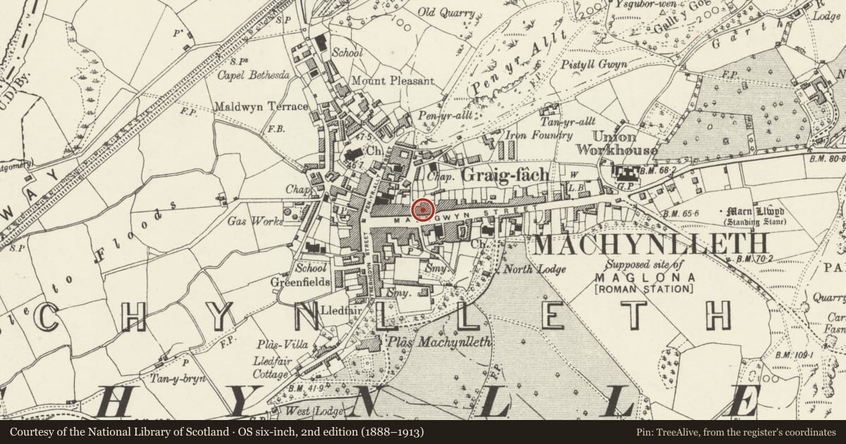
Slide toward Today to fade the historical sheet and see the modern map underneath.
David Rumsey Map Collection, Stanford LibrariesDavid Rumsey Map Collection, Stanford LibrariesDavid Rumsey Map Collection, Stanford LibrariesDavid Rumsey Map Collection, Stanford LibrariesLlyfrgell Genedlaethol Cymru – The National Library of Wales
5 historical maps cover this location, the earliest the 1795 map "To Sir Watkin Williams-Wynn Bart ... the map of the six counties of North Wales is most humbly inscribed by his obedient humble servant" (Llyfrgell Genedlaethol Cymru – The National Library of Wales).
Historical maps covering this location
- 1795 · To Sir Watkin Williams-Wynn Bart ... the map of the six counties of North Wales is most… (Llyfrgell Genedlaethol Cymru – The National Library of Wales)
- 1883 · Watershed map England, Wales 3. (David Rumsey Map Collection, Stanford Libraries)
- 1896 · Sheet 7. Ordnance Survey of England and Wales. (David Rumsey Map Collection, Stanford Libraries)
- 1899 · 149 Barmouth (Hills) (David Rumsey Map Collection, Stanford Libraries)
- 1901 · Sheet 9 and 10. (David Rumsey Map Collection, Stanford Libraries)
Cadw's description
Location
Stepped up from adjoining properties; facing the junction with Bank Lane.
History
Mid to late Cl9 frontage to earlier structure.
Exterior
3-storey, 3-window rendered symmetrical front with light Victorian Gothic ornament; plinth and lst floor impost band. Slightly undulating slate roof with end chimney stacks, one blue brick; pointed arch eaves band. Horned 4-pane sash windows; those to the 2nd floor have semi-circular arched heads with trefoils to the spandrels. Lower windows are square headed with ornamented tympani contained under semi-circular arched hoods with panelled ornament; stopped labels to ground floor. Arched and gabled Gothic hood to entrance with trefoils and pendants flanking the doorway, half-glazed door below punched circular tympanum. Rubble rear with red brick voussoirs to small pane sash windows, stepped back to E end.
Interior
Internally the central passage walls have been removed to create a full width shop; former hallway arches retained.
Reason for designation
Group value with Nos 29-37, 30-36 and Maengwyn Chapel.
Nearby in the register
- 29 Heol MaengwynCommercialunder 1 mi
- 31 Heol MaengwynCommercialunder 1 mi
- 33 Heol MaengwynCommercialunder 1 mi
- 35 Heol MaengwynCommercialunder 1 mi
Other entries of the same register within about three miles of this one, by straight line.