Cof Cymru: National Historic Assets of Wales · Wales
Milestone at Pont Maentwrog
Maentwrog, Gwynedd, Wales
A Grade II listed building in Maentwrog, Gwynedd, designated on 25 February 2005.
The record
- Designation
- Listed building, Grade II
- Broad class
- Transport
- Date of designation
- 25 February 2005
- Locality
- Maentwrog
- Community
- Maentwrog
- Unitary authority
- Gwynedd
- Country
- Wales
- Coordinates
- 52.94734, -3.98830
- Cadw reference
- 84011
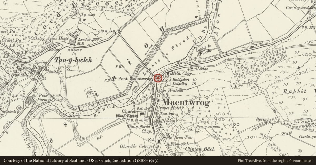
Slide toward Today to fade the historical sheet and see the modern map underneath.
David Rumsey Map Collection, Stanford LibrariesDavid Rumsey Map Collection, Stanford LibrariesDavid Rumsey Map Collection, Stanford LibrariesLlyfrgell Genedlaethol Cymru – The National Library of WalesDavid Rumsey Map Collection, Stanford Libraries
5 historical maps cover this location, the earliest the 1795 map "To Sir Watkin Williams-Wynn Bart ... the map of the six counties of North Wales is most humbly inscribed by his obedient humble servant" (Llyfrgell Genedlaethol Cymru – The National Library of Wales).
Historical maps covering this location
- 1795 · To Sir Watkin Williams-Wynn Bart ... the map of the six counties of North Wales is most… (Llyfrgell Genedlaethol Cymru – The National Library of Wales)
- 1883 · Watershed map England, Wales 3. (David Rumsey Map Collection, Stanford Libraries)
- 1896 · Sheet 7. Ordnance Survey of England and Wales. (David Rumsey Map Collection, Stanford Libraries)
- 1899 · 119 Snowdon (Hills) (David Rumsey Map Collection, Stanford Libraries)
- 1901 · Sheet 9 and 10. (David Rumsey Map Collection, Stanford Libraries)
Cadw's description
Location
Set in the walling branching to SE off Pont Maentwrog. (A496)
History
Probably late C18 milepost. Merioneth was the last of the Welsh counties to have turnpike roads and it was at a county meeting in Dolgellau in 1775 that it was resolved to convert the principal tracks of the county into turnpikes, in partnership with Caernarfonshire. By the end of the C18 most of the existing roads had been brought under the Trust under the Merioneth Turnpike Act of 1777.
Exterior
Stone slab milestone, roughly rectangular in shape and now painted, that bears the inscription:
(20miles = 32 Km)
MILES / LONDON / 220 / DOLGELLEY / 18 / CAERNARVON / 23 / BALA / 22 / CERNIOGE / 20 / BEDDGELERT / 10 / HARLECH / 10 / BARMOUTH / 20.
Reason for designation
Listed as a well preserved late C18 milestone that forms a group with the adjacent road bridge and tollgate cottage at the N end of the village of Maentwrog.
Nearby in the register
- Tollgate Cottage aka CerdwydDomesticunder 1 mi
- Pont MaentwrogTransportunder 1 mi
- The Old RectoryDomesticunder 1 mi
- Stable block to S of The Old RectoryAgriculture and Subsistenceunder 1 mi
Other entries of the same register within about three miles of this one, by straight line.