Cof Cymru: National Historic Assets of Wales · Wales
Morris Cottages
Machynlleth, Powys, Wales
A Grade II listed building in Machynlleth, Powys, designated on 19 November 1990.
The record
- Designation
- Listed building, Grade II
- Broad class
- Domestic
- Date of designation
- 19 November 1990
- Community
- Machynlleth
- Unitary authority
- Powys
- Country
- Wales
- Coordinates
- 52.59325, -3.85440
- Cadw reference
- 8399
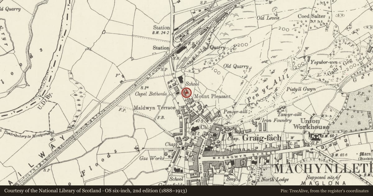
Slide toward Today to fade the historical sheet and see the modern map underneath.
David Rumsey Map Collection, Stanford LibrariesDavid Rumsey Map Collection, Stanford LibrariesDavid Rumsey Map Collection, Stanford LibrariesDavid Rumsey Map Collection, Stanford LibrariesLlyfrgell Genedlaethol Cymru – The National Library of Wales
5 historical maps cover this location, the earliest the 1795 map "To Sir Watkin Williams-Wynn Bart ... the map of the six counties of North Wales is most humbly inscribed by his obedient humble servant" (Llyfrgell Genedlaethol Cymru – The National Library of Wales).
Historical maps covering this location
- 1795 · To Sir Watkin Williams-Wynn Bart ... the map of the six counties of North Wales is most… (Llyfrgell Genedlaethol Cymru – The National Library of Wales)
- 1883 · Watershed map England, Wales 3. (David Rumsey Map Collection, Stanford Libraries)
- 1896 · Sheet 7. Ordnance Survey of England and Wales. (David Rumsey Map Collection, Stanford Libraries)
- 1899 · 149 Barmouth (Hills) (David Rumsey Map Collection, Stanford Libraries)
- 1901 · Sheet 9 and 10. (David Rumsey Map Collection, Stanford Libraries)
Cadw's description
Location
On the northern edge of the town; terrace at a splayed angle to the road.
History
Built in l828 (see datestone to No 23) by Lewis Morris, perhaps as weavers' cottages.
Exterior
Ten 2-storey cottages set in reflected pairs with central tunnel passage. Colourwashed rubble l-window fronts; slate roofs, some renewed, some grouted and rubble chimney stacks with weathercourses, some rendered. Mostly horned sash windows, only one of which (to No l5 lst floor) is small pane; otherwise without any glazing bars except to No 23 which has 4-pane sashes; No 23 also has a later small pane casement over the passage and Nos l9 and 21 have modern windows. Cambered voussoirs to ground floor windows; boarded doors retained only to No 15, otherwise half-glazed - the modern door to No 21 is recessed (later alteration). Scribed rendered left end, rubble right end and colourwashed rubble rear with mostly modern windows, some lean-tos and modern cross range to left. Slate flagged, whitewashed rubble walled through passage.
The pairs, Nos l9 and 21 and 25 and 27 have been combined into single properties.
Reason for designation
Group value with Nos l-6 to rear.
Nearby in the register
- Morris CottagesDomesticunder 1 mi
- Morris CottagesDomesticunder 1 mi
- Morris CottagesDomesticunder 1 mi
- 25 Heol-Y-DollDomesticunder 1 mi
Other entries of the same register within about three miles of this one, by straight line.