Cof Cymru: National Historic Assets of Wales · Wales
Gellilydan Terrace
Maentwrog, Gwynedd, Wales
A Grade II listed building in Gellilydan, Maentwrog, Gwynedd, designated on 25 February 2005.
The record
- Designation
- Listed building, Grade II
- Broad class
- Domestic
- Date of designation
- 25 February 2005
- Locality
- Gellilydan
- Community
- Maentwrog
- Unitary authority
- Gwynedd
- Country
- Wales
- Coordinates
- 52.94021, -3.96023
- Cadw reference
- 83981
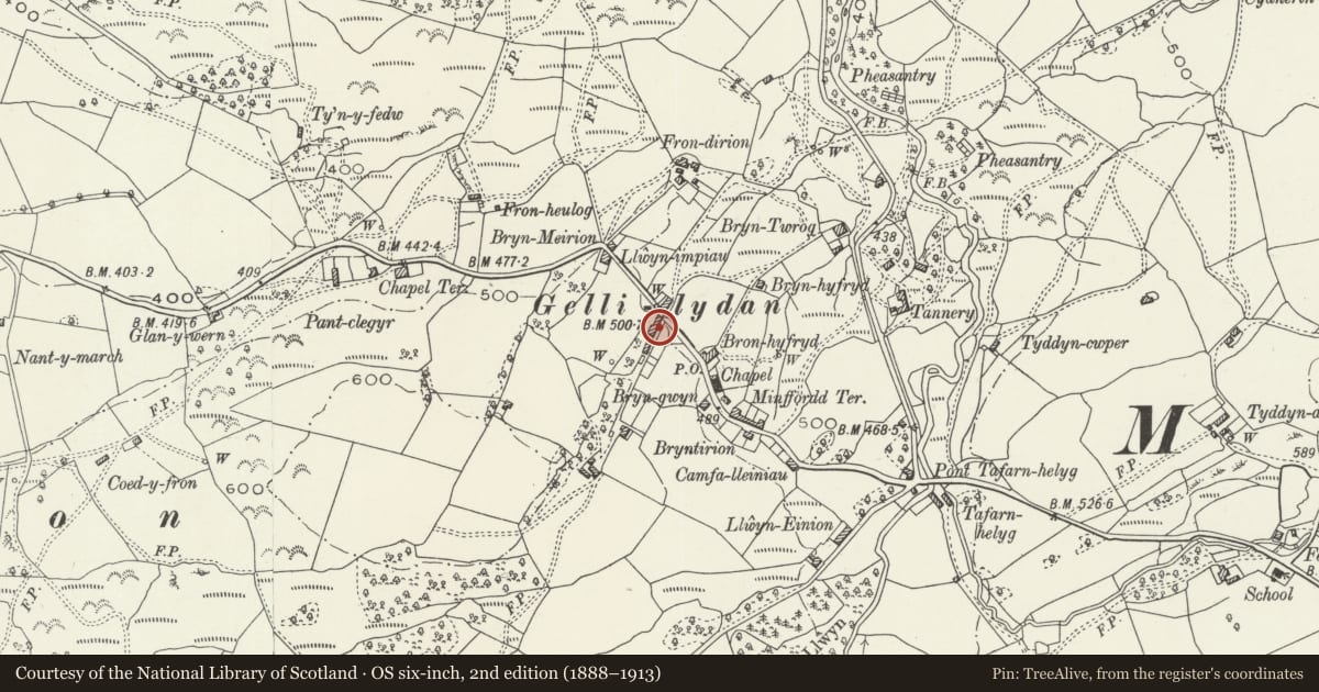
Slide toward Today to fade the historical sheet and see the modern map underneath.
David Rumsey Map Collection, Stanford LibrariesDavid Rumsey Map Collection, Stanford LibrariesDavid Rumsey Map Collection, Stanford LibrariesLlyfrgell Genedlaethol Cymru – The National Library of WalesDavid Rumsey Map Collection, Stanford Libraries
5 historical maps cover this location, the earliest the 1795 map "To Sir Watkin Williams-Wynn Bart ... the map of the six counties of North Wales is most humbly inscribed by his obedient humble servant" (Llyfrgell Genedlaethol Cymru – The National Library of Wales).
Historical maps covering this location
- 1795 · To Sir Watkin Williams-Wynn Bart ... the map of the six counties of North Wales is most… (Llyfrgell Genedlaethol Cymru – The National Library of Wales)
- 1883 · Watershed map England, Wales 3. (David Rumsey Map Collection, Stanford Libraries)
- 1896 · Sheet 7. Ordnance Survey of England and Wales. (David Rumsey Map Collection, Stanford Libraries)
- 1899 · 119 Snowdon (Hills) (David Rumsey Map Collection, Stanford Libraries)
- 1901 · Sheet 9 and 10. (David Rumsey Map Collection, Stanford Libraries)
Cadw's description
Location
Set at an angle to the SW side of the main road that runs NW through the village of Gellilydan.
History
Mid to late C19 terrace. Gellilydan is recorded in tithe apportionment as an area of over 85 acres, owned by Ellis Humphreys and occupied by Robert Pugh, the village was developed due to the expansion of the slate and quarrying industries in the area.
Exterior
Belongs to a group of:
1-3 Gellilydan Terrace.
Two storey terrace of houses, built of roughly coursed mortared rubble masonry, with large stones as quoins and lintels. Slate roof with stone coping at NE gable and rectangular stone stacks with dripstones and capping.
The 3rd house in the row from the R (NE) end of the terrace. The doorway is offset to R and to L is a single ground and first floor horned sash window; a 12-pane sash at ground floor level and unequal sash of 9-panes set under the eaves above.
Interior
The interior was not inspected at the time of the survey (June/July 2003).
Reason for designation
Listed as one of a row of little altered houses within a late C19 terrace. Forms a group with the adjacent houses that retain good traditional character.
Nearby in the register
- Gellilydan TerraceDomesticunder 1 mi
- 1 Gellilydan TerraceDomesticunder 1 mi
- Holy Cross ChurchReligious, Ritual and Funeraryunder 1 mi
- Pandy BachDomesticunder 1 mi
Other entries of the same register within about three miles of this one, by straight line.