Cof Cymru: National Historic Assets of Wales · Wales
Minfor (formerly Vane Almhouses)
Machynlleth, Powys, Wales
A Grade II listed building in Machynlleth, Powys, designated on 19 November 1990.
The record
- Designation
- Listed building, Grade II
- Broad class
- Domestic
- Date of designation
- 19 November 1990
- Community
- Machynlleth
- Unitary authority
- Powys
- Country
- Wales
- Coordinates
- 52.59222, -3.85265
- Cadw reference
- 8395
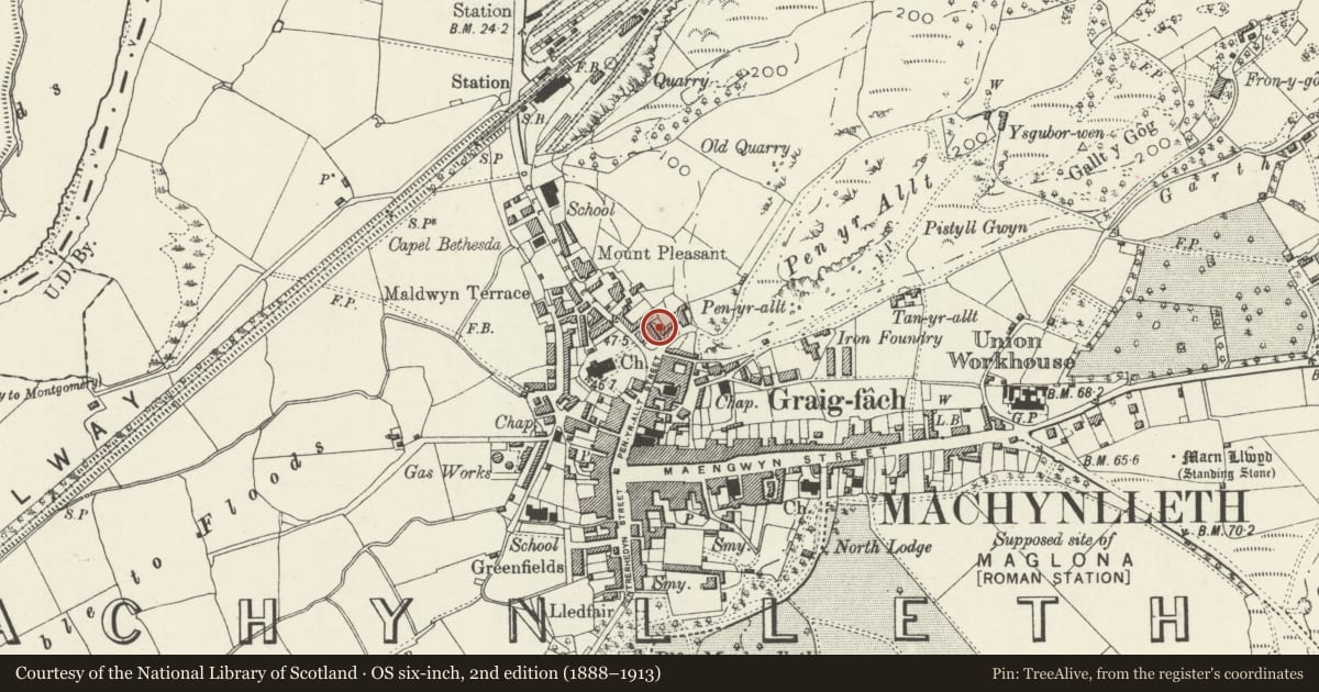
Slide toward Today to fade the historical sheet and see the modern map underneath.
David Rumsey Map Collection, Stanford LibrariesDavid Rumsey Map Collection, Stanford LibrariesDavid Rumsey Map Collection, Stanford LibrariesDavid Rumsey Map Collection, Stanford LibrariesLlyfrgell Genedlaethol Cymru – The National Library of Wales
5 historical maps cover this location, the earliest the 1795 map "To Sir Watkin Williams-Wynn Bart ... the map of the six counties of North Wales is most humbly inscribed by his obedient humble servant" (Llyfrgell Genedlaethol Cymru – The National Library of Wales).
Historical maps covering this location
- 1795 · To Sir Watkin Williams-Wynn Bart ... the map of the six counties of North Wales is most… (Llyfrgell Genedlaethol Cymru – The National Library of Wales)
- 1883 · Watershed map England, Wales 3. (David Rumsey Map Collection, Stanford Libraries)
- 1896 · Sheet 7. Ordnance Survey of England and Wales. (David Rumsey Map Collection, Stanford Libraries)
- 1899 · 149 Barmouth (Hills) (David Rumsey Map Collection, Stanford Libraries)
- 1901 · Sheet 9 and 10. (David Rumsey Map Collection, Stanford Libraries)
Cadw's description
Location
Above and behind Llys Maldwyn near the northern edge of the town.
History
Dated l868; built by Mary Cornelia, Countess Vane of Plas Machynlleth for 6 poor local widows. Subsequently converted into one property.
Exterior
Single storey; painted roughcast 4-bay symmetrical front with advanced and gabled central and penultimate bays. Slate roof with wide boarded eaves and cresting; 4 pairs of octagonal stone chimney stacks; ornamental bargeboards with pendants and finials (pendant missing to central gable). Tudor labels to 2-light casement windows with diamond leaded glazing. The outer gabled bays have modern glazed infill to the former entrances; elliptical arched labels. Similar labels to central entrance below slate datestone; recessed timber panelled door. 12-window rear with simple diamond pattern glazing.
Reason for designation
Group value with Llys Maldwyn, the War Memorial, Pillar-Box and No 36 Heol Penrallt.
Nearby in the register
- Llys MaldwynDomesticunder 1 mi
- Pillar Box on corner below MinforCommunicationsunder 1 mi
- Boundary Walls and Railings to the East part of the Churchyard to the Parish Church of St. PeterReligious, Ritual and Funeraryunder 1 mi
- War MemorialCommemorativeunder 1 mi
Other entries of the same register within about three miles of this one, by straight line.