Cof Cymru: National Historic Assets of Wales · Wales
Cynon Cottage
Llanidloes, Powys, Wales
A Grade II listed building in Dol-Llys, Llanidloes, Powys, designated on 10 April 1989.
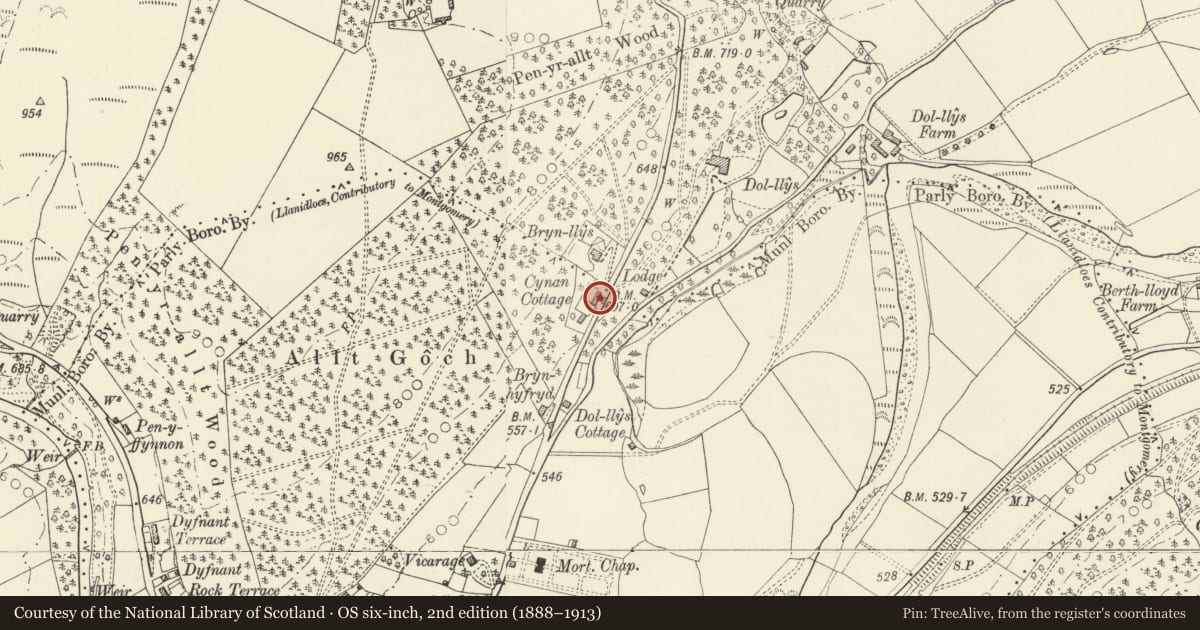
The record
- Designation
- Listed building, Grade II
- Broad class
- Domestic
- Date of designation
- 10 April 1989
- Locality
- Dol-Llys
- Community
- Llanidloes
- Unitary authority
- Powys
- Country
- Wales
- Coordinates
- 52.45774, -3.53528
- Cadw reference
- 8390
Slide toward Today to fade the historical sheet and see the modern map underneath.
David Rumsey Map Collection, Stanford LibrariesDavid Rumsey Map Collection, Stanford LibrariesDavid Rumsey Map Collection, Stanford LibrariesDavid Rumsey Map Collection, Stanford LibrariesDavid Rumsey Map Collection, Stanford Libraries
5 historical maps cover this location, the earliest the 1608 map "(13) Cambriae Typus." (David Rumsey Map Collection, Stanford Libraries).
Historical maps covering this location
- 1608 · (13) Cambriae Typus. (David Rumsey Map Collection, Stanford Libraries)
- 1637 · Particular description of Wales. Cambria seu Wallia (David Rumsey Map Collection, Stanford Libraries)
- 1883 · Watershed map England, Wales 3. (David Rumsey Map Collection, Stanford Libraries)
- 1899 · 164 Llanidloes (Hills) (David Rumsey Map Collection, Stanford Libraries)
- 1901 · Sheet 14. (David Rumsey Map Collection, Stanford Libraries)
Cadw's description
Location
Set in the slope on the Trefeglwys road approximately 1 mile from the town; on the hill above Dol-llys.
History
Built as estate cottages to Dol-llys, probably early C19.
Exterior
Victorian glazing and modern alterations. 2-storey, 2 + 2-window shale front with red brick dressings; slate roof, wide boarded eaves and central red brick chimney stack with pilaster strips and dentil band. Advanced and gabled bay to centre containing twin segmental headed entrances with pilasters and 4-panel doors; blind attic roundel to the gable. Plain full height end pilasters project to the same depth as the central bay. Very shallow splayed bays inserted into the recesses therby created; side opening casement and no glazing bars. Possibly mid C19 lean-to on left end with slightly larger bricks and cambered voussoirs over metal frame small pane casement window. Modern boarded lean-to on right hand end with shale gable end. Pointed doorway with brick voussoirs on left gable end and small pane Gothic window beside. Cross range window to ground floor.
Nearby in the register
- Cynon CottageDomesticunder 1 mi
- Dol-Llys LodgeDomesticunder 1 mi
- Dol-Llys HallDomesticunder 1 mi
- WestbourneDomesticunder 1 mi
Other entries of the same register within about three miles of this one, by straight line.