Cof Cymru: National Historic Assets of Wales · Wales
Milestone on A483
Llanelwedd, Powys, Wales
A Grade II listed building in Pencerrig, Llanelwedd, Powys, designated on 18 February 2005.
The record
- Designation
- Listed building, Grade II
- Broad class
- No class recorded
- Date of designation
- 18 February 2005
- Locality
- Pencerrig
- Community
- Llanelwedd
- Unitary authority
- Powys
- Country
- Wales
- Coordinates
- 52.17404, -3.39719
- Cadw reference
- 83718
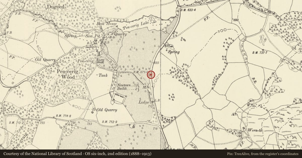
Slide toward Today to fade the historical sheet and see the modern map underneath.
David Rumsey Map Collection, Stanford LibrariesDavid Rumsey Map Collection, Stanford LibrariesDavid Rumsey Map Collection, Stanford LibrariesDavid Rumsey Map Collection, Stanford LibrariesDavid Rumsey Map Collection, Stanford Libraries
5 historical maps cover this location, the earliest the 1608 map "(13) Cambriae Typus." (David Rumsey Map Collection, Stanford Libraries).
Historical maps covering this location
- 1608 · (13) Cambriae Typus. (David Rumsey Map Collection, Stanford Libraries)
- 1637 · Particular description of Wales. Cambria seu Wallia (David Rumsey Map Collection, Stanford Libraries)
- 1883 · Watershed map England, Wales 3. (David Rumsey Map Collection, Stanford Libraries)
- 1899 · 196 Builth (Hills) (David Rumsey Map Collection, Stanford Libraries)
- 1901 · Sheet 14. (David Rumsey Map Collection, Stanford Libraries)
Cadw's description
Location
Nearly opposite the modern driveway opening to Pencerrig Gardens Hotel about 3.25 km N of Builth Wells.
History
A milestone probably erected in 1759 (the date is on another milestone in the series).
Exterior
A roughly hewn boulder painted white, inscribed in black painted letters 'To the Wells 5Ms' and 'To Builth 2'. The lower part of the inscription has an inserted Ordnance datum.
Reason for designation
Listed for its special historic interest as one of a series of well-preserved C18 milestones on the A483 between Builth Wells and Llandrindod Wells.
Nearby in the register
- Milestone on A483No class recordedunder 1 mi
- Pencerrig LodgeNo class recordedunder 1 mi
- Pencerrig Gardens HotelNo class recordedunder 1 mi
- Cefndyrys LodgeNo class recordedunder 1 mi
Other entries of the same register within about three miles of this one, by straight line.