Cof Cymru: National Historic Assets of Wales · Wales
Bridge over Afon Honddu
Honddu Isaf, Powys, Wales
A Grade II listed building in Llandefaelog Fach, Brecon, Honddu Isaf, Powys, designated on 16 February 2005.
The record
- Designation
- Listed building, Grade II
- Broad class
- Transport
- Date of designation
- 16 February 2005
- Locality
- Llandefaelog Fach
- Town
- Brecon
- Community
- Honddu Isaf
- Unitary authority
- Powys
- Country
- Wales
- Coordinates
- 51.98187, -3.40699
- Cadw reference
- 83678
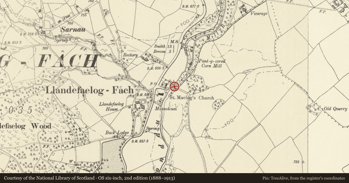
Slide toward Today to fade the historical sheet and see the modern map underneath.
David Rumsey Map Collection, Stanford LibrariesDavid Rumsey Map Collection, Stanford LibrariesDavid Rumsey Map Collection, Stanford LibrariesDavid Rumsey Map Collection, Stanford LibrariesDavid Rumsey Map Collection, Stanford Libraries
5 historical maps cover this location, the earliest the 1608 map "(13) Cambriae Typus." (David Rumsey Map Collection, Stanford Libraries).
Historical maps covering this location
- 1608 · (13) Cambriae Typus. (David Rumsey Map Collection, Stanford Libraries)
- 1636 · Cornubia : Devonia, Somersetus, Dorcestria, Wiltonia, Glocestria ... (David Rumsey Map Collection, Stanford Libraries)
- 1856 · 42. Brecon. (David Rumsey Map Collection, Stanford Libraries)
- 1898 · 213 Brecon (Hills) (David Rumsey Map Collection, Stanford Libraries)
- 1901 · Sheet 14. (David Rumsey Map Collection, Stanford Libraries)
Cadw's description
Location
Carrying a minor road over the Afon Honddu just N of the Church of Saint Maelog in Llandefaelog Fach.
History
C19 single arched road bridge over the Afon Honddu.
Exterior
Road bridge, single arch, squared rubble stone with rock-faced stone voussoirs to broad segmental arch. Arch and spandrels each side are recessed, framed by vertical step each side and a rock faced stone course above with parapet over. Stone copings. Parapets are higher in centre and splayed out at ends, curve to SW has been widened on iron girders.
Reason for designation
Included for historic interest as a C19 broad single-arched road bridge of definite character,
Nearby in the register
- Cross-Slab in ChurchCross-marked stoneunder 1 mi
- Church of Saint MaelogReligious, Ritual and Funeraryunder 1 mi
- Churchyard cross and Dickinson vaultReligious, Ritual and Funeraryunder 1 mi
- Mausoleum to Watkins family of PenoyreReligious, Ritual and Funeraryunder 1 mi
Other entries of the same register within about three miles of this one, by straight line.