Cof Cymru: National Historic Assets of Wales · Wales
Walled gardens at Maes-y-neuadd
Talsarnau, Gwynedd, Wales
A Grade II listed building in Eisingrug, Talsarnau, Gwynedd, designated on 30 December 2004.
The record
- Designation
- Listed building, Grade II
- Broad class
- Domestic
- Date of designation
- 30 December 2004
- Locality
- Eisingrug
- Community
- Talsarnau
- Unitary authority
- Gwynedd
- Country
- Wales
- Coordinates
- 52.89070, -4.05799
- Cadw reference
- 83475
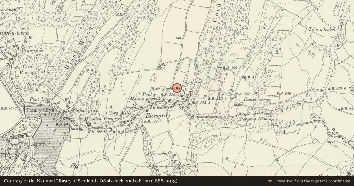
Slide toward Today to fade the historical sheet and see the modern map underneath.
David Rumsey Map Collection, Stanford LibrariesDavid Rumsey Map Collection, Stanford LibrariesDavid Rumsey Map Collection, Stanford LibrariesLlyfrgell Genedlaethol Cymru – The National Library of WalesDavid Rumsey Map Collection, Stanford Libraries
5 historical maps cover this location, the earliest the 1795 map "To Sir Watkin Williams-Wynn Bart ... the map of the six counties of North Wales is most humbly inscribed by his obedient humble servant" (Llyfrgell Genedlaethol Cymru – The National Library of Wales).
Historical maps covering this location
- 1795 · To Sir Watkin Williams-Wynn Bart ... the map of the six counties of North Wales is most… (Llyfrgell Genedlaethol Cymru – The National Library of Wales)
- 1883 · Watershed map England, Wales 3. (David Rumsey Map Collection, Stanford Libraries)
- 1896 · Sheet 7. Ordnance Survey of England and Wales. (David Rumsey Map Collection, Stanford Libraries)
- 1899 · 135 Harlech (Hills) (David Rumsey Map Collection, Stanford Libraries)
- 1901 · Sheet 9 and 10. (David Rumsey Map Collection, Stanford Libraries)
Cadw's description
Location
In an elevated position, set back from the E side of the country road leading N out of the small hamlet of Eisingrug. The walled gardens are to front and rear of the house at Maes-y-neuadd.
History
Probably C18 walled gardens enclosing kitchen gardens to SW of the house at Maes-y-neuadd.
Exterior
Rubble masonry walling standing to a height of 2 - 2.5m tall with flat stone copings. To the rear of the house the grounds are enclosed by further rubble walling with roughly embattled coping, raised as a flat headed arch over a gated entrance which includes a reset commemorative stone tablet that bears the inscription: J N W / AGED IV 1856.
Reason for designation
Included as well preserved C18 walling that forms a group with the adjacent house and estate centre at Maes-y-neuadd for which it was constructed.
Nearby in the register
- Maes-y-neuaddDomesticunder 1 mi
- Yr YsgolEducationunder 1 mi
- Cowhouse at Maes y MeillionAgriculture and Subsistenceunder 1 mi
- Barn and hammel at Maes y MeillionAgriculture and Subsistenceunder 1 mi
Other entries of the same register within about three miles of this one, by straight line.