Cof Cymru: National Historic Assets of Wales · Wales
Tower at Glyn Cywarch
Talsarnau, Gwynedd, Wales
A Grade II listed building in Glyn Cywarch, Talsarnau, Gwynedd, designated on 30 December 2004.
The record
- Designation
- Listed building, Grade II
- Broad class
- No class recorded
- Date of designation
- 30 December 2004
- Locality
- Glyn Cywarch
- Community
- Talsarnau
- Unitary authority
- Gwynedd
- Country
- Wales
- Coordinates
- 52.88455, -4.07378
- Cadw reference
- 83470
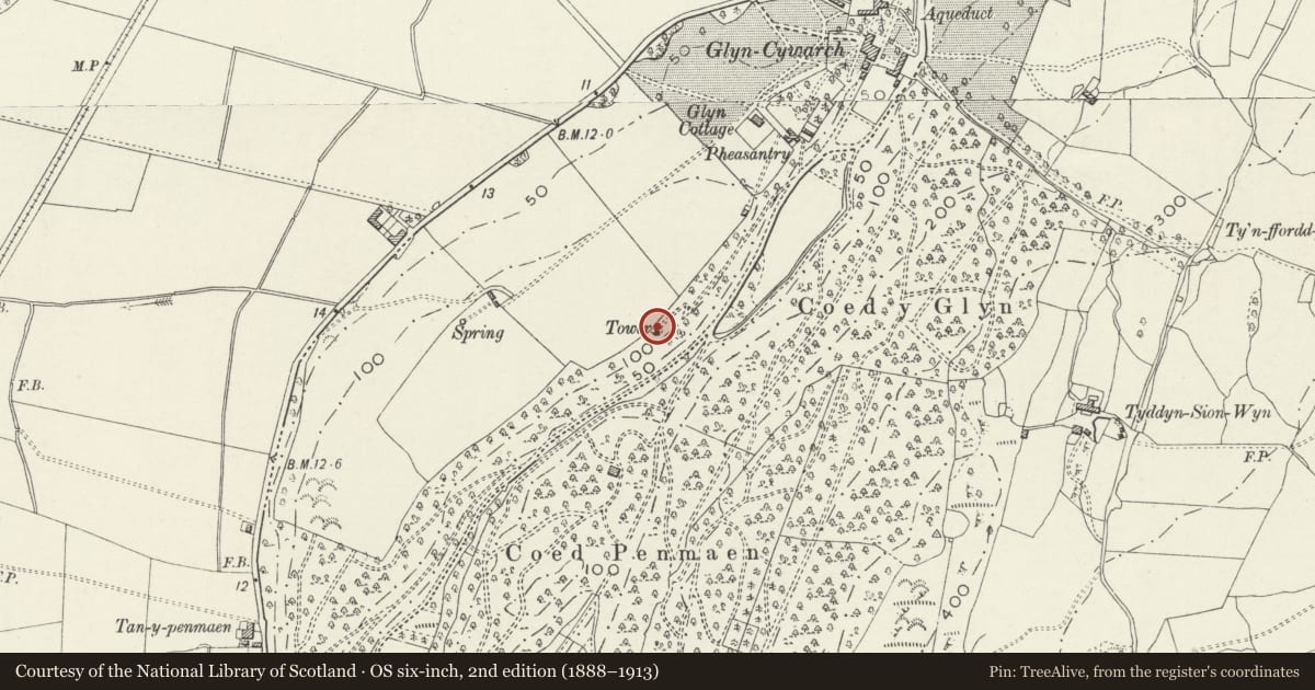
Slide toward Today to fade the historical sheet and see the modern map underneath.
David Rumsey Map Collection, Stanford LibrariesDavid Rumsey Map Collection, Stanford LibrariesDavid Rumsey Map Collection, Stanford LibrariesLlyfrgell Genedlaethol Cymru – The National Library of WalesDavid Rumsey Map Collection, Stanford Libraries
5 historical maps cover this location, the earliest the 1795 map "To Sir Watkin Williams-Wynn Bart ... the map of the six counties of North Wales is most humbly inscribed by his obedient humble servant" (Llyfrgell Genedlaethol Cymru – The National Library of Wales).
Historical maps covering this location
- 1795 · To Sir Watkin Williams-Wynn Bart ... the map of the six counties of North Wales is most… (Llyfrgell Genedlaethol Cymru – The National Library of Wales)
- 1883 · Watershed map England, Wales 3. (David Rumsey Map Collection, Stanford Libraries)
- 1896 · Sheet 7. Ordnance Survey of England and Wales. (David Rumsey Map Collection, Stanford Libraries)
- 1899 · 135 Harlech (Hills) (David Rumsey Map Collection, Stanford Libraries)
- 1901 · Sheet 9 and 10. (David Rumsey Map Collection, Stanford Libraries)
Cadw's description
Location
In private grounds set well back from the NE side of the B4573, to S of Glan-y-wern and SE of Eisingrug; the tower is in an elevated position along a track c350m SW of the house at Glyn Cywarch.
History
Late C19 observation tower, erected in 1881.
Exterior
Circular look out tower, built of stone, standing to a height of c.6m and with an internal diameter of c.4m. The ground floor is open fronted to the SE, with the upper floor supported on circular iron pillars. The platform roof is reached via stone steps and wooden stairs to the rear (NW), and has a low parapet wall with embattled coping. There are 2 steps from the ground floor down to a path that runs round the tower and has a low parapet wall of mortared rubble masonry.
Interior
The interior was not inspected at the time of the survey.
Reason for designation
Included as a tower and viewing platform that formed an integral part of the development of the estate grounds at Glyn Cywarch in the latter part of the C19.
Nearby in the register
- Glyn CottageDomesticunder 1 mi
- Walled garden at Glyn CywarchGardens, Parks and Urban Spacesunder 1 mi
- Glyn CywarchDomesticunder 1 mi
- Gatehouse at Glyn CywarchDomesticunder 1 mi
Other entries of the same register within about three miles of this one, by straight line.