Cof Cymru: National Historic Assets of Wales · Wales
Brynhafren
Llanidloes, Powys, Wales
A Grade II listed building in Llanidloes, Powys, designated on 10 April 1989.
The record
- Designation
- Listed building, Grade II
- Broad class
- Domestic
- Date of designation
- 10 April 1989
- Community
- Llanidloes
- Unitary authority
- Powys
- Country
- Wales
- Coordinates
- 52.44898, -3.54295
- Cadw reference
- 8346
Slide toward Today to fade the historical sheet and see the modern map underneath.
David Rumsey Map Collection, Stanford LibrariesDavid Rumsey Map Collection, Stanford LibrariesDavid Rumsey Map Collection, Stanford LibrariesDavid Rumsey Map Collection, Stanford LibrariesDavid Rumsey Map Collection, Stanford Libraries
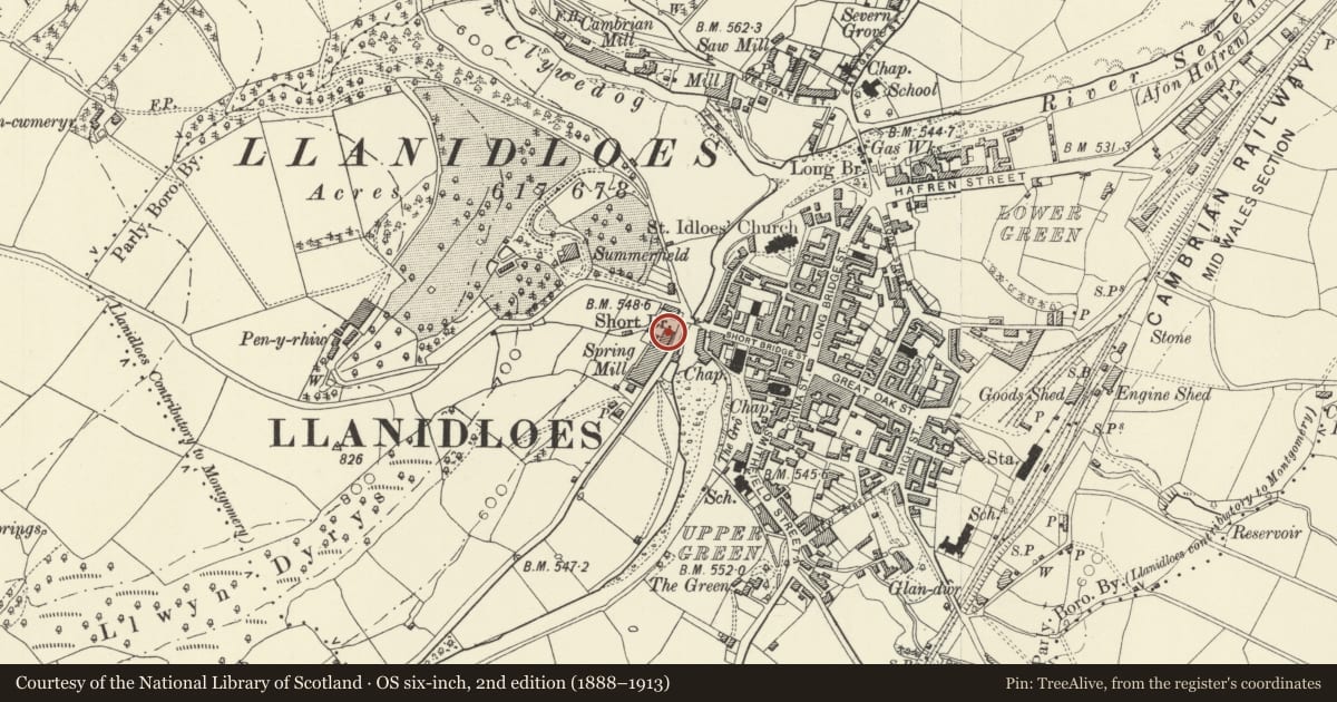
5 historical maps cover this location, the earliest the 1608 map "(13) Cambriae Typus." (David Rumsey Map Collection, Stanford Libraries).
Historical maps covering this location
- 1608 · (13) Cambriae Typus. (David Rumsey Map Collection, Stanford Libraries)
- 1637 · Particular description of Wales. Cambria seu Wallia (David Rumsey Map Collection, Stanford Libraries)
- 1883 · Watershed map England, Wales 3. (David Rumsey Map Collection, Stanford Libraries)
- 1899 · 164 Llanidloes (Hills) (David Rumsey Map Collection, Stanford Libraries)
- 1901 · Sheet 14. (David Rumsey Map Collection, Stanford Libraries)
Cadw's description
Location
Close to the Short Bridge. Above the road with railed forecourts.
History
Early to mid C19; formerly back to back houses and part of a longer symmetrical terrace adjoining the Spring Mill.
Exterior
3-storey red brick pair with slate roof, bracket eaves and blue brick chimney stack. 1-window front to No 1, 2-windows to No 2; 12-pane sashes to 2nd floor and lintels and keystones to 1st and ground floor windows - 16-pane to No 1 and modern to No 2. Mid C20 doors with bracket cornices. Steps lead up to right of centre to round arched entry into tunnel passage with 4-panel door.
Rendered left gable end, rebuilt on demolition of the remainder of the terrace sometime between 1963 and 1981. Shale right gable end. Brick walled tunnel passage has door to left midway along and another to right at end. Shale rear elevation, part rendered with small pane metal frame windows to 2nd floor, which appears to have been a weaving loft. This has a boarded door reached from the high rear garden by an elevated walkway.
Reason for designation
Included for group value with Upper White House, Nos 1 to 5, the Short Bridge and Former Flannel Mill.
Nearby in the register
- BrynhafrenDomesticunder 1 mi
- 1 Highgate TerraceDomesticunder 1 mi
- 2 Highgate TerraceDomesticunder 1 mi
- 3 Highgate TerraceDomesticunder 1 mi
Other entries of the same register within about three miles of this one, by straight line.