Cof Cymru: National Historic Assets of Wales · Wales
Milepost to N of Llandecwyn
Talsarnau, Gwynedd, Wales
A Grade II listed building in Llandecwyn, Talsarnau, Gwynedd, designated on 30 December 2004.
The record
- Designation
- Listed building, Grade II
- Broad class
- Transport
- Date of designation
- 30 December 2004
- Locality
- Llandecwyn
- Community
- Talsarnau
- Unitary authority
- Gwynedd
- Country
- Wales
- Coordinates
- 52.92105, -4.04822
- Cadw reference
- 83457
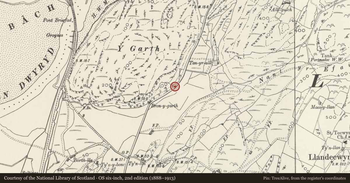
Slide toward Today to fade the historical sheet and see the modern map underneath.
David Rumsey Map Collection, Stanford LibrariesDavid Rumsey Map Collection, Stanford LibrariesDavid Rumsey Map Collection, Stanford LibrariesLlyfrgell Genedlaethol Cymru – The National Library of WalesDavid Rumsey Map Collection, Stanford Libraries
5 historical maps cover this location, the earliest the 1795 map "To Sir Watkin Williams-Wynn Bart ... the map of the six counties of North Wales is most humbly inscribed by his obedient humble servant" (Llyfrgell Genedlaethol Cymru – The National Library of Wales).
Historical maps covering this location
- 1795 · To Sir Watkin Williams-Wynn Bart ... the map of the six counties of North Wales is most… (Llyfrgell Genedlaethol Cymru – The National Library of Wales)
- 1883 · Watershed map England, Wales 3. (David Rumsey Map Collection, Stanford Libraries)
- 1896 · Sheet 7. Ordnance Survey of England and Wales. (David Rumsey Map Collection, Stanford Libraries)
- 1899 · 119 Snowdon (Hills) (David Rumsey Map Collection, Stanford Libraries)
- 1901 · Sheet 9 and 10. (David Rumsey Map Collection, Stanford Libraries)
Cadw's description
Location
Set along the NW side of the A496 leading N out of the village of Llandecwyn.
History
Probably mid C19 milepost. Merioneth was the last of the Welsh counties to have turnpike roads and it was at a county meeting in Dolgellau in 1775 that it was resolved to convert the principal tracks of the county into turnpikes, in partnership with Caernarfonshire. By the end of the C18 most of the existing roads had been brought under the Trust under the Merioneth Turnpike Act of 1777. The stretch of road that this series of mileposts serves was constructed following the reclamation of Traeth Mawr, and the erection of the Cob at Porthmadog, opened in 1808.
Exterior
Cast iron milepost with a triangular profile, wider at the top with a raking head and facing panels which bear the names and distances: BLAENAU / FFESTINIOG / 8 on the left hand face and HARLECH / 6 on the right.
Reason for designation
Listed as a C19 milepost, one of a series along the road between Maentwrog and Harlech.
Nearby in the register
- Church of St TecwynReligious, Ritual and Funeraryunder 1 mi
- Ty'n LlanNo class recordedunder 1 mi
- Wharf at Cei NewyddMaritimeunder 1 mi
- Lychgate and churchyard walls, Church of St TecwynReligious, Ritual and Funeraryunder 1 mi
Other entries of the same register within about three miles of this one, by straight line.