Cof Cymru: National Historic Assets of Wales · Wales
Lofted cartshed at Tyddyn Eglwys
Talsarnau, Gwynedd, Wales
A Grade II listed building in Llanfihangel y Traethau, Talsarnau, Gwynedd, designated on 30 December 2004.
The record
- Designation
- Listed building, Grade II
- Broad class
- Agriculture and Subsistence
- Date of designation
- 30 December 2004
- Locality
- Llanfihangel y Traethau
- Community
- Talsarnau
- Unitary authority
- Gwynedd
- Country
- Wales
- Coordinates
- 52.89631, -4.08844
- Cadw reference
- 83454
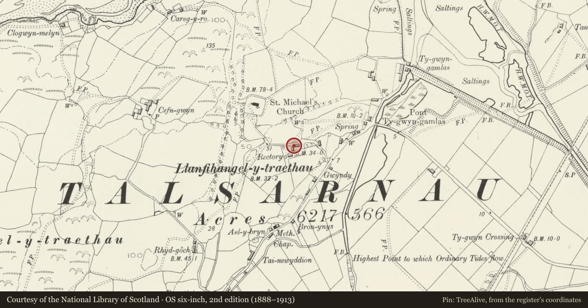
Slide toward Today to fade the historical sheet and see the modern map underneath.
David Rumsey Map Collection, Stanford LibrariesDavid Rumsey Map Collection, Stanford LibrariesDavid Rumsey Map Collection, Stanford LibrariesLlyfrgell Genedlaethol Cymru – The National Library of WalesDavid Rumsey Map Collection, Stanford Libraries
5 historical maps cover this location, the earliest the 1795 map "To Sir Watkin Williams-Wynn Bart ... the map of the six counties of North Wales is most humbly inscribed by his obedient humble servant" (Llyfrgell Genedlaethol Cymru – The National Library of Wales).
Historical maps covering this location
- 1795 · To Sir Watkin Williams-Wynn Bart ... the map of the six counties of North Wales is most… (Llyfrgell Genedlaethol Cymru – The National Library of Wales)
- 1883 · Watershed map England, Wales 3. (David Rumsey Map Collection, Stanford Libraries)
- 1896 · Sheet 7. Ordnance Survey of England and Wales. (David Rumsey Map Collection, Stanford Libraries)
- 1899 · 135 Harlech (Hills) (David Rumsey Map Collection, Stanford Libraries)
- 1901 · Sheet 9 and 10. (David Rumsey Map Collection, Stanford Libraries)
Cadw's description
Location
Slightly set back from the S side of a country lane which leads W off the A496 in Ynys towards the Church of St Michael; to NNE of the house at Tyddyn Eglwys.
History
Early-mid C19 lofted stable and cartshed, contemporary with the adjacent rectory for which it was built.
Exterior
Set at right angles to the rectory and built along the E side of the front garden or courtyard. Built of coursed, mortared, rubble masonry; slate roof with tiled ridge. The range is built into the slope with the loft entrance facing W and raised by a short flight of stone steps. The E wall faces an enclosed yard and has two cartshed bays at ground floor level, each of which has a flat head comprised of a massive stone. Above each cartshed bay is a 4-paned light set under the eaves.
Interior
The interior was not inspected at the time of the survey.
Reason for designation
Included as a little altered early-mid C19 lofted stable range which forms a group with the adjacent rectory at Tyddyn Eglwys for which it was built.
Nearby in the register
- Tyddyn EglwysDomesticunder 1 mi
- Church of St MichaelReligious, Ritual and Funeraryunder 1 mi
- Inscribed stone pillar at Church of St MichaelCommemorativeunder 1 mi
- Inscribed Stone in Llanfihangel Traethau ChurchyardInscribed Stoneunder 1 mi
Other entries of the same register within about three miles of this one, by straight line.