Cof Cymru: National Historic Assets of Wales · Wales
Haybarn (W) at Felinrhyd-fawr
Talsarnau, Gwynedd, Wales
A Grade II listed building in Vale of Ffestiniog, Talsarnau, Gwynedd, designated on 30 December 2004.
The record
- Designation
- Listed building, Grade II
- Broad class
- Agriculture and Subsistence
- Date of designation
- 30 December 2004
- Locality
- Vale of Ffestiniog
- Community
- Talsarnau
- Unitary authority
- Gwynedd
- Country
- Wales
- Coordinates
- 52.93747, -4.01124
- Cadw reference
- 83450
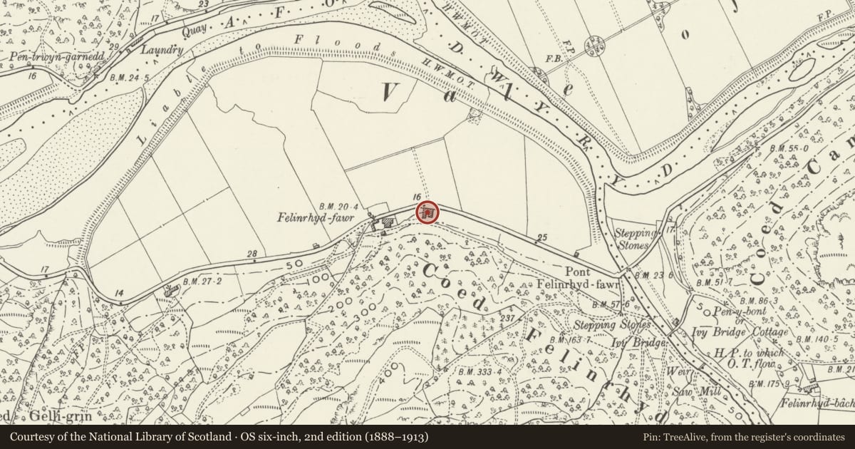
Slide toward Today to fade the historical sheet and see the modern map underneath.
David Rumsey Map Collection, Stanford LibrariesDavid Rumsey Map Collection, Stanford LibrariesDavid Rumsey Map Collection, Stanford LibrariesLlyfrgell Genedlaethol Cymru – The National Library of WalesDavid Rumsey Map Collection, Stanford Libraries
5 historical maps cover this location, the earliest the 1795 map "To Sir Watkin Williams-Wynn Bart ... the map of the six counties of North Wales is most humbly inscribed by his obedient humble servant" (Llyfrgell Genedlaethol Cymru – The National Library of Wales).
Historical maps covering this location
- 1795 · To Sir Watkin Williams-Wynn Bart ... the map of the six counties of North Wales is most… (Llyfrgell Genedlaethol Cymru – The National Library of Wales)
- 1883 · Watershed map England, Wales 3. (David Rumsey Map Collection, Stanford Libraries)
- 1896 · Sheet 7. Ordnance Survey of England and Wales. (David Rumsey Map Collection, Stanford Libraries)
- 1899 · 119 Snowdon (Hills) (David Rumsey Map Collection, Stanford Libraries)
- 1901 · Sheet 9 and 10. (David Rumsey Map Collection, Stanford Libraries)
Cadw's description
Location
Set at right angles to the S side of the A496 to E of the farmhouse and adjacent buildings at Felinrhyd-fawr farm; parallel to an adjacent haybarn to E.
History
Probably late C19, contemporary with the other agricultural buildings (the stables are dated 1873) and the conversion of the house at Felinrhyd-fawr at the time of the enlargement of this estate farm.
Exterior
Lofted haybarn built of mortared rubble masonry with large stones as quoins and lintels; slate roof. There is a doorway in the N gable with circular pitching hole in the apex above. Lateral walls have wide open bays with rubble pillars between.
Reason for designation
Included as a traditional haybarn and for group value with the farmhouse and other listed items at Felinrhyd Fawr.
Nearby in the register
- Haybarn (E) at Felinrhyd-fawrAgriculture and Subsistenceunder 1 mi
- Felinrhyd-fawrDomesticunder 1 mi
- Forge and open storage area at Felinrhyd-fawrIndustrialunder 1 mi
- Stables at Felinrhyd-fawrDomesticunder 1 mi
Other entries of the same register within about three miles of this one, by straight line.