Cof Cymru: National Historic Assets of Wales · Wales
Malta House
Llantwit Major, Vale of Glamorgan, Wales
A Grade II listed building in Llantwit Major, Cowbridge / Y Bont-Faen, Vale of Glamorgan, designated on 16 December 2004.
The record
- Designation
- Listed building, Grade II
- Broad class
- Domestic
- Date of designation
- 16 December 2004
- Locality
- Llantwit Major
- Town
- Cowbridge / Y Bont-Faen
- Community
- Llantwit Major
- Unitary authority
- Vale of Glamorgan
- Country
- Wales
- Coordinates
- 51.40525, -3.48535
- Cadw reference
- 83394
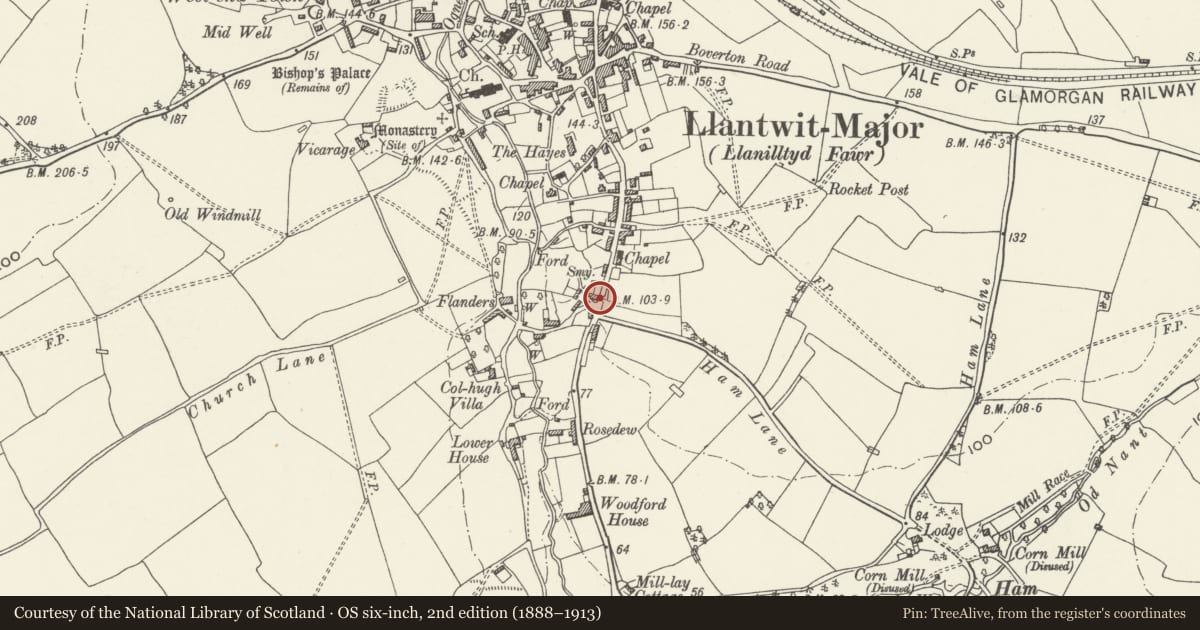
Slide toward Today to fade the historical sheet and see the modern map underneath.
David Rumsey Map Collection, Stanford LibrariesDavid Rumsey Map Collection, Stanford LibrariesDavid Rumsey Map Collection, Stanford LibrariesDavid Rumsey Map Collection, Stanford LibrariesDavid Rumsey Map Collection, Stanford Libraries
5 historical maps cover this location, the earliest the 1636 map "Cornubia : Devonia, Somersetus, Dorcestria, Wiltonia, Glocestria ..." (David Rumsey Map Collection, Stanford Libraries).
Historical maps covering this location
- 1636 · Cornubia : Devonia, Somersetus, Dorcestria, Wiltonia, Glocestria ... (David Rumsey Map Collection, Stanford Libraries)
- 1858 · 20. Bridgewater. (David Rumsey Map Collection, Stanford Libraries)
- 1865 · England and Wales. England No. 6. (David Rumsey Map Collection, Stanford Libraries)
- 1897 · 262 Pontypridd (Hills) (David Rumsey Map Collection, Stanford Libraries)
- 1897 · 262 Pontypridd (Outline) (David Rumsey Map Collection, Stanford Libraries)
Cadw's description
Location
About 300m south of the town centre just off the road to the beach.
History
Shown on the 1840 Tithe map but must date from very shortly before then.
Exterior
Rendered and painted, probably over local rubblestone, Welsh slate gable roof with red brick end stacks. Two storeys, double depth with rear outshut. The ground floor has, from left, a 3 + 3 pane casement, a 2 over 2 pane sash, a 6-panel door with the top four panels glazed, a double casement with 12 panes. Above are two 3 + 3 pane casements as before.
Interior
Interior not inspected.
Reason for designation
Included for group value with No 4 and with To-hesg in Colhugh Street.
Nearby in the register
- 2 Flanders RoadDomesticunder 1 mi
- The Cottage with attached garden wallsDomesticunder 1 mi
- To-hesg including attached garden wallsDomesticunder 1 mi
- Garden Wall and Gate of Flanders FarmhouseDomesticunder 1 mi
Other entries of the same register within about three miles of this one, by straight line.