Cof Cymru: National Historic Assets of Wales · Wales
Bwthyn y Wawr
Blaenrheidol, Ceredigion, Wales
A Grade II listed building in Ystumtuen, Aberystwyth, Blaenrheidol, Ceredigion, designated on 25 November 2004.
The record
- Designation
- Listed building, Grade II
- Broad class
- Domestic
- Date of designation
- 25 November 2004
- Locality
- Ystumtuen
- Town
- Aberystwyth
- Community
- Blaenrheidol
- Unitary authority
- Ceredigion
- Country
- Wales
- Coordinates
- 52.39103, -3.85983
- Cadw reference
- 83325
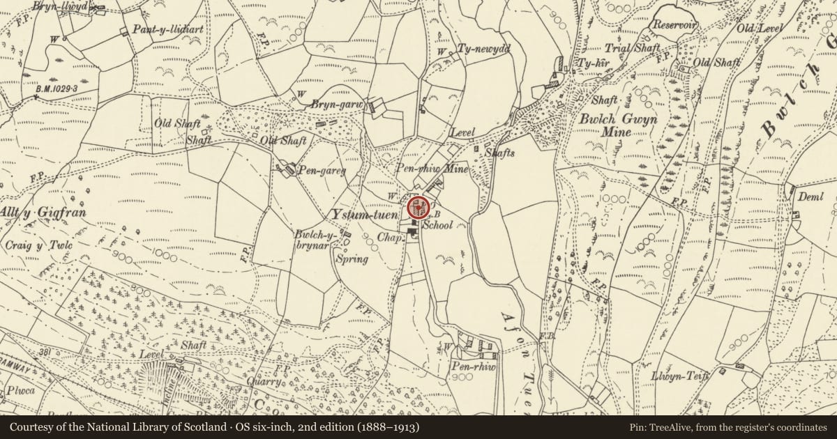
Slide toward Today to fade the historical sheet and see the modern map underneath.
David Rumsey Map Collection, Stanford LibrariesDavid Rumsey Map Collection, Stanford LibrariesDavid Rumsey Map Collection, Stanford LibrariesDavid Rumsey Map Collection, Stanford LibrariesDavid Rumsey Map Collection, Stanford Libraries
5 historical maps cover this location, the earliest the 1830 map "V.3:11-15:XV. Britisches Reich. A. Kon: England. b. Frstenthum Wales: Shire: 37-40" (David Rumsey Map Collection, Stanford Libraries).
Historical maps covering this location
- 1830 · V.3:11-15:XV. Britisches Reich. A. Kon: England. b. Frstenthum Wales: Shire: 37-40 (David Rumsey Map Collection, Stanford Libraries)
- 1883 · Watershed map England, Wales 3. (David Rumsey Map Collection, Stanford Libraries)
- 1896 · Sheet 7. Ordnance Survey of England and Wales. (David Rumsey Map Collection, Stanford Libraries)
- 1899 · 178 Llanilar (Hills) (David Rumsey Map Collection, Stanford Libraries)
- 1901 · Sheet 14. (David Rumsey Map Collection, Stanford Libraries)
Cadw's description
Location
Situated some 50m N of Ebenezer chapel at N end of short row of three, attached to Clydfan.
History
House, former pair of houses, mid C19, not marked on 1845 Tithe map. Probably of slightly later date than the pair to left, as straight joint between.
Exterior
House, painted rubble stone and slate roof with stone right end stack, the left one shared with Clydfan. Two storeys, three bays with long C20 6-pane windows under eaves above and 12-pane sashes below (two renewed in C20, the third C19, horned). Slate sills. Originally with two doors in gabled stone surrounds, one each side of centre window, the right one removed. Left one has slate roofed gabled surround with rubble stone piers and gable slightly projecting with pointed arch. Half-glazed double doors and triangular traceried overlight. Right gable with single window to right, overhanging verges. Outshut rear.
Interior
Not available for inspection.
Reason for designation
Included as a house in late Georgian style, probably associated with lead-mining, and for group value in short terrace of houses N of the chapel.
Nearby in the register
- ClydfanDomesticunder 1 mi
- Cottage attached to ClydfanDomesticunder 1 mi
- Telephone Call-boxCommunicationsunder 1 mi
- Ebenezer Wesleyan Chapel, forecourt wall and outbuildingReligious, Ritual and Funeraryunder 1 mi
Other entries of the same register within about three miles of this one, by straight line.