Cof Cymru: National Historic Assets of Wales · Wales
Ynys Einion
Ysgubor-y-Coed, Ceredigion, Wales
A Grade II listed building in Eglwys Fach, Machynlleth, Ysgubor-y-Coed, Ceredigion, designated on 23 November 2004.
The record
- Designation
- Listed building, Grade II
- Broad class
- Domestic
- Date of designation
- 23 November 2004
- Locality
- Eglwys Fach
- Town
- Machynlleth
- Community
- Ysgubor-y-Coed
- Unitary authority
- Ceredigion
- Country
- Wales
- Coordinates
- 52.54226, -3.93891
- Cadw reference
- 83275
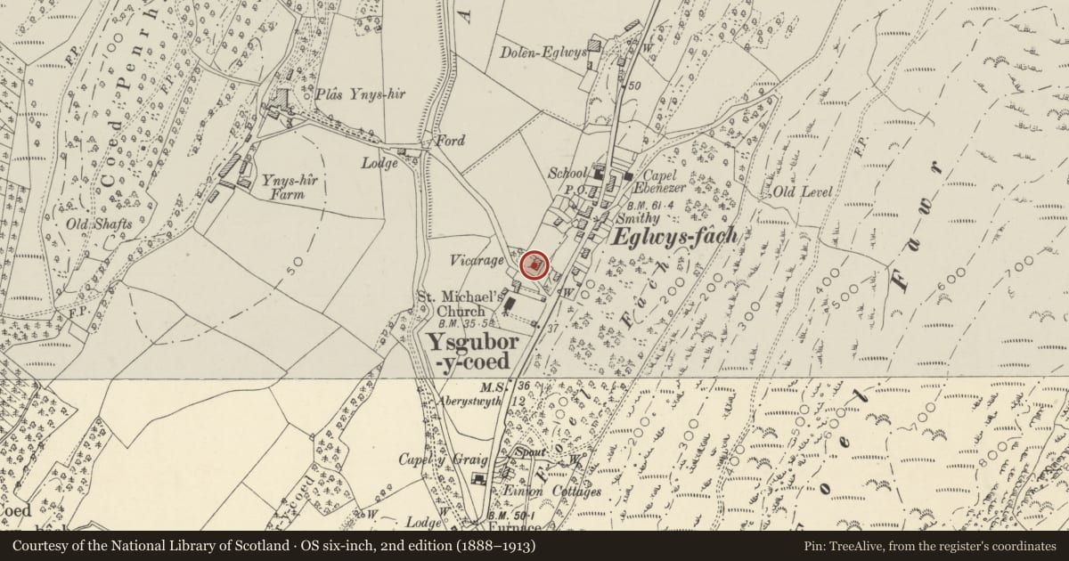
Slide toward Today to fade the historical sheet and see the modern map underneath.
David Rumsey Map Collection, Stanford LibrariesDavid Rumsey Map Collection, Stanford LibrariesDavid Rumsey Map Collection, Stanford LibrariesDavid Rumsey Map Collection, Stanford LibrariesDavid Rumsey Map Collection, Stanford Libraries
5 historical maps cover this location, the earliest the 1830 map "V.3:11-15:XV. Britisches Reich. A. Kon: England. b. Frstenthum Wales: Shire: 37-40" (David Rumsey Map Collection, Stanford Libraries).
Historical maps covering this location
- 1830 · V.3:11-15:XV. Britisches Reich. A. Kon: England. b. Frstenthum Wales: Shire: 37-40 (David Rumsey Map Collection, Stanford Libraries)
- 1883 · Watershed map England, Wales 3. (David Rumsey Map Collection, Stanford Libraries)
- 1896 · Sheet 7. Ordnance Survey of England and Wales. (David Rumsey Map Collection, Stanford Libraries)
- 1899 · 163 Aberystwyth (Hills) (David Rumsey Map Collection, Stanford Libraries)
- 1901 · Sheet 14. (David Rumsey Map Collection, Stanford Libraries)
Cadw's description
Location
Situated just off A487, to N of churchyard, facing S over lane to Ynyshir.
History
Former vicarage of Eglwys Fach, later C19. Notable as having been the home of the Rev. R. S. Thomas when he was vicar of the parish from 1954 to 1967, and where he wrote several important collections of poetry. Thomas disliked the brick banding of the stonework and attempted to paint it over.
Exterior
House, former vicarage, rubble stone and red brick with slate eaves roofs and brick chimneys. Two storeys, 3-window range with small brick stack behind ridge towards right. Long four-pane sash windows with segmental-pointed brick heads and slate sills, ground floor windows slightly larger. Half-glazed centre door with side-lights and large overlight. Basement window to left. Red brick bands at sill level both floors and double band at ground floor window head level.
W side has gable to right with timber verge boards and 2-window range, projecting forward of 2-window range to left. Brick stacks on roof slope to left of gable and at left end. E side has similar window at mid height and rear wing.
Interior
Not inspected.
Reason for designation
Included for literary interest as home of the Rev. R. S. Thomas 1954-67.
Nearby in the register
- The Church HallCivilunder 1 mi
- No 2 Ty MawrDomesticunder 1 mi
- No 1 Ty MawrDomesticunder 1 mi
- Church of St MichaelReligious, Ritual and Funeraryunder 1 mi
Other entries of the same register within about three miles of this one, by straight line.