Cof Cymru: National Historic Assets of Wales · Wales
The Granary
Rhoose, Vale of Glamorgan, Wales
A Grade II listed building in East Aberthaw, Barry, Rhoose, Vale of Glamorgan, designated on 30 September 2004.
The record
- Designation
- Listed building, Grade II
- Broad class
- Domestic
- Date of designation
- 30 September 2004
- Locality
- East Aberthaw
- Town
- Barry
- Community
- Rhoose
- Unitary authority
- Vale of Glamorgan
- Country
- Wales
- Coordinates
- 51.39149, -3.38869
- Cadw reference
- 83162
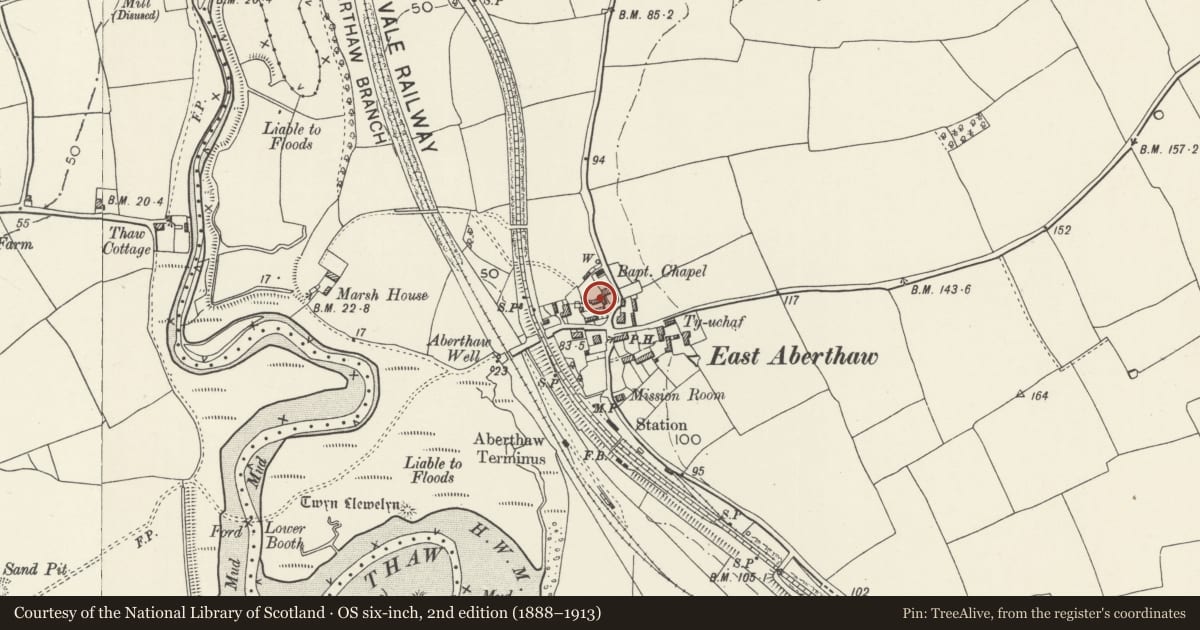
Slide toward Today to fade the historical sheet and see the modern map underneath.
David Rumsey Map Collection, Stanford LibrariesDavid Rumsey Map Collection, Stanford LibrariesDavid Rumsey Map Collection, Stanford LibrariesDavid Rumsey Map Collection, Stanford LibrariesDavid Rumsey Map Collection, Stanford Libraries
5 historical maps cover this location, the earliest the 1636 map "Cornubia : Devonia, Somersetus, Dorcestria, Wiltonia, Glocestria ..." (David Rumsey Map Collection, Stanford Libraries).
Historical maps covering this location
- 1636 · Cornubia : Devonia, Somersetus, Dorcestria, Wiltonia, Glocestria ... (David Rumsey Map Collection, Stanford Libraries)
- 1637 · The fourth table of England. Cornub. Devonia, Somerset etc. (David Rumsey Map Collection, Stanford Libraries)
- 1858 · 20. Bridgewater. (David Rumsey Map Collection, Stanford Libraries)
- 1865 · England and Wales. England No. 6. (David Rumsey Map Collection, Stanford Libraries)
- 1895 · Sheet 11. Ordnance Survey of England and Wales. (David Rumsey Map Collection, Stanford Libraries)
Cadw's description
Location
In the centre of East Aberthaw village on the west side of the road adjoining Marsh House.
History
Probably c1800 or soon afterwards. Built as the stables, hayloft and granary of the adjoining Marsh House (qv) and converted to domestic use in the late C20. It is shown on the Tithe Map of 1841.
Exterior
Wholly rendered and painted two-storey outbuilding with a slate roof and red ridge tiles. L-shaped plan with a wing projecting forward on the right-hand with end gable facing front, plain door on lower level with a 6 over 6 pane sash reached by a flight of stone steps and replacing the previous door. To the left and set back are another two bays and a second flight of steps with a part glazed door at the top. This wing has a modern stack on the left gable. Rear elevation not seen.
Interior
Interior not seen at resurvey, but it is now in domestic use having been converted in the late C20.
Reason for designation
Included for group value with Marsh House and the Blue Anchor PH.
Nearby in the register
- Marsh House, with attached garden wallDomesticunder 1 mi
- The Blue Anchor Inn PHDomesticunder 1 mi
- Aberthaw Signal BoxTransportunder 1 mi
- East Kilns at Aberthaw Lime and Cement WorksIndustrialunder 1 mi
Other entries of the same register within about three miles of this one, by straight line.