Cof Cymru: National Historic Assets of Wales · Wales
Retaining Walls of South Garden at Fonmon Castle
Rhoose, Vale of Glamorgan, Wales
A Grade II listed building in Fonmon, Barry, Rhoose, Vale of Glamorgan, designated on 30 September 2004.
The record
- Designation
- Listed building, Grade II
- Broad class
- Domestic
- Date of designation
- 30 September 2004
- Locality
- Fonmon
- Town
- Barry
- Community
- Rhoose
- Unitary authority
- Vale of Glamorgan
- Country
- Wales
- Coordinates
- 51.40335, -3.37067
- Cadw reference
- 83159
Slide toward Today to fade the historical sheet and see the modern map underneath.
David Rumsey Map Collection, Stanford LibrariesDavid Rumsey Map Collection, Stanford LibrariesDavid Rumsey Map Collection, Stanford LibrariesDavid Rumsey Map Collection, Stanford LibrariesDavid Rumsey Map Collection, Stanford Libraries
5 historical maps cover this location, the earliest the 1636 map "Cornubia : Devonia, Somersetus, Dorcestria, Wiltonia, Glocestria ..." (David Rumsey Map Collection, Stanford Libraries).
Historical maps covering this location
- 1636 · Cornubia : Devonia, Somersetus, Dorcestria, Wiltonia, Glocestria ... (David Rumsey Map Collection, Stanford Libraries)
- 1637 · The fourth table of England. Cornub. Devonia, Somerset etc. (David Rumsey Map Collection, Stanford Libraries)
- 1858 · 20. Bridgewater. (David Rumsey Map Collection, Stanford Libraries)
- 1865 · England and Wales. England No. 6. (David Rumsey Map Collection, Stanford Libraries)
- 1897 · 262 Pontypridd (Hills) (David Rumsey Map Collection, Stanford Libraries)
Cadw's description
Location
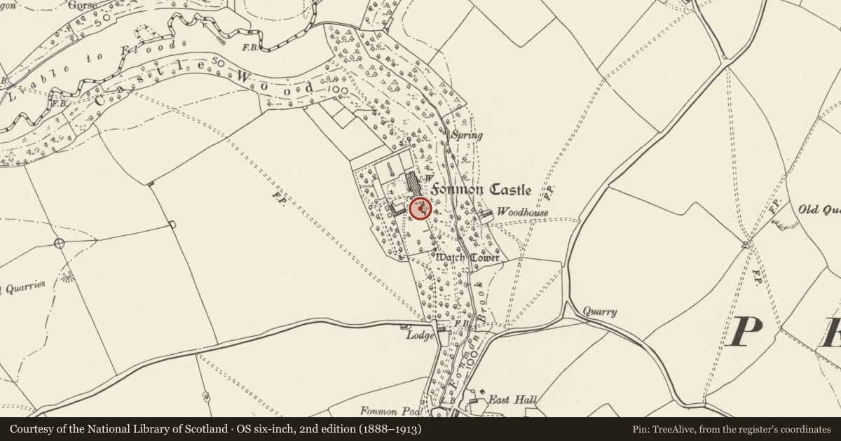
On the south side of Fonmon Castle.
History
Probably mainly mid/late C19 in design, but incorporating earlier fragmentary walls from the castle and from the late C17 'Keep Garden'. There have been alterations, additions and strengthening in the C20.
Exterior
Castellated limestone rubble walling defining the main south terrace of the castle garden and retaining it against the east ravine. The highest corner by the beech tree has buttresses lately added.
Reason for designation
Included for their group value within the gardens of Fonmon Castle.
Nearby in the register
- Stable Block at Fonmon CastleDomesticunder 1 mi
- Fonmon CastleDomesticunder 1 mi
- Watchtower at Fonmon CastleDomesticunder 1 mi
- Walls of Walled Gardens at Fonmon CastleDomesticunder 1 mi
Other entries of the same register within about three miles of this one, by straight line.