Cof Cymru: National Historic Assets of Wales · Wales
Hen Dy Ysgol
Aberedw, Powys, Wales
A Grade II listed building in Aberedw, Powys, designated on 24 September 2004.
The record
- Designation
- Listed building, Grade II
- Broad class
- No class recorded
- Date of designation
- 24 September 2004
- Locality
- Aberedw
- Community
- Aberedw
- Unitary authority
- Powys
- Country
- Wales
- Coordinates
- 52.11648, -3.34233
- Cadw reference
- 83138
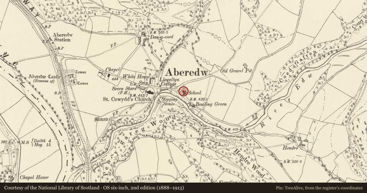
Slide toward Today to fade the historical sheet and see the modern map underneath.
David Rumsey Map Collection, Stanford LibrariesDavid Rumsey Map Collection, Stanford LibrariesDavid Rumsey Map Collection, Stanford LibrariesDavid Rumsey Map Collection, Stanford LibrariesDavid Rumsey Map Collection, Stanford Libraries
5 historical maps cover this location, the earliest the 1608 map "(13) Cambriae Typus." (David Rumsey Map Collection, Stanford Libraries).
Historical maps covering this location
- 1608 · (13) Cambriae Typus. (David Rumsey Map Collection, Stanford Libraries)
- 1636 · Cornubia : Devonia, Somersetus, Dorcestria, Wiltonia, Glocestria ... (David Rumsey Map Collection, Stanford Libraries)
- 1637 · Particular description of Wales. Cambria seu Wallia (David Rumsey Map Collection, Stanford Libraries)
- 1899 · 196 Builth (Hills) (David Rumsey Map Collection, Stanford Libraries)
- 1901 · Sheet 14. (David Rumsey Map Collection, Stanford Libraries)
Cadw's description
Location
Set back from and above the N side of the road through the village, approximately 150m E of the parish church. The former school (now Llau Edw) is attached to the SE angle of the house.
History
Aberedw National school was built in 1869-70 by J.L. Pearson, architect of London. The school house is probably contemporary and by the same architect. It is shown on the 1889 Ordnance Survey. The attached former school is now also a house.
Exterior
A 1½-storey cottage in early Arts and Crafts style, of rubble-stone walls, red-tile roof half-hipped to the L, and roughcast stacks L of centre and behind to the R. The near symmetrical front has a central porch with bay window to its L under the same catslide roof. The open-fronted porch has a pointed arch, and replacement half-glazed door. Windows to the R and L have a continuous freestone sill band and relieving arches, and are 3-light casements with diamond leaded lights. A central hipped roof dormer has a similar 2-light window. The R gable end also has a similar attic casement window.
Interior
Not inspected.
Reason for designation
Listed for its special architectural interest as a well-preserved, early Arts-and-Crafts style house.
Nearby in the register
- Llewellyn HouseNo class recordedunder 1 mi
- Church of St CewyddReligious, Ritual and Funeraryunder 1 mi
- Multi-purpose farm building at Dan-y-Coed FarmNo class recordedunder 1 mi
- Dan-y-CoedNo class recordedunder 1 mi
Other entries of the same register within about three miles of this one, by straight line.