Cof Cymru: National Historic Assets of Wales · Wales
Heavy Horse Stable at West Aberthaw Farm
St. Athan, Vale of Glamorgan, Wales
A Grade II listed building in West Aberthaw, Barry, St. Athan, Vale of Glamorgan, designated on 3 September 2004.
The record
- Designation
- Listed building, Grade II
- Broad class
- Agriculture and Subsistence
- Date of designation
- 3 September 2004
- Locality
- West Aberthaw
- Town
- Barry
- Community
- St. Athan
- Unitary authority
- Vale of Glamorgan
- Country
- Wales
- Coordinates
- 51.39235, -3.40525
- Cadw reference
- 83122
Slide toward Today to fade the historical sheet and see the modern map underneath.
David Rumsey Map Collection, Stanford LibrariesDavid Rumsey Map Collection, Stanford LibrariesDavid Rumsey Map Collection, Stanford LibrariesDavid Rumsey Map Collection, Stanford LibrariesDavid Rumsey Map Collection, Stanford Libraries
5 historical maps cover this location, the earliest the 1636 map "Cornubia : Devonia, Somersetus, Dorcestria, Wiltonia, Glocestria ..." (David Rumsey Map Collection, Stanford Libraries).
Historical maps covering this location
- 1636 · Cornubia : Devonia, Somersetus, Dorcestria, Wiltonia, Glocestria ... (David Rumsey Map Collection, Stanford Libraries)
- 1637 · The fourth table of England. Cornub. Devonia, Somerset etc. (David Rumsey Map Collection, Stanford Libraries)
- 1858 · 20. Bridgewater. (David Rumsey Map Collection, Stanford Libraries)
- 1865 · England and Wales. England No. 6. (David Rumsey Map Collection, Stanford Libraries)
- 1897 · 262 Pontypridd (Outline) (David Rumsey Map Collection, Stanford Libraries)
Cadw's description
Location
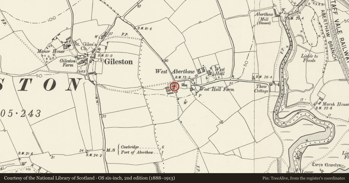
A part of the farmyard group about 50m west of West Aberthaw Farmhouse.
History
An early to mid C19 heavy horse stable which was extended on the west end later in the C19 and has not been altered since apart from the blocking of openings. It is shown before extension on the Tithe Map of 1839.
Exterior
The building is constructed of roughly coursed local lias limestone rubble with dressed quoins, Welsh slate roof. Rectangular single storey range with a central door with a segmental head and windows on either side, the one on the right in a blocked doorway.
Interior
Single cell interior with queen strut roof trusses with iron reinforcement on the struts.
Reason for designation
Included for its special interest as a part of a very complete C19 Vale farmstead group.
Nearby in the register
- Cart Shed at West Aberthaw FarmAgriculture and Subsistenceunder 1 mi
- Bullhouse (Old Chapel) at West Aberthaw FarmReligious, Ritual and Funeraryunder 1 mi
- Barn at West Aberthaw FarmAgriculture and Subsistenceunder 1 mi
- Garden Wall of West Aberthaw FarmhouseDomesticunder 1 mi
Other entries of the same register within about three miles of this one, by straight line.