Cof Cymru: National Historic Assets of Wales · Wales
Barn at Pentrusco
Beguildy, Powys, Wales
A Grade II listed building in Heyop, Beguildy, Powys, designated on 24 August 2004.
The record
- Designation
- Listed building, Grade II
- Broad class
- No class recorded
- Date of designation
- 24 August 2004
- Locality
- Heyop
- Community
- Beguildy
- Unitary authority
- Powys
- Country
- Wales
- Coordinates
- 52.36087, -3.11129
- Cadw reference
- 83075
Slide toward Today to fade the historical sheet and see the modern map underneath.
David Rumsey Map Collection, Stanford LibrariesDavid Rumsey Map Collection, Stanford LibrariesDavid Rumsey Map Collection, Stanford LibrariesDavid Rumsey Map Collection, Stanford LibrariesDavid Rumsey Map Collection, Stanford Libraries
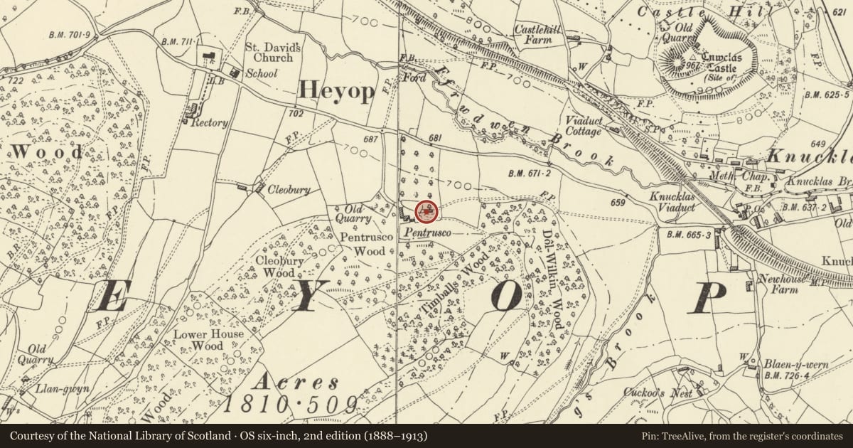
5 historical maps cover this location, the earliest the 1608 map "(13) Cambriae Typus." (David Rumsey Map Collection, Stanford Libraries).
Historical maps covering this location
- 1608 · (13) Cambriae Typus. (David Rumsey Map Collection, Stanford Libraries)
- 1637 · Particular description of Wales. Cambria seu Wallia (David Rumsey Map Collection, Stanford Libraries)
- 1883 · Watershed map England, Wales 3. (David Rumsey Map Collection, Stanford Libraries)
- 1899 · 180 Knighton (Hills) (David Rumsey Map Collection, Stanford Libraries)
- 1901 · Sheet 14. (David Rumsey Map Collection, Stanford Libraries)
Cadw's description
Location
On the E side of the house.
History
Dated 1768.
Exterior
A timber-framed barn clad in weatherboarding and partly rebuilt in brick and blockwork, with corrugated-iron roof. It has double boarded doors R of centre, and a door and 2 metal-framed windows to the L side where it is rebuilt in blockwork. There are 6 loft openings, 3 of which retain shutters. In the R gable end are 2 inserted boarded doors and loft opening. The rear has 2 C20 corrugated iron lean-tos, and a loft door L of centre.
Interior
Not inspected but RCAHM Wales recorded a tie-beam dated 1678.
Reason for designation
Listed as one of the earlier dated barns of Radnorshire and, with the house, as part of a strong farm group.
Nearby in the register
- Pentrusco Farmhouse and attached agricultural range.Agriculture and Subsistenceunder 1 mi
- Lower DolwilkinNo class recordedunder 1 mi
- Church of St DavidReligious, Ritual and Funeraryunder 1 mi
- Knucklas Railway ViaductTransportunder 1 mi
Other entries of the same register within about three miles of this one, by straight line.