Cof Cymru: National Historic Assets of Wales · Wales
Outbuilding at Pantgwyn Mawr
Clydau, Pembrokeshire, Wales
A Grade II listed building in Tegryn, Llanfrynach, Clydau, Pembrokeshire, designated on 19 August 2004.
The record
- Designation
- Listed building, Grade II
- Broad class
- Agriculture and Subsistence
- Date of designation
- 19 August 2004
- Locality
- Tegryn
- Town
- Llanfrynach
- Community
- Clydau
- Unitary authority
- Pembrokeshire
- Country
- Wales
- Coordinates
- 51.95994, -4.55501
- Cadw reference
- 83061
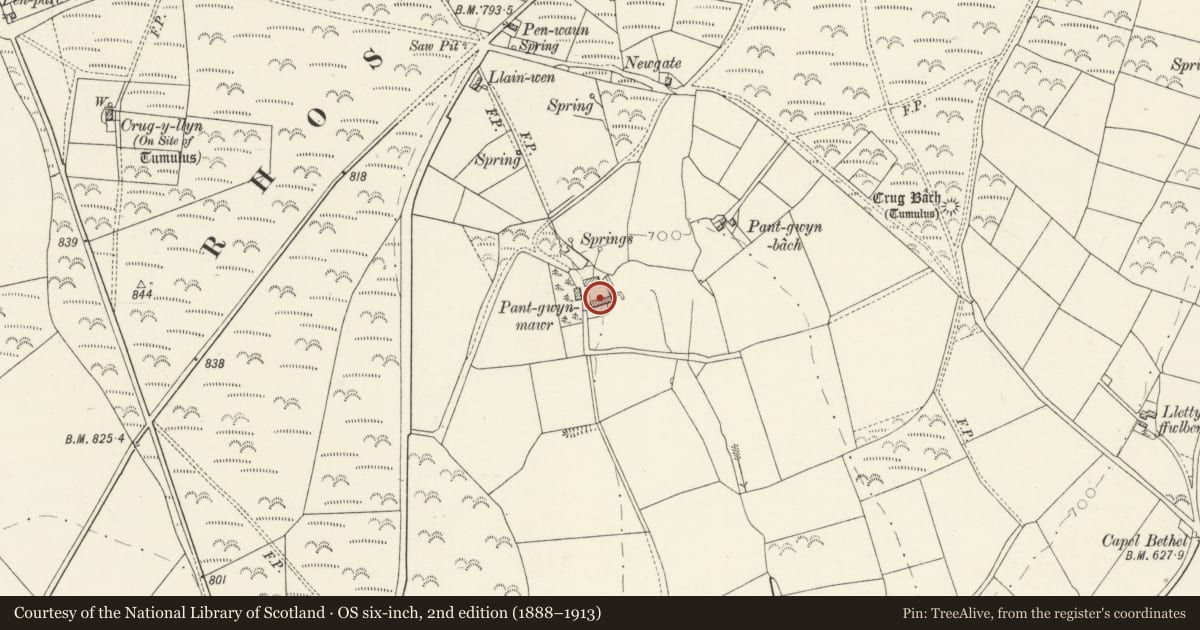
Slide toward Today to fade the historical sheet and see the modern map underneath.
David Rumsey Map Collection, Stanford LibrariesDavid Rumsey Map Collection, Stanford LibrariesDavid Rumsey Map Collection, Stanford LibrariesDavid Rumsey Map Collection, Stanford LibrariesDavid Rumsey Map Collection, Stanford Libraries
5 historical maps cover this location, the earliest the 1636 map "Cornubia : Devonia, Somersetus, Dorcestria, Wiltonia, Glocestria ..." (David Rumsey Map Collection, Stanford Libraries).
Historical maps covering this location
- 1636 · Cornubia : Devonia, Somersetus, Dorcestria, Wiltonia, Glocestria ... (David Rumsey Map Collection, Stanford Libraries)
- 1830 · V.3:11-15:XV. Britisches Reich. A. Kon: England. b. Frstenthum Wales: Shire: 37-40 (David Rumsey Map Collection, Stanford Libraries)
- 1891 · Sheet 10. Ordnance Survey of England and Wales. . (David Rumsey Map Collection, Stanford Libraries)
- 1898 · 211 Newcastle Emlyn (Hills) (David Rumsey Map Collection, Stanford Libraries)
- 1901 · Sheet 14. (David Rumsey Map Collection, Stanford Libraries)
Cadw's description
Location
On the S side of the yard just E of the house at Pantgwyn Mawr.
History
Outbuilding to Pantgwyn Mawr, earlier to mid C19, lofted stable, barn and lofted coach-house.
Exterior
Outbuilding, rubble stone with corrugated asbestos roof cladding. Long range with lean-to on left end and C20 outside stairs to loft door, with recessed head and cut slate voussoirs, on right end. Distinctive recessed heads to openings with cut slate voussoirs, alternately whitened. Lean-to has a door to front end wall. Main range has the stable to left with window each side of a door and two louvred loft openings above. Centre is windowless, right part has door to barn and then cart-entry with broad elliptical arch and renewed double doors, the arch central under two square loft windows with C20 glazing.
Interior
Interior not available for inspection.
Reason for designation
Included for group value with Pantgwyn Mawr as a complete C19 farmstead with house, lofted cart-shed, barn and stable, and cow-shed.
Nearby in the register
- Pantgwyn MawrDomesticunder 1 mi
- Former cowshed at Pantgwyn MawrAgriculture and Subsistenceunder 1 mi
- Crug Bach Round BarrowRound Barrowunder 1 mi
- Henfeddau Fawr Defended EnclosureEnclosure - Defensiveunder 1 mi
Other entries of the same register within about three miles of this one, by straight line.