Cof Cymru: National Historic Assets of Wales · Wales
Outbuilding at Old Rectory
Glantwymyn, Powys, Wales
A Grade II listed building in Darowen, Glantwymyn, Powys, designated on 5 August 2004.
The record
- Designation
- Listed building, Grade II
- Broad class
- No class recorded
- Date of designation
- 5 August 2004
- Locality
- Darowen
- Community
- Glantwymyn
- Unitary authority
- Powys
- Country
- Wales
- Coordinates
- 52.60191, -3.72907
- Cadw reference
- 83033
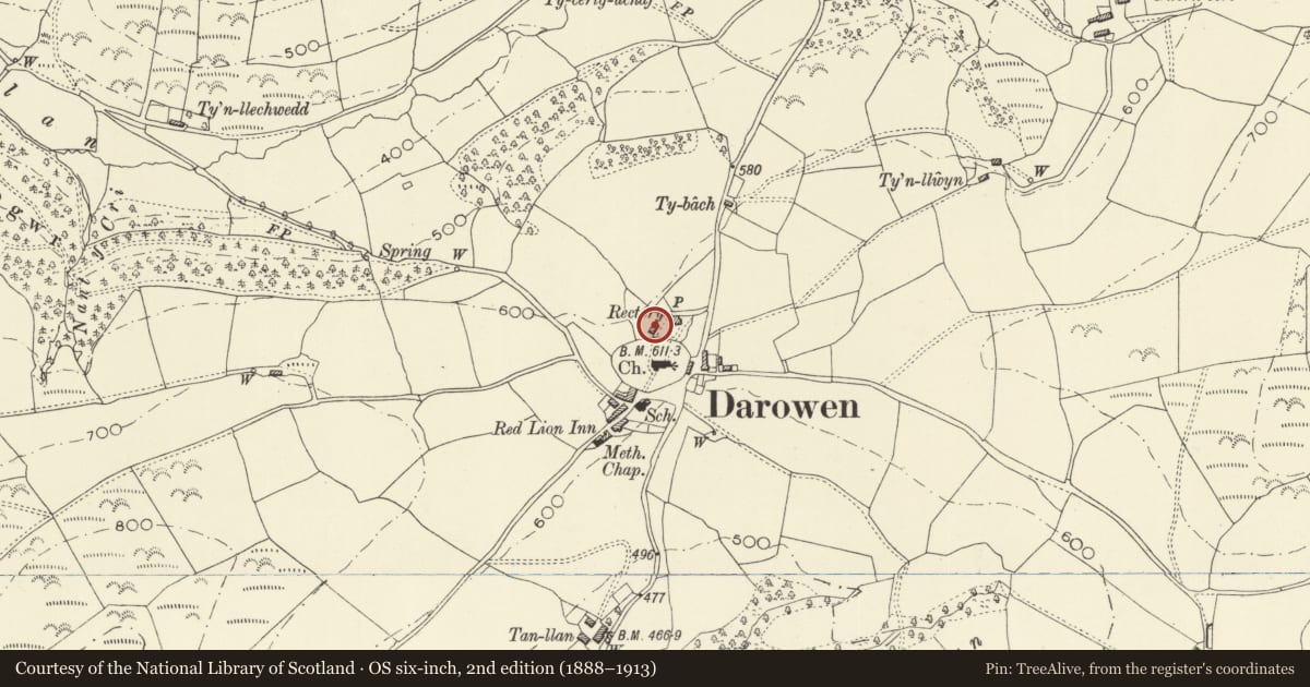
Slide toward Today to fade the historical sheet and see the modern map underneath.
David Rumsey Map Collection, Stanford LibrariesDavid Rumsey Map Collection, Stanford LibrariesDavid Rumsey Map Collection, Stanford LibrariesLlyfrgell Genedlaethol Cymru – The National Library of WalesDavid Rumsey Map Collection, Stanford Libraries
5 historical maps cover this location, the earliest the 1795 map "To Sir Watkin Williams-Wynn Bart ... the map of the six counties of North Wales is most humbly inscribed by his obedient humble servant" (Llyfrgell Genedlaethol Cymru – The National Library of Wales).
Historical maps covering this location
- 1795 · To Sir Watkin Williams-Wynn Bart ... the map of the six counties of North Wales is most… (Llyfrgell Genedlaethol Cymru – The National Library of Wales)
- 1830 · V.3:11-15:XV. Britisches Reich. A. Kon: England. b. Frstenthum Wales: Shire: 37-40 (David Rumsey Map Collection, Stanford Libraries)
- 1883 · Watershed map England, Wales 3. (David Rumsey Map Collection, Stanford Libraries)
- 1899 · 150 Dinas-Mawddwy (Hills) (David Rumsey Map Collection, Stanford Libraries)
- 1901 · Sheet 9 and 10. (David Rumsey Map Collection, Stanford Libraries)
Cadw's description
Location
Located in the grounds to the W of the former rectory.
History
Probably early C19 and shown on the Tithe map of 1846. Possibly contemporary with a rebuilding of the house in 1820. It was probably a stable and coachhouse with attached kennel and pig sty.
Exterior
Lofted range of random slate blocks, formerly lime-washed, under a slate roof. Boarded doors, most of the ground floor openings with segmental brick heads. Single door to L of centre; 4-pane wooden window to its R, the elevation obscured by vegetation to its L. Double boarded doors to R of centre under long timber lintel, with loft hatch above. To the N gable end is a single-storey lean-to, formerly a kennel with pig sty to rear; it has a short door to front under a segmental brick head. S gable end has a door and window above, both with red brick surrounds and segmental heads.
Interior
No access to interior at time of inspection.
Reason for designation
Listed as an outbuilding retaining its character, and for group value with Darowen Rectory.
Nearby in the register
- Old RectoryNo class recordedunder 1 mi
- Telephone call-box, Darowen.Communicationsunder 1 mi
- Pen y bancNo class recordedunder 1 mi
- Fron Goch hillfortHillfortunder 1 mi
Other entries of the same register within about three miles of this one, by straight line.