Cof Cymru: National Historic Assets of Wales · Wales
Wine Vaults Public House
Ruthin, Denbighshire, Wales
A Grade II listed building in Ruthin, Denbighshire, designated on 24 October 1950.
The record
- Designation
- Listed building, Grade II
- Broad class
- Commercial
- Date of designation
- 24 October 1950
- Town
- Ruthin
- Community
- Ruthin
- Unitary authority
- Denbighshire
- Country
- Wales
- Coordinates
- 53.11418, -3.31080
- Cadw reference
- 830
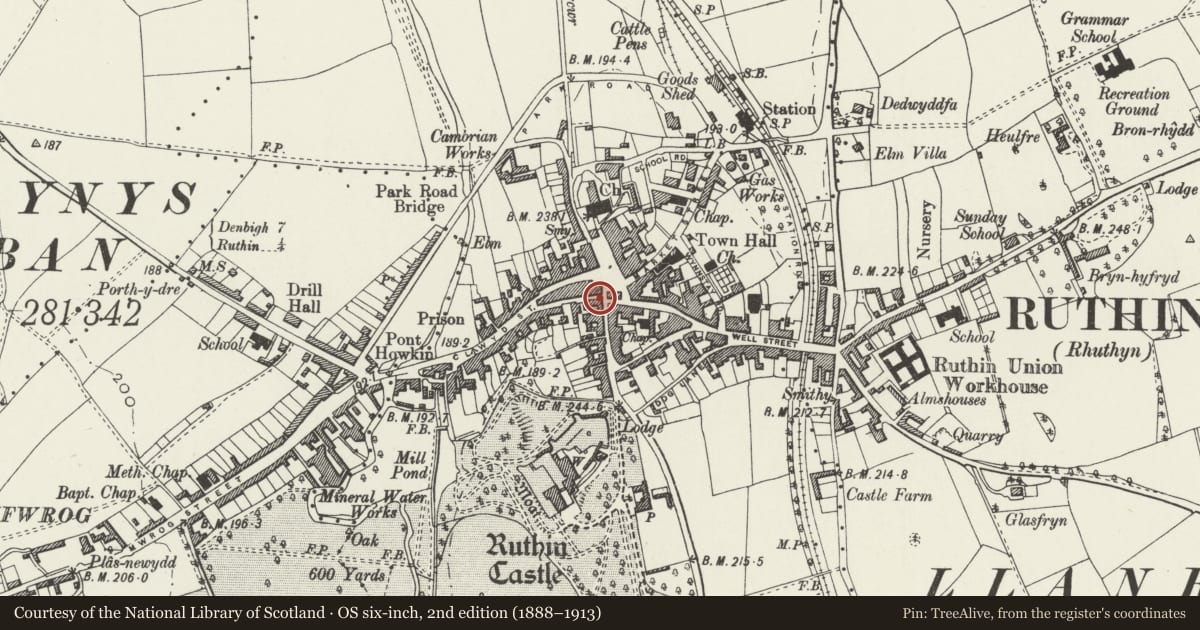
Slide toward Today to fade the historical sheet and see the modern map underneath.
David Rumsey Map Collection, Stanford LibrariesDavid Rumsey Map Collection, Stanford LibrariesDavid Rumsey Map Collection, Stanford LibrariesLlyfrgell Genedlaethol Cymru – The National Library of WalesDavid Rumsey Map Collection, Stanford Libraries
5 historical maps cover this location, the earliest the 1795 map "To Sir Watkin Williams-Wynn Bart ... the map of the six counties of North Wales is most humbly inscribed by his obedient humble servant" (Llyfrgell Genedlaethol Cymru – The National Library of Wales).
Historical maps covering this location
- 1795 · To Sir Watkin Williams-Wynn Bart ... the map of the six counties of North Wales is most… (Llyfrgell Genedlaethol Cymru – The National Library of Wales)
- 1883 · Watershed map England, Wales 3. (David Rumsey Map Collection, Stanford Libraries)
- 1898 · 108 Flint (Hills) (David Rumsey Map Collection, Stanford Libraries)
- 1898 · 108 Flint (Outline) (David Rumsey Map Collection, Stanford Libraries)
- 1901 · Sheet 9 and 10. (David Rumsey Map Collection, Stanford Libraries)
Cadw's description
Location
Located on the corner of Castle Street and Upper Clwyd Street.
History
Late C18 Public House, though the cellars may suggest earlier origins. It was known as the Black Horse during the 1820s, and later as the Spirit Vault. The Tontine Friendly Society was based here from 1903, but the building also housed a wine retailer, and the shop front to L was probably associated with this. The windows were probably replaced in the late C19. In early C20 photos, the building has a brick front with rusticated quoins, the windows with fluted keystones and aprons. It was stuccoed later.
Exterior
Three-storey 5-window front. Stuccoed and lined under a shallow slate roof, hipped to R end; brick stack to L end. Windows aligned to upper storeys, 3 grouped to L and 2 to R, all horned 4-pane sashes with flat heads and stone sills. Two attic dormers, to L and centre, with hipped roofs, slate-hung sides and 2-light casements. To ground floor, fine veranda of 6 Tuscan columns with ringed capitals and bases, the cornice not continuous, under a lean-to slate roof. Plain wooden railings between columns with 2 gates. Ground floor has 2 doorways both with panelled doors, possibly renewed, between which are 2 x 12-pane hornless sashes in moulded frames. To far R, a small 6-pane window. Former shop front to far L has a bow-window with large-pane wooden glazing on a roughcast stall board, the fascia reading 'Unicorn Wines'; plain-glazed wooden door to its L. The N end, facing Upper Clwyd Street, is 2-window with 4-pane sashes; small brick stack to NW angle. Joined by Corporation Arms to L. Red brick to rear.
Interior
Interior not seen.
Reason for designation
Listed as a large Public House retaining definite late C18 and C19 character, the veranda, probably an original feature, of particular interest. Group value with surrounding listed buildings.
Nearby in the register
- 1 Upper Clwyd StreetNo class recordedunder 1 mi
- 2 Upper Clwyd StreetCommercialunder 1 mi
- 2A Upper Clwyd StreetNo class recordedunder 1 mi
- Siop LlyfrCommercialunder 1 mi
Other entries of the same register within about three miles of this one, by straight line.