Cof Cymru: National Historic Assets of Wales · Wales
Railings to Rhydfendigaid Calvinistic Methodist chapel
Ystrad Fflur, Ceredigion, Wales
A Grade II listed building in Pontrhydfendigaid, Ystrad Meurig, Ystrad Fflur, Ceredigion, designated on 20 July 2004.
The record
- Designation
- Listed building, Grade II
- Broad class
- Religious, Ritual and Funerary
- Date of designation
- 20 July 2004
- Locality
- Pontrhydfendigaid
- Town
- Ystrad Meurig
- Community
- Ystrad Fflur
- Unitary authority
- Ceredigion
- Country
- Wales
- Coordinates
- 52.28328, -3.86223
- Cadw reference
- 82981
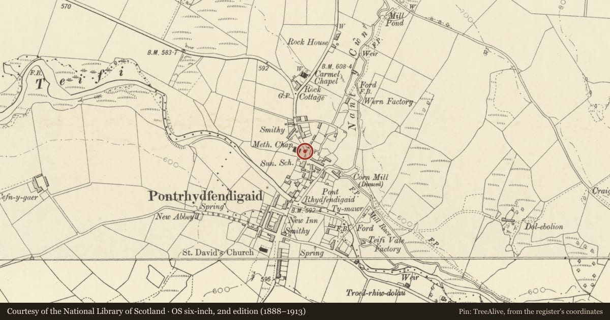
Slide toward Today to fade the historical sheet and see the modern map underneath.
David Rumsey Map Collection, Stanford LibrariesDavid Rumsey Map Collection, Stanford LibrariesDavid Rumsey Map Collection, Stanford LibrariesDavid Rumsey Map Collection, Stanford LibrariesDavid Rumsey Map Collection, Stanford Libraries
5 historical maps cover this location, the earliest the 1830 map "V.3:11-15:XV. Britisches Reich. A. Kon: England. b. Frstenthum Wales: Shire: 37-40" (David Rumsey Map Collection, Stanford Libraries).
Historical maps covering this location
- 1830 · V.3:11-15:XV. Britisches Reich. A. Kon: England. b. Frstenthum Wales: Shire: 37-40 (David Rumsey Map Collection, Stanford Libraries)
- 1883 · Watershed map England, Wales 3. (David Rumsey Map Collection, Stanford Libraries)
- 1896 · Sheet 7. Ordnance Survey of England and Wales. (David Rumsey Map Collection, Stanford Libraries)
- 1899 · 178 Llanilar (Hills) (David Rumsey Map Collection, Stanford Libraries)
- 1901 · Sheet 14. (David Rumsey Map Collection, Stanford Libraries)
Cadw's description
Location
Situated on W side of main street, in front of chapel.
History
Entrance gate piers and gate probably of 1859 and side railings with piers probably of 1907.
Exterior
Entrance gates between two piers of squared stone with plinth, cap and pyramid top of white quartz. Pair of cast-iron gates with dogbars, spearhead rails and curved top-rail. Added walls and rails each side have rendered wall carrying lengths of iron rails with twisted dog-bars, spearhead main uprights and heart-scrolls under top rail. Rails are in sections betwen red brick piers with tops chamfered in to cast- terracotta caps with slightly rounded friezes, cornices and shallow pyramidal tops. Eight piers to right, five piers to left of centre gate, and at far left a pair of rock-faced stone piers with white quartz caps.
Reason for designation
Included as good C19 to C20 ironwork, of group value with the chapel.
Nearby in the register
- IslwynDomesticunder 1 mi
- Rhydfendigaid Calvinistic Methodist ChapelReligious, Ritual and Funeraryunder 1 mi
- Pont RhydfendigaidTransportunder 1 mi
- The Post OfficeCommercialunder 1 mi
Other entries of the same register within about three miles of this one, by straight line.