Cof Cymru: National Historic Assets of Wales · Wales
Outbuilding to N of Boulston Manor
Uzmaston, Boulston and Slebech, Pembrokeshire, Wales
A Grade II listed building in Boulston, Haverfordwest, Uzmaston, Boulston and Slebech, Pembrokeshire, designated on 16 July 2004.
The record
- Designation
- Listed building, Grade II
- Broad class
- Agriculture and Subsistence
- Date of designation
- 16 July 2004
- Locality
- Boulston
- Town
- Haverfordwest
- Community
- Uzmaston, Boulston and Slebech
- Unitary authority
- Pembrokeshire
- Country
- Wales
- Coordinates
- 51.77609, -4.93630
- Cadw reference
- 82966
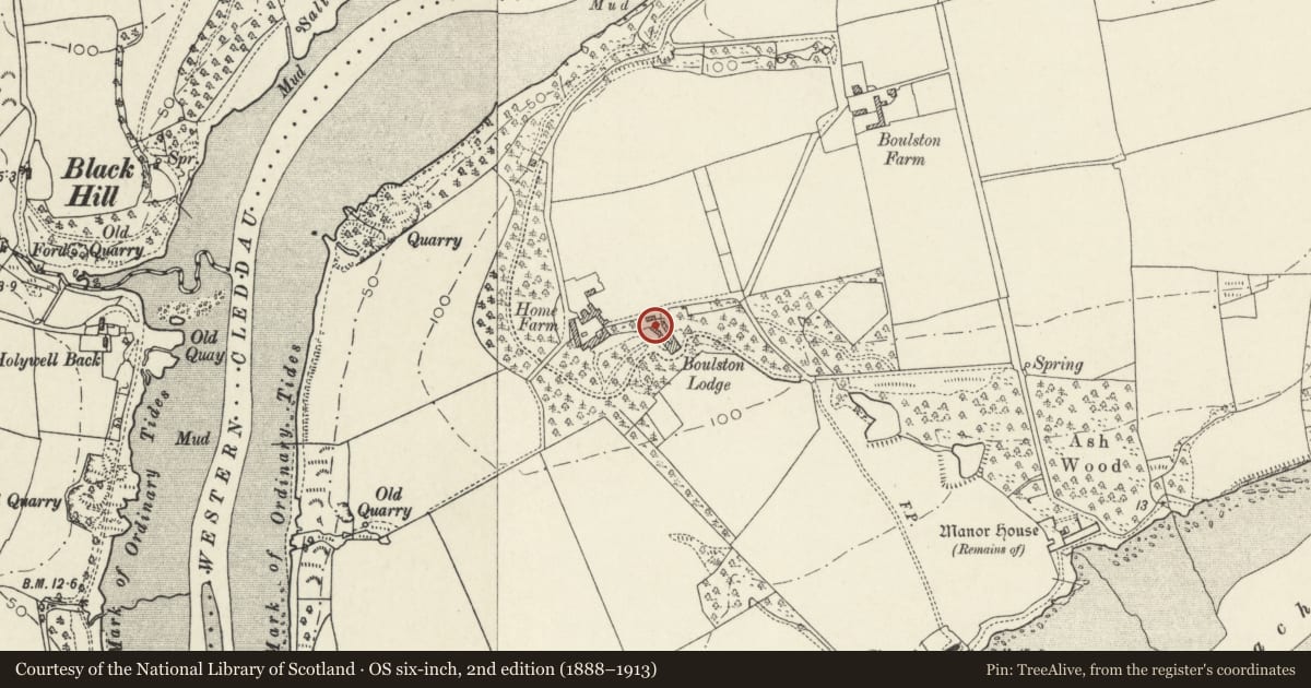
Slide toward Today to fade the historical sheet and see the modern map underneath.
David Rumsey Map Collection, Stanford LibrariesDavid Rumsey Map Collection, Stanford LibrariesDavid Rumsey Map Collection, Stanford LibrariesDavid Rumsey Map Collection, Stanford LibrariesDavid Rumsey Map Collection, Stanford Libraries
5 historical maps cover this location, the earliest the 1608 map "(13) Cambriae Typus." (David Rumsey Map Collection, Stanford Libraries).
Historical maps covering this location
- 1608 · (13) Cambriae Typus. (David Rumsey Map Collection, Stanford Libraries)
- 1636 · Cornubia : Devonia, Somersetus, Dorcestria, Wiltonia, Glocestria ... (David Rumsey Map Collection, Stanford Libraries)
- 1891 · Sheet 10. Ordnance Survey of England and Wales. . (David Rumsey Map Collection, Stanford Libraries)
- 1898 · 228 Haverfordwest (Hills) (David Rumsey Map Collection, Stanford Libraries)
- 1901 · Sheet 13. (David Rumsey Map Collection, Stanford Libraries)
Cadw's description
Location
Situated just N of rear court at Boulston House.
History
Lofted outbuilding with Gothic detail, to Boulston House, the house built in 1797. Of similar date, or early C19. In poor condition 2004.
Exterior
Outbuilding, rubble stone with asbestos sheet roofing, hipped to W, short brick chimney to E. Two storeys, three bays offset to left, with pointed window each floor to left, the upper one blank, pointed door left of centre and former blank pointed opening to ground floor right, with inserted window. Cut stone voussoirs. First floor, above door and right bay have plain cross-windows under eaves. Right end wall has pointed doorway to left.
Rear has outside stone steps to loft door, one loft window to left, two ground floor windows to right. Stone stairs have stone voussoirs to asymmetrical arch beneath. Rendered W end wall.
Interior
Not inspected.
Reason for designation
Included as an outbuilding to Boulston House with unusual simple Gothic detail.
Nearby in the register
- Boulston ManorDomesticunder 1 mi
- Hook QuayQuayunder 1 mi
- Little MilfordDomesticunder 1 mi
- Limekiln at Little MilfordAgriculture and Subsistenceunder 1 mi
Other entries of the same register within about three miles of this one, by straight line.