Cof Cymru: National Historic Assets of Wales · Wales
Ty'n-y-bwlch
Ystrad Meurig, Ceredigion, Wales
A Grade II listed building in Tynygraig, Ystrad Meurig, Ceredigion, designated on 15 July 2004.
The record
- Designation
- Listed building, Grade II
- Broad class
- No class recorded
- Date of designation
- 15 July 2004
- Locality
- Tynygraig
- Town
- Ystrad Meurig
- Community
- Ystrad Meurig
- Unitary authority
- Ceredigion
- Country
- Wales
- Coordinates
- 52.31584, -3.94334
- Cadw reference
- 82961
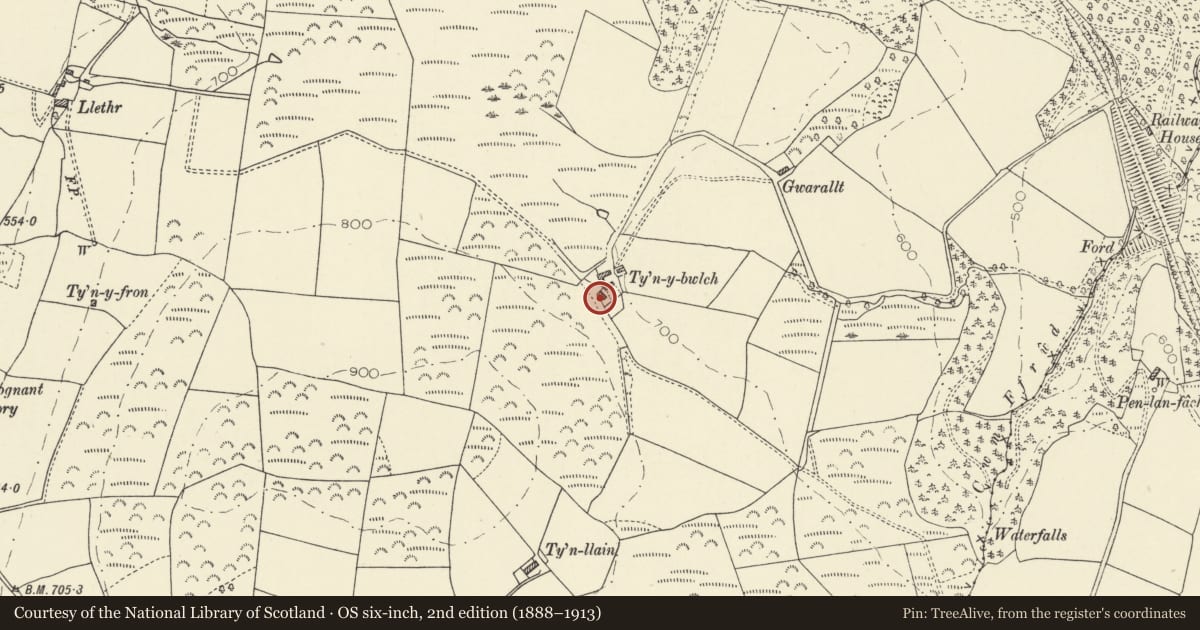
Slide toward Today to fade the historical sheet and see the modern map underneath.
David Rumsey Map Collection, Stanford LibrariesDavid Rumsey Map Collection, Stanford LibrariesDavid Rumsey Map Collection, Stanford LibrariesDavid Rumsey Map Collection, Stanford LibrariesDavid Rumsey Map Collection, Stanford Libraries
5 historical maps cover this location, the earliest the 1830 map "V.3:11-15:XV. Britisches Reich. A. Kon: England. b. Frstenthum Wales: Shire: 37-40" (David Rumsey Map Collection, Stanford Libraries).
Historical maps covering this location
- 1830 · V.3:11-15:XV. Britisches Reich. A. Kon: England. b. Frstenthum Wales: Shire: 37-40 (David Rumsey Map Collection, Stanford Libraries)
- 1883 · Watershed map England, Wales 3. (David Rumsey Map Collection, Stanford Libraries)
- 1896 · Sheet 7. Ordnance Survey of England and Wales. (David Rumsey Map Collection, Stanford Libraries)
- 1899 · 178 Llanilar (Hills) (David Rumsey Map Collection, Stanford Libraries)
- 1901 · Sheet 14. (David Rumsey Map Collection, Stanford Libraries)
Cadw's description
Location
Situated some 1.2 km NW of Gwnnws church, at the end of a 400m farm track.
History
Earlier C19 farmhouse.
Exterior
Farmhouse, whitewashed stone rubble, with slate roof and stone end stacks with dripstones, left one larger. Two-storey, three-window range offset to right, upper floor with hornless nine-pane sashes and ground floor with hornless twelve-pane sash either side of broad doorway. Two slate low steps up to to framed board door. All openings with stone voussoirs and windows with painted rough slate sills. The window-bays are not regularly spaced, that to left spaced further from the entrance bay than that to right. C20 rendered lean-to to right end, corrugated iron lean-to on left end. Outshut to rear, set into bank.
Interior
Interior not inspected.
Reason for designation
Included as a well-preserved traditional farmhouse in late Georgian style.
Nearby in the register
- Cwmllechwedd UchafDomesticunder 1 mi
- Llanwnnws Inscribed Stone in ChurchCross-marked stoneunder 1 mi
- No 1 TynyberthDomesticunder 1 mi
- No 2 TynyberthDomesticunder 1 mi
Other entries of the same register within about three miles of this one, by straight line.