Cof Cymru: National Historic Assets of Wales · Wales
Cottage by Nant-y-ffin Hotel
Llandissilio West, Pembrokeshire, Wales
A Grade II listed building in Llandissilio, Clynderwen, Llandissilio West, Pembrokeshire, designated on 15 July 2004.
The record
- Designation
- Listed building, Grade II
- Broad class
- Domestic
- Date of designation
- 15 July 2004
- Locality
- Llandissilio
- Town
- Clynderwen
- Community
- Llandissilio West
- Unitary authority
- Pembrokeshire
- Country
- Wales
- Coordinates
- 51.85396, -4.72853
- Cadw reference
- 82946
Slide toward Today to fade the historical sheet and see the modern map underneath.
David Rumsey Map Collection, Stanford LibrariesDavid Rumsey Map Collection, Stanford LibrariesDavid Rumsey Map Collection, Stanford LibrariesDavid Rumsey Map Collection, Stanford LibrariesDavid Rumsey Map Collection, Stanford Libraries
5 historical maps cover this location, the earliest the 1636 map "Cornubia : Devonia, Somersetus, Dorcestria, Wiltonia, Glocestria ..." (David Rumsey Map Collection, Stanford Libraries).
Historical maps covering this location
- 1636 · Cornubia : Devonia, Somersetus, Dorcestria, Wiltonia, Glocestria ... (David Rumsey Map Collection, Stanford Libraries)
- 1830 · V.3:11-15:XV. Britisches Reich. A. Kon: England. b. Frstenthum Wales: Shire: 37-40 (David Rumsey Map Collection, Stanford Libraries)
- 1891 · Sheet 10. Ordnance Survey of England and Wales. . (David Rumsey Map Collection, Stanford Libraries)
- 1898 · 228 Haverfordwest (Hills) (David Rumsey Map Collection, Stanford Libraries)
- 1901 · Sheet 13. (David Rumsey Map Collection, Stanford Libraries)
Cadw's description
Location
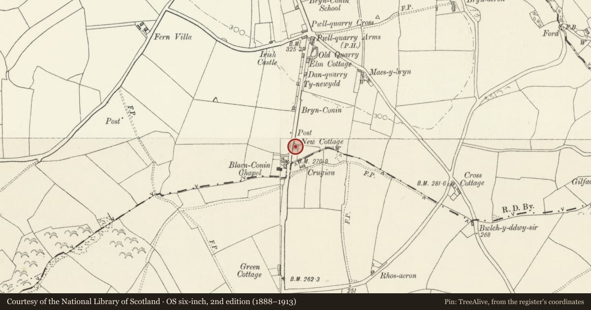
On the S side of Llandissilio by the roadside in front of the Nant-y-ffin Hotel.
History
Early C19 single storey cottage of traditional type formerly with croglofft. Shown on the Tithe map of 1839 as a cottage with garden, part of the 42 acres (17 hectares) of glebe land of the Rev. Edward Harries.
Exterior
Cottage, whitewashed rubble stone with corrugated-iron roof and very small yellow brick end stacks. Single storey, double-fronted with board door between small 4-pane windows, all with timber lintels. Windowless rear and ends.
Reason for designation
Included as a well-preserved example of the smallest rural cottages, now rare in the region.
Nearby in the register
- Crugiau Round BarrowsRound Barrowunder 1 mi
- Llandissilio War MemorialCommemorativeunder 1 mi
- Inscribed Stone in outer face of wall of St Michael's Church (now in Llandissilio Church)Cross-marked stoneunder 1 mi
- Church of Saint TysilioReligious, Ritual and Funeraryunder 1 mi
Other entries of the same register within about three miles of this one, by straight line.