Cof Cymru: National Historic Assets of Wales · Wales
Rhyd-coed-bach
Crymych, Pembrokeshire, Wales
A Grade II listed building in Glandwr, Whitland, Crymych, Pembrokeshire, designated on 18 June 2004.
The record
- Designation
- Listed building, Grade II
- Broad class
- No class recorded
- Date of designation
- 18 June 2004
- Locality
- Glandwr
- Town
- Whitland
- Community
- Crymych
- Unitary authority
- Pembrokeshire
- Country
- Wales
- Coordinates
- 51.92734, -4.63165
- Cadw reference
- 82936
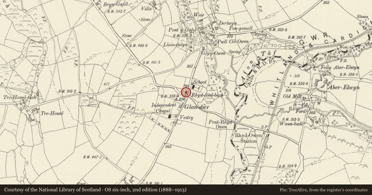
Slide toward Today to fade the historical sheet and see the modern map underneath.
David Rumsey Map Collection, Stanford LibrariesDavid Rumsey Map Collection, Stanford LibrariesDavid Rumsey Map Collection, Stanford LibrariesDavid Rumsey Map Collection, Stanford LibrariesDavid Rumsey Map Collection, Stanford Libraries
5 historical maps cover this location, the earliest the 1636 map "Cornubia : Devonia, Somersetus, Dorcestria, Wiltonia, Glocestria ..." (David Rumsey Map Collection, Stanford Libraries).
Historical maps covering this location
- 1636 · Cornubia : Devonia, Somersetus, Dorcestria, Wiltonia, Glocestria ... (David Rumsey Map Collection, Stanford Libraries)
- 1891 · Sheet 10. Ordnance Survey of England and Wales. . (David Rumsey Map Collection, Stanford Libraries)
- 1898 · 210 Cardigan (Hills) (David Rumsey Map Collection, Stanford Libraries)
- 1898 · 210 Cardigan (Outline) (David Rumsey Map Collection, Stanford Libraries)
- 1901 · Sheet 13. (David Rumsey Map Collection, Stanford Libraries)
Cadw's description
Location
On the NE side of the crossroads in the centre of the village of Glandwr.
History
Village house, probably late C18 or early C19 plan form and structure; some later detailing like replacement window frames and added porch.
Exterior
House, pebbledashed stone with slate close-eaved roof and end stacks, rendered to left, rebuilt in red brick to right. Two storeys, three-window range of small 4-pane horned sashes, centre C20 door in added rendered gabled porch. Facade is offset to right, reflecting large kitchen fireplace to left. Rendered painted left end with two inserted C20 uPVC windows at first floor. Outshut rear with stone low rear wall, two windows and door, all replaced in uPVC.
Interior
Not inspected.
Reason for designation
Included for its historic interest as a substantial village house which has retained its regional character.
Nearby in the register
- Inscribed Stone near Glan-Dwr Independent ChapelInscribed Stoneunder 1 mi
- Glandwr ChapelReligious, Ritual and Funeraryunder 1 mi
- Pont-y-GafelDomesticunder 1 mi
- AberelwynDomesticunder 1 mi
Other entries of the same register within about three miles of this one, by straight line.