Cof Cymru: National Historic Assets of Wales · Wales
Upton House
Llandovery, Carmarthenshire, Wales
A Grade II listed building in Llandovery, Carmarthenshire, designated on 18 June 2004.
The record
- Designation
- Listed building, Grade II
- Broad class
- Domestic
- Date of designation
- 18 June 2004
- Community
- Llandovery
- Unitary authority
- Carmarthenshire
- Country
- Wales
- Coordinates
- 51.99582, -3.79704
- Cadw reference
- 82910
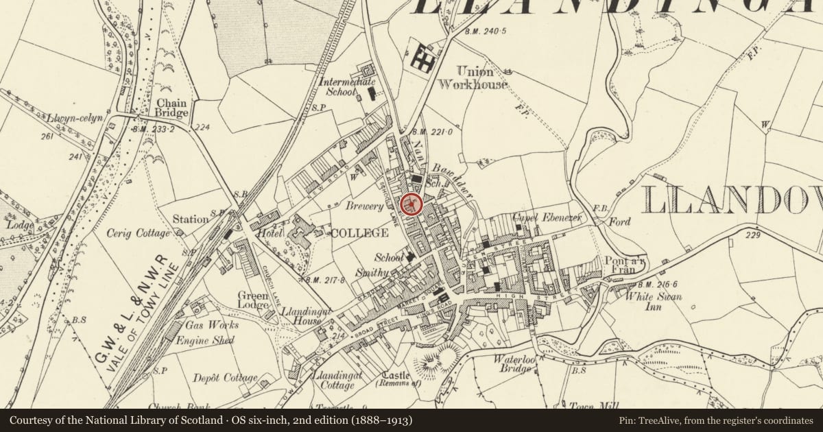
Slide toward Today to fade the historical sheet and see the modern map underneath.
David Rumsey Map Collection, Stanford LibrariesDavid Rumsey Map Collection, Stanford LibrariesDavid Rumsey Map Collection, Stanford LibrariesDavid Rumsey Map Collection, Stanford LibrariesDavid Rumsey Map Collection, Stanford Libraries
5 historical maps cover this location, the earliest the 1860 map "41. Caermathen." (David Rumsey Map Collection, Stanford Libraries).
Historical maps covering this location
- 1860 · 41. Caermathen. (David Rumsey Map Collection, Stanford Libraries)
- 1891 · Sheet 10. Ordnance Survey of England and Wales. . (David Rumsey Map Collection, Stanford Libraries)
- 1898 · 212 Llandovery (Outline) (David Rumsey Map Collection, Stanford Libraries)
- 1898 · 212 Llandovery (Hills) (David Rumsey Map Collection, Stanford Libraries)
- 1901 · Sheet 14. (David Rumsey Map Collection, Stanford Libraries)
Cadw's description
Location
Situated opposite junction with Victoria Crescent.
History
House in terrace of earlier C19 origins altered in later C19 . Probably first built before 1836 by William Williams, owner of Ty Cerrig, No 42, next door, recorded as occupied by William Marsden draper in 1836, and tenanted by various shops through C19. Rees Bishop, draper, of Upton House, died in 1890, his widow remained there afterwards.
Exterior
House in terrace of 3 bays and 2 and a half storeys. Slate gabled roof without chimneys, and 2 gables, bracketed eaves. Roughcast facade with stucco dressings, long and short quoins to left and right, and shouldered surrounds with keystones to windows of main floors. Renewed horned sashes with marginal glazing bars, smaller windows to attic with keystones only. Recessed C20 panelled door with plain rectangular overlight and no surround.
Reason for designation
Included as terraced house of earlier C19 origins, of group value with No 42.
Nearby in the register
- Ty CerrigDomesticunder 1 mi
- The New White Lion InnCommercialunder 1 mi
- The Plough HotelCommercialunder 1 mi
- 30 Stone StreetDomesticunder 1 mi
Other entries of the same register within about three miles of this one, by straight line.