Cof Cymru: National Historic Assets of Wales · Wales
Oak House
Llandovery, Carmarthenshire, Wales
A Grade II listed building in Llandovery, Carmarthenshire, designated on 18 June 2004.
The record
- Designation
- Listed building, Grade II
- Broad class
- Commercial
- Date of designation
- 18 June 2004
- Community
- Llandovery
- Unitary authority
- Carmarthenshire
- Country
- Wales
- Coordinates
- 51.99418, -3.79565
- Cadw reference
- 82896
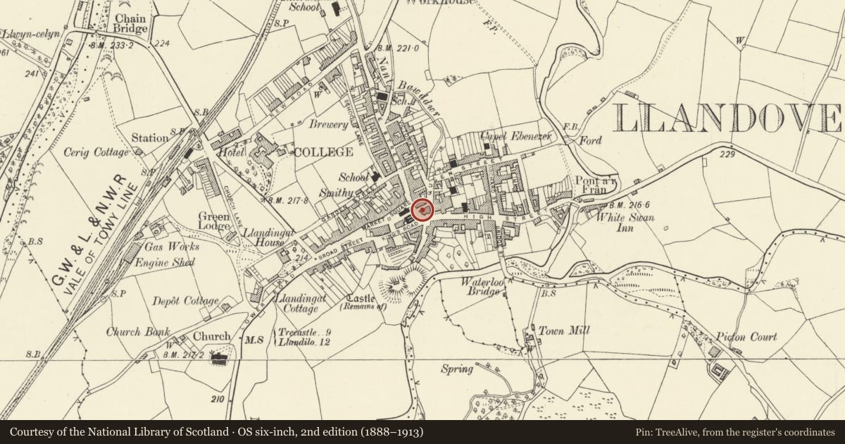
Slide toward Today to fade the historical sheet and see the modern map underneath.
David Rumsey Map Collection, Stanford LibrariesDavid Rumsey Map Collection, Stanford LibrariesDavid Rumsey Map Collection, Stanford LibrariesDavid Rumsey Map Collection, Stanford LibrariesDavid Rumsey Map Collection, Stanford Libraries
5 historical maps cover this location, the earliest the 1860 map "41. Caermathen." (David Rumsey Map Collection, Stanford Libraries).
Historical maps covering this location
- 1860 · 41. Caermathen. (David Rumsey Map Collection, Stanford Libraries)
- 1891 · Sheet 10. Ordnance Survey of England and Wales. . (David Rumsey Map Collection, Stanford Libraries)
- 1898 · 212 Llandovery (Outline) (David Rumsey Map Collection, Stanford Libraries)
- 1898 · 212 Llandovery (Hills) (David Rumsey Map Collection, Stanford Libraries)
- 1901 · Sheet 14. (David Rumsey Map Collection, Stanford Libraries)
Cadw's description
Location
Situated on corner of High Street and Stone Street facing former Market Hall.
History
Commercial premises with accommodation over, late C19 in late Georgian style. No 2, known as Oak House and No 4 were built on the yard of the Three Horseshoes inn (No 6) sold in 1882, and building by J James of Penygawse 12 High Street took place after 1883. Oak House was occupied by Henry Davies grocer in the 1890s and Daniel Jenkins confectioner in 1926.
Exterior
House and shop, 3 storeys, 4 bays with slate deep-eaved roof, hipped to left, but joined at canted angle to No 4 to right, with black brick right stack. Brackets to flat eaves. Large painted roughcast facade with raised plinth, big raised angle strips, 4 horned 4-pane sashes to each upper floor and one similar window to ground floor right now with fixed plate glass. Half-glazed door in second bay from right and broad shop-window of 3 plate glass panes in left 2 bays, with fascia and dentil cornice across over window and door. Left end wall to Water Street has 4-pane sash to first and second floors on left. Lower rear NE wing.
Interior
Ground floor wholly altered as shop.
Reason for designation
Included as a large building of late C19 date though still conforming to late Georgian style of the principal buildings of the town, on prominent corner site.
Nearby in the register
- 4 High StreetCommercialunder 1 mi
- 1 Stone StreetCommercialunder 1 mi
- 3 Stone StreetCommercialunder 1 mi
- Belmont including front walls, railings and gateDomesticunder 1 mi
Other entries of the same register within about three miles of this one, by straight line.