Cof Cymru: National Historic Assets of Wales · Wales
Milestone S of Blaenos
Llandovery, Carmarthenshire, Wales
A Grade II listed building in Llandeilo Road, Llandovery, Carmarthenshire, designated on 18 June 2004.
The record
- Designation
- Listed building, Grade II
- Broad class
- Transport
- Date of designation
- 18 June 2004
- Locality
- Llandeilo Road
- Community
- Llandovery
- Unitary authority
- Carmarthenshire
- Country
- Wales
- Coordinates
- 51.99256, -3.81160
- Cadw reference
- 82892
Slide toward Today to fade the historical sheet and see the modern map underneath.
David Rumsey Map Collection, Stanford LibrariesDavid Rumsey Map Collection, Stanford LibrariesDavid Rumsey Map Collection, Stanford LibrariesDavid Rumsey Map Collection, Stanford LibrariesDavid Rumsey Map Collection, Stanford Libraries
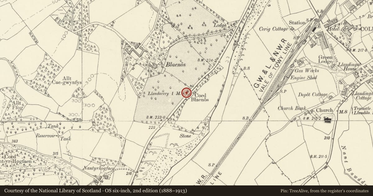
5 historical maps cover this location, the earliest the 1860 map "41. Caermathen." (David Rumsey Map Collection, Stanford Libraries).
Historical maps covering this location
- 1860 · 41. Caermathen. (David Rumsey Map Collection, Stanford Libraries)
- 1891 · Sheet 10. Ordnance Survey of England and Wales. . (David Rumsey Map Collection, Stanford Libraries)
- 1898 · 212 Llandovery (Outline) (David Rumsey Map Collection, Stanford Libraries)
- 1898 · 212 Llandovery (Hills) (David Rumsey Map Collection, Stanford Libraries)
- 1901 · Sheet 14. (David Rumsey Map Collection, Stanford Libraries)
Cadw's description
Location
Situated some 300m W of Gate Lodge in low stone revetment wall.
History
Milestone on turnpike road to Carmarthen, late C18 or earlier C19, the turnpike trust formed in 1763.
Exterior
Milestone, stone formerly whitewashed with eroded inscription in lower case letters: 1 mile to Llandovery'.
Reason for designation
Included as a milestone on a turnpike road, of transport historical interest.
Nearby in the register
- LlwyncelynDomesticunder 1 mi
- Sir Gardner Wilkinson tomb in churchyard of Church of St Dingat.Religious, Ritual and Funeraryunder 1 mi
- Railings to grave enclosure against N wall of churchyard of Church of St DingatReligious, Ritual and Funeraryunder 1 mi
- Llandovery StationTransportunder 1 mi
Other entries of the same register within about three miles of this one, by straight line.