Cof Cymru: National Historic Assets of Wales · Wales
Village Pump at Wiston
Wiston, Pembrokeshire, Wales
A Grade II listed building in Wiston, Haverfordwest, Pembrokeshire, designated on 16 June 2004.
The record
- Designation
- Listed building, Grade II
- Broad class
- Water Supply and Drainage
- Date of designation
- 16 June 2004
- Locality
- Wiston
- Town
- Haverfordwest
- Community
- Wiston
- Unitary authority
- Pembrokeshire
- Country
- Wales
- Coordinates
- 51.82589, -4.87225
- Cadw reference
- 82854
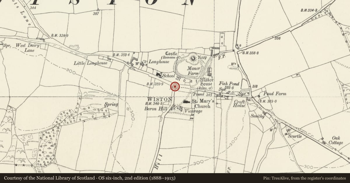
Slide toward Today to fade the historical sheet and see the modern map underneath.
David Rumsey Map Collection, Stanford LibrariesDavid Rumsey Map Collection, Stanford LibrariesDavid Rumsey Map Collection, Stanford LibrariesDavid Rumsey Map Collection, Stanford LibrariesDavid Rumsey Map Collection, Stanford Libraries
5 historical maps cover this location, the earliest the 1608 map "(13) Cambriae Typus." (David Rumsey Map Collection, Stanford Libraries).
Historical maps covering this location
- 1608 · (13) Cambriae Typus. (David Rumsey Map Collection, Stanford Libraries)
- 1636 · Cornubia : Devonia, Somersetus, Dorcestria, Wiltonia, Glocestria ... (David Rumsey Map Collection, Stanford Libraries)
- 1891 · Sheet 10. Ordnance Survey of England and Wales. . (David Rumsey Map Collection, Stanford Libraries)
- 1898 · 228 Haverfordwest (Hills) (David Rumsey Map Collection, Stanford Libraries)
- 1901 · Sheet 13. (David Rumsey Map Collection, Stanford Libraries)
Cadw's description
Location
At the junction of minor roads in Wiston just NW of the Church of Saint Mary.
History
Late C19 or early C20 cast-iron pump in small enclosure in centre of village.
Exterior
Cast-iron pump of standard type with round ringed shaft, fluted neck and fluted domed cap with finial. Curved spout and long handle. Set in renewed low-walled rubble stone square enclosure with wrought iron gate in taller N side wall.
Reason for designation
Included as a rare surviving example of a village water pump in a heritage location.
Nearby in the register
- House Platforms N of St. Mary's ChurchyardHouse Platformunder 1 mi
- Telephone Call-box to N of the Church of Saint MaryCommunicationsunder 1 mi
- Church of Saint MaryReligious, Ritual and Funeraryunder 1 mi
- Wiston CastleMotte and Baileyunder 1 mi
Other entries of the same register within about three miles of this one, by straight line.