Cof Cymru: National Historic Assets of Wales · Wales
Chimney at Llancynfelin lead mine
Llangynfelyn, Ceredigion, Wales
A Grade II listed building in Llangynfelyn, Machynlleth, Ceredigion, designated on 28 May 2004.
The record
- Designation
- Listed building, Grade II
- Broad class
- Industrial
- Date of designation
- 28 May 2004
- Locality
- Llangynfelyn
- Town
- Machynlleth
- Community
- Llangynfelyn
- Unitary authority
- Ceredigion
- Country
- Wales
- Coordinates
- 52.51085, -3.98867
- Cadw reference
- 82819
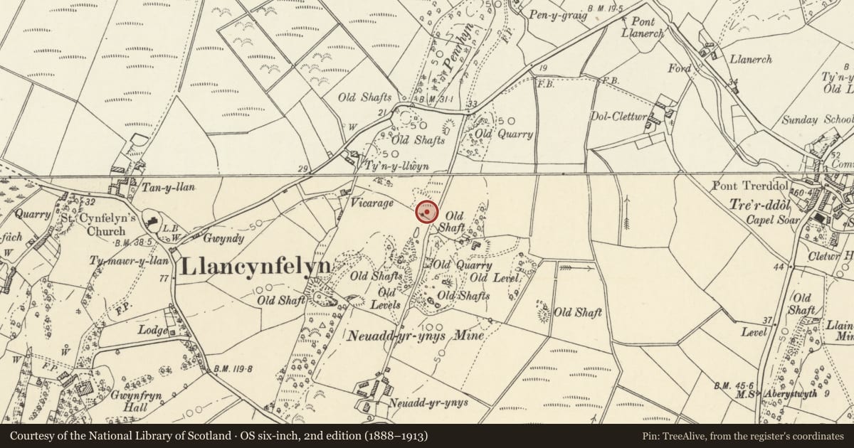
Slide toward Today to fade the historical sheet and see the modern map underneath.
David Rumsey Map Collection, Stanford LibrariesDavid Rumsey Map Collection, Stanford LibrariesDavid Rumsey Map Collection, Stanford LibrariesDavid Rumsey Map Collection, Stanford LibrariesDavid Rumsey Map Collection, Stanford Libraries
5 historical maps cover this location, the earliest the 1830 map "V.3:11-15:XV. Britisches Reich. A. Kon: England. b. Frstenthum Wales: Shire: 37-40" (David Rumsey Map Collection, Stanford Libraries).
Historical maps covering this location
- 1830 · V.3:11-15:XV. Britisches Reich. A. Kon: England. b. Frstenthum Wales: Shire: 37-40 (David Rumsey Map Collection, Stanford Libraries)
- 1883 · Watershed map England, Wales 3. (David Rumsey Map Collection, Stanford Libraries)
- 1896 · Sheet 7. Ordnance Survey of England and Wales. (David Rumsey Map Collection, Stanford Libraries)
- 1899 · 163 Aberystwyth (Hills) (David Rumsey Map Collection, Stanford Libraries)
- 1901 · Sheet 14. (David Rumsey Map Collection, Stanford Libraries)
Cadw's description
Location
Situated on the land of Neuadd yr Ynys, but reached by track running S off the B4353 roughly 600m E of church.
History
Mine chimney, the only remaining above-ground feature of the Llancynfelin or Taliesin lead mine, possibly of very ancient origins, worked in the 1740s. It was revived in 1846 by Matthew Francis and worked by a 36" rotative engine but closed shortly thereafter. The machinery was sold and then when a new attempt to revive it was made in 1854 an engine was brought from Green's Foundry. Aberystwyth. It failed by late 1856. The chimney is presumably of 1854.
Exterior
Cylindrical tapering stone chimney roughly 3.65m in diameter and over 18m tall, with upper 3m of brick and with protruding ring near top. Ground level opening to NW side into chamber at base of chimney, which has three niches to the three other sides.
Reason for designation
Included as a prominent landscape feature and one of the last mine chimneys in the region.
Nearby in the register
- Entrance gateway and gates to parish cemeteryCommemorativeunder 1 mi
- Hay-barn at Neuadd yr ynysAgriculture and Subsistenceunder 1 mi
- Dol ClettwrNo class recordedunder 1 mi
- Church of St. CynfelynReligious, Ritual and Funeraryunder 1 mi
Other entries of the same register within about three miles of this one, by straight line.