Cof Cymru: National Historic Assets of Wales · Wales
Broncastell
Melindwr, Ceredigion, Wales
A Grade II listed building in Capel Bangor, Aberystwyth, Melindwr, Ceredigion, designated on 26 May 2004.
The record
- Designation
- Listed building, Grade II
- Broad class
- Domestic
- Date of designation
- 26 May 2004
- Locality
- Capel Bangor
- Town
- Aberystwyth
- Community
- Melindwr
- Unitary authority
- Ceredigion
- Country
- Wales
- Coordinates
- 52.40409, -3.97843
- Cadw reference
- 82801
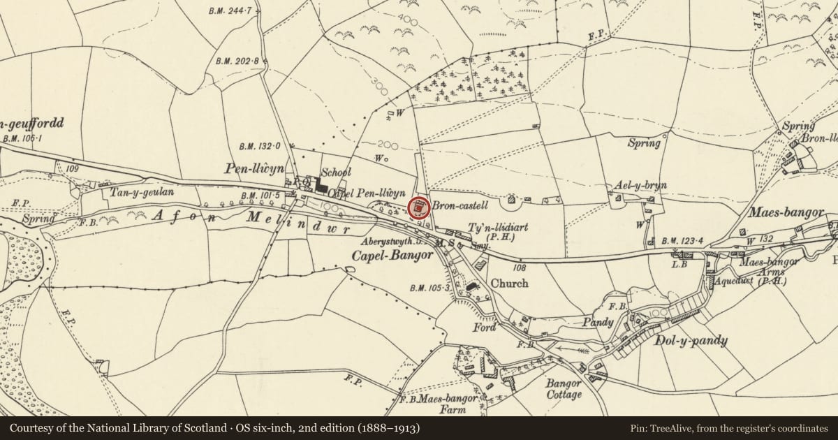
Slide toward Today to fade the historical sheet and see the modern map underneath.
David Rumsey Map Collection, Stanford LibrariesDavid Rumsey Map Collection, Stanford LibrariesDavid Rumsey Map Collection, Stanford LibrariesDavid Rumsey Map Collection, Stanford LibrariesDavid Rumsey Map Collection, Stanford Libraries
5 historical maps cover this location, the earliest the 1830 map "V.3:11-15:XV. Britisches Reich. A. Kon: England. b. Frstenthum Wales: Shire: 37-40" (David Rumsey Map Collection, Stanford Libraries).
Historical maps covering this location
- 1830 · V.3:11-15:XV. Britisches Reich. A. Kon: England. b. Frstenthum Wales: Shire: 37-40 (David Rumsey Map Collection, Stanford Libraries)
- 1883 · Watershed map England, Wales 3. (David Rumsey Map Collection, Stanford Libraries)
- 1896 · Sheet 7. Ordnance Survey of England and Wales. (David Rumsey Map Collection, Stanford Libraries)
- 1899 · 163 Aberystwyth (Hills) (David Rumsey Map Collection, Stanford Libraries)
- 1901 · Sheet 14. (David Rumsey Map Collection, Stanford Libraries)
Cadw's description
Location
Situated in own grounds opposite lane to parish church.
History
House or villa in late Georgian style, but probably built as late as the 1860s. It was advertised to let in 1865 as a genteel residence, with request to apply to Richard James on the premises, who may be the Richard James, builder, of Aberystwyth. In 1926 occupied by Mrs James.
Exterior
House, painted stucco with slate hipped roof, deep bracketed eaves and rendered end chimneys. Basement and two storeys, three-window range with tripartite outer windows and 12-pane sash over centre door. Upper tripartite sashes are of 4-8-4 panes, lower ones are shallow canted bays of 4-12-4 panes. Centre 4-panel door, two glazed, with overlight in large painted timber classical doorcase with Roman Doric columns, frieze and cornice. Four deep slate-slab steps up to door. Nine-pane cellar windows below tripartite windows. E end wall has blank window each floor to left and to right a similar tripartite sash over a canted bay. W end is similar.
Reason for designation
Included as a substantial villa with original late Georgian style detail including fine columned doorcase.
Nearby in the register
- Entrance gates to BroncastellDomesticunder 1 mi
- Milestone at Capel BangorTransportunder 1 mi
- Ty'r EglwysNo class recordedunder 1 mi
- The Church HallEducationunder 1 mi
Other entries of the same register within about three miles of this one, by straight line.