Cof Cymru: National Historic Assets of Wales · Wales
Nos.43 & 45 Old Market Street, and attached iron railings
Usk, Monmouthshire, Wales
A Grade II listed building in Usk, Monmouthshire, designated on 30 April 2004.
The record
- Designation
- Listed building, Grade II
- Broad class
- Domestic
- Date of designation
- 30 April 2004
- Locality
- Usk
- Town
- Usk
- Community
- Usk
- Unitary authority
- Monmouthshire
- Country
- Wales
- Coordinates
- 51.69988, -2.90461
- Cadw reference
- 82778
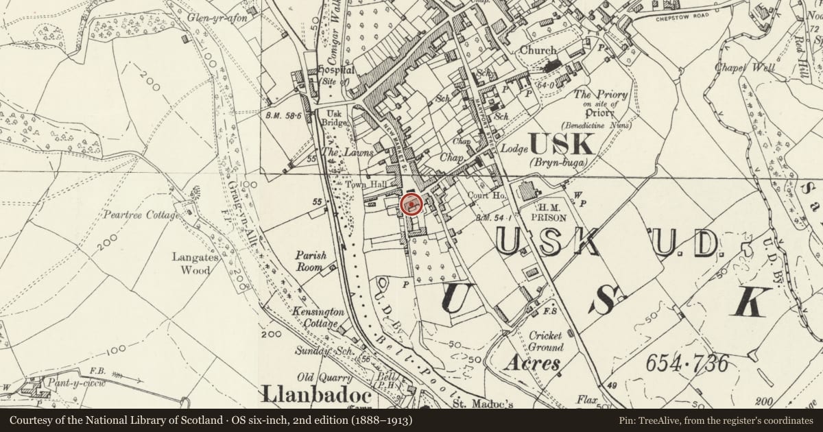
Slide toward Today to fade the historical sheet and see the modern map underneath.
David Rumsey Map Collection, Stanford LibrariesDavid Rumsey Map Collection, Stanford LibrariesDavid Rumsey Map Collection, Stanford LibrariesDavid Rumsey Map Collection, Stanford LibrariesDavid Rumsey Map Collection, Stanford Libraries
5 historical maps cover this location, the earliest the 1636 map "Cornubia : Devonia, Somersetus, Dorcestria, Wiltonia, Glocestria ..." (David Rumsey Map Collection, Stanford Libraries).
Historical maps covering this location
- 1636 · Cornubia : Devonia, Somersetus, Dorcestria, Wiltonia, Glocestria ... (David Rumsey Map Collection, Stanford Libraries)
- 1637 · The fourth table of England. Cornub. Devonia, Somerset etc. (David Rumsey Map Collection, Stanford Libraries)
- 1830 · V.3:11-15:XV.Britisches Reich. A. Kon: England. a. England ab sich: Shire:15-17, 33 (David Rumsey Map Collection, Stanford Libraries)
- 1895 · Sheet 11. Ordnance Survey of England and Wales. (David Rumsey Map Collection, Stanford Libraries)
- 1913 · Sheet 102. Newport. (David Rumsey Map Collection, Stanford Libraries)
Cadw's description
Location
Part of the W section of the range facing the Market Hall, set back behind small front gardens.
History
Late Georgian frontage, probably with an earlier origin.
Reason for designation
Listed as a Georgian fronted pair of houses, an integral part of this important S range. Group value with other listed buildings in the lower part of New and Old Market Streets.
Nearby in the register
- Nos.43 & 45 Old Market Street and attached iron railingsDomesticunder 1 mi
- 47 Old Market StreetDomesticunder 1 mi
- No.41 Old Market Street, and attached iron railingsDomesticunder 1 mi
- The Town HallCivilunder 1 mi
Other entries of the same register within about three miles of this one, by straight line.