Cof Cymru: National Historic Assets of Wales · Wales
Entrance gateway to Porth-y-carn
Usk, Monmouthshire, Wales
A Grade II listed building in Usk, Monmouthshire, designated on 30 April 2004.
The record
- Designation
- Listed building, Grade II
- Broad class
- No class recorded
- Date of designation
- 30 April 2004
- Locality
- Usk
- Town
- Usk
- Community
- Usk
- Unitary authority
- Monmouthshire
- Country
- Wales
- Coordinates
- 51.70477, -2.90540
- Cadw reference
- 82761
Slide toward Today to fade the historical sheet and see the modern map underneath.
David Rumsey Map Collection, Stanford LibrariesDavid Rumsey Map Collection, Stanford LibrariesDavid Rumsey Map Collection, Stanford LibrariesDavid Rumsey Map Collection, Stanford LibrariesDavid Rumsey Map Collection, Stanford Libraries
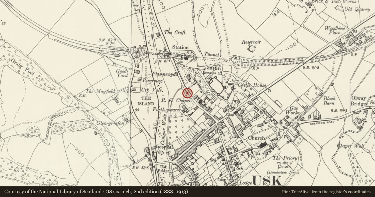
5 historical maps cover this location, the earliest the 1636 map "Cornubia : Devonia, Somersetus, Dorcestria, Wiltonia, Glocestria ..." (David Rumsey Map Collection, Stanford Libraries).
Historical maps covering this location
- 1636 · Cornubia : Devonia, Somersetus, Dorcestria, Wiltonia, Glocestria ... (David Rumsey Map Collection, Stanford Libraries)
- 1637 · The fourth table of England. Cornub. Devonia, Somerset etc. (David Rumsey Map Collection, Stanford Libraries)
- 1830 · V.3:11-15:XV.Britisches Reich. A. Kon: England. a. England ab sich: Shire:15-17, 33 (David Rumsey Map Collection, Stanford Libraries)
- 1895 · Sheet 11. Ordnance Survey of England and Wales. (David Rumsey Map Collection, Stanford Libraries)
- 1913 · Sheet 102. Newport. (David Rumsey Map Collection, Stanford Libraries)
Cadw's description
Location
orming the drive entrance, set back slightly from the pavement in a sem-circular bay.
History
Probably near contemporary with the house, mid C19.
Exterior
Gateway comprising two tall painted stone piers with recessed panels and half-round and corniced caps on deep plinths; double iron gates with spear finials, anthemion finials to the main uprights, centre rail and braces, swept down at centre. Attached at each side,a curved rock-faced stone wall with iron railings forms the bay, terminating in tall rock-faced piers with caps adjoining the front garden wall.
Reason for designation
Listed as a gateway contemporary with Porth-y-carn and for group value with it.
Nearby in the register
- Entrance Gateway to Plas-newyddDomesticunder 1 mi
- Castle Vale, and attached iron railingsDomesticunder 1 mi
- Porth-y-carnDomesticunder 1 mi
- Church of St Francis Xavier and St David LewisReligious, Ritual and Funeraryunder 1 mi
Other entries of the same register within about three miles of this one, by straight line.